 INSPIRE Geoportal
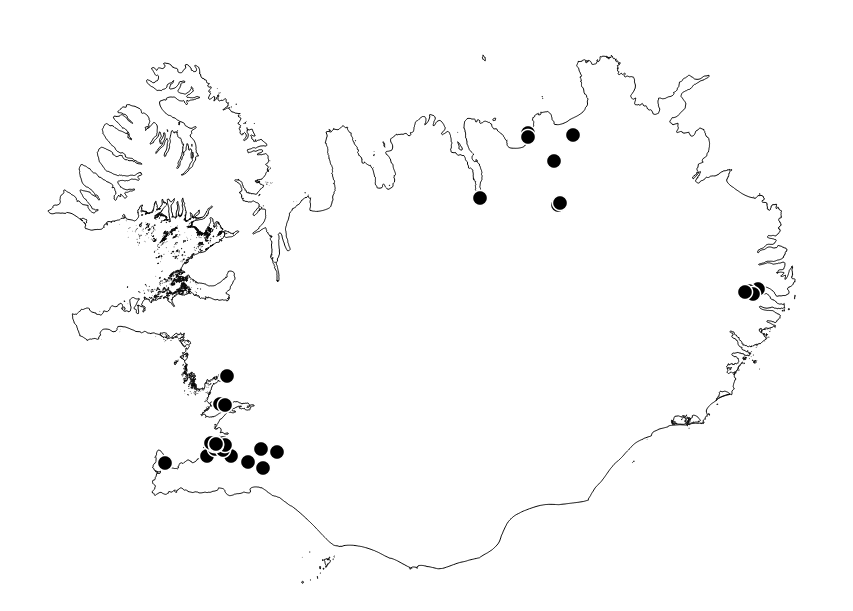
Loftmælistöðvar á Íslandi
Staðsetningar loftmælistöðva á Íslandi. Umhverfisstofnun skilar árlega loftgæðaskýrslum til Evrópsku umhverfisstofnunarinnar (EEA) og uppfylla þau gögn INSPIRE-tilskipanir varðandi flokkun stöðva.
Rekstraraðilar geta breytt gögnum stöðva.
Simple
- Date (Publication)
- 2020-12-01
- Citation identifier
- CC77E50C-A326-4E75-A893-9BCAF125B911
- Point of contact
-
Organisation name Individual name Electronic mail address Role Umhverfisstofnun
Author
- Maintenance and update frequency
- Continual
-
Legislation Level
-
-
INSPIRE
-
Evrópuverkefni
-
european
-
Priority dataset
-
-
Degree of conformity
-
-
Not evaluated
-
- Keywords
-
-
GSL
-
INSPIRE
-
Evrópuverkefni
-
- Use constraints
- Other restrictions
- Other constraints
- No conditions apply to access and use
- Access constraints
- Other restrictions
- Spatial representation type
- Vector
- Language
- English
- Topic category
-
- Environment
))
- Reference system identifier
- EPSG / 8088 / 1
- Distribution format
-
Name Version ESRI Shapefile
1.0
- OnLine resource
-
Protocol Linkage Name OGC:WFS
http://gis.ust.is/geoserver/wms?SERVICE=WFS INSPIRE:v_geo_aq_stations
OGC:WMS
http://gis.ust.is/geoserver/wms?SERVICE=WMS INSPIRE:v_geo_aq_stations
WWW:LINK-1.0-http--link
https://loftgaedi.is/?zoomLevel=7&lat=64.894972&lng=-18.675028 Loftgæðavefur Umhverfisstofnunnar
WWW:LINK-1.0-http--link
https://kort.lmi.is/ Landupplýsingagátt
- Hierarchy level
- Dataset
Conformance result
- Date (Publication)
- 2010-12-08
- Explanation
-
Information required according to INSPIRE Geoportal Validator´s verification report. Validation has not been performed.
- Pass
- Yes
- Statement
-
Gögnin koma alfarið frá Umhverfisstofnun.
Metadata
- File identifier
- {CC77E50C-A326-4E75-A893-9BCAF125B911} XML
- Metadata language
- English
- Hierarchy level
- Dataset
- Date stamp
- 2022-05-27T14:49:23
- Metadata standard name
-
INSPIRE Metadata Implementing Rules
- Metadata standard version
-
Technical Guidelines based on EN ISO 19115 and EN ISO 19119 (Version 1.2)
- Metadata author
-
Organisation name Individual name Electronic mail address Role Umhverfisstofnun
Point of contact
- Dataset URI
-
CC77E50C-A326-4E75-A893-9BCAF125B911
Overviews
Spatial extent
Provided by
