 INSPIRE Geoportal
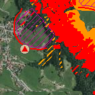
Georisiken in Bayern - WMS
Der Web Map Service Georisiken in Bayern beinhaltet die GEORISK-Objekte (Felsstürze, Rutschungen, Schuttströme, Erdfälle etc.) mit deren Anbruch- und Ablagerungsbereichen. Zudem beinhaltet er Gefahrenhinweiskarten, soweit diese bereits vorliegen. Diese enthalten eine Übersicht der Gefährdungssituation durch Geogefahren.
Simple
Identification info
- Date (Publication)
- 2014-07-01
- Citation identifier
- https://registry.gdi-de.org/id/de.by/DEBY_1ad15d0e-cf45-3634-ad53-94e7cc736039
- Status
- On going
- Point of contact
-
Organisation name Individual name Electronic mail address Role Bayerisches Landesamt für Umwelt
Datenstelle
datenstelle@lfu.bay datenstelle@lfu.bayern.de
Point of contact
- Maintenance and update frequency
- Monthly
- Theme
-
-
Georisiken
-
Bodeninformationssystem Bayern
-
BIS
-
Gefahrenhinweiskarte
-
Steinschlag
-
Blockschlag
-
Felssturz
-
Bergsturz
-
Rutschung
-
Hangrutschung
-
Doline
-
Erdfall
-
-
Spatial scope
-
-
Regional
-
- Keywords
-
-
opendata
-
gdiby
-
infoMapAccessService
-
inspireidentifiziert
-
- Use limitation
-
keine Einschränkungen
- Use constraints
- Other restrictions
- Other constraints
-
Der Datensatz/Dienst steht unter der Lizenz: Creative Commons Namensnennung 4.0 International (CC BY 4.0). Die Namensnennung des Bayerischen Landesamtes für Umwelt als Rechteinhaber hat in folgender Weise zu erfolgen: "Datenquelle: Bayerisches Landesamt für Umwelt, www.lfu.bayern.de".
- Other constraints
-
{
"id": "cc-by",
"name": "Creative Commons Namensnennung (CC BY)",
"quelle": "Datenquelle: Bayerisches Landesamt für Umwelt, www.lfu.bayern.de",
"url": " http://creativecommons.org/licenses/by/3.0/deed.de"
}
- Access constraints
- Other restrictions
- Other constraints
- Es gelten keine Zugriffsbeschränkungen
- Classification
- Unclassified
- Service Type
- view
- Service Version
-
OGC:WMS 1.3.0
- Description
-
Der Dienst umfasst die Landesfläche Bayerns.
))
- Coupling Type
- Tight
- Contains Operations
-
Operation Name Distributed Computing Platforms Connect Point GetCapabilities
Web services https://www.lfu.bayern.de/gdi/wms/geologie/georisiken? GetMap
Web services https://www.lfu.bayern.de/gdi/wms/geologie/georisiken? GetFeatureInfo
Web services https://www.lfu.bayern.de/gdi/wms/geologie/georisiken?
- Unique resource identifier
- EPSG:4326
- Version
-
7.9
- Unique resource identifier
- EPSG:31468
- Version
-
7.9
- Unique resource identifier
- EPSG:31467
- Version
-
7.9
- Unique resource identifier
- EPSG:4258
- Version
-
7.9
- Unique resource identifier
- EPSG:25832
- Version
-
7.9
- Unique resource identifier
- EPSG:25833
- Version
-
7.9
- Unique resource identifier
- EPSG:31258
- Version
-
7.9
- Unique resource identifier
- EPSG:3857
- Version
-
7.9
- Distribution format
-
Name Version sonstiges
keine Angabe
Distributor
- Distributor contact
-
Organisation name Individual name Electronic mail address Role Bayerisches Landesamt für Umwelt
Datenstelle
datenstelle@lfu.bay datenstelle@lfu.bayern.de
Point of contact
- Fees
-
geldleistungsfrei
- OnLine resource
-
Protocol Linkage Name https://www.lfu.bayern.de/gdi/wms/geologie/georisiken? URL des Dienstes
- Hierarchy level
- Service
- Other
-
Dienst
- Dataset
-
Verfügbarkeit der Gefahrenhinweiskarten
- Dataset
-
Gefahrenhinweisbereich großflächige Senkungsgebiete
- Dataset
-
Gefahrenhinweisbereich Erdfälle/Dolinen
- Dataset
-
Gefahrenhinweisbereich Anfälligkeit für flachgründige Hanganbrüche im Extremfall
- Dataset
-
Gefahrenhinweisbereich Anfälligkeit für flachgründige Hanganbrüche
- Dataset
-
Gefahrenhinweisbereich Rutschanfälligkeit
- Dataset
-
Gefahrenhinweisbereich Tiefreichende Rutschungen
- Dataset
-
Gefahrenhinweisbereich Steinschlag/Blockschlag ohne Walddämpfung/Felssturz
- Dataset
-
Gefahrenhinweisbereich Steinschlag/Blockschlag mit Walddämpfung
- Dataset
-
GEORISK-Ablagerungsbereiche
- Dataset
-
GEORISK-Anbruchbereiche
- Dataset
-
GEORISK-Punktobjekte
Conformance result
- Date (Publication)
- 2013-04-04
- Explanation
-
Der Dienst erfüllt die funktionalen und qualitativen Anforderungen.
- Pass
- Yes
Conformance result
- Date (Publication)
- 2009-10-20
- Explanation
-
Getestet mit der GDI-DE Testsuite.
- Pass
- Yes
Conformance result
- Date (Publication)
- 2010-12-07
- Explanation
-
Datenmodelltransformation noch nicht durchgeführt.
- Pass
- No
Metadata
- File identifier
- 03f453e2-198a-3fed-b690-5650053ee4fe XML
- Metadata language
- Deutsch
- Character set
- UTF8
- Hierarchy level
- Service
- Hierarchy level name
-
Geologie
- Date stamp
- 2023-11-16T09:19:46+01:00
- Metadata standard name
-
ISO 19115 - Geographic Information - Metadaten; ISO 19119 - Geographic Information - Services;
Metadatenprofil der Bayerischen Vermessungsverwaltung
- Metadata standard version
-
ISO 19115:2003/Cor. 1:2006; ISO 19119:2005/Amd 1:2008
- Metadata author
-
Organisation name Individual name Electronic mail address Role Bayerisches Landesamt für Umwelt
Datenstelle
datenstelle@lfu.bay datenstelle@lfu.bayern.de
Point of contact
Overviews
Spatial extent
Provided by
