 INSPIRE Geoportal
Landshæðarkerfi Íslands ÍSH2004
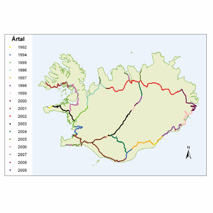
Þann 16. mars 2011 gáfu Landmælingar Íslands út í fyrsta sinn sameiginlegt hæðarkerfi fyrir Ísland. Kerfið er kallað Landshæðarkerfi Íslands og er viðmiðunin ISH2004. Tilkoma sameiginlegs hæðarkerfis markaði stór tímamót í sögu landmælinga á Íslandi. Á sama hátt og viðmiðunin ISN93 skapaði grundvöll fyrir alla til að vinna í sama hnitakerfi mun ISH2004 skapa grundvöll fyrir alla til að vinna í sama hæðarkerfi. Eitt samræmt hæðarkerfi er mikilvægt fyrir ýmsar framkvæmdir s.s. vegagerð og jarðgangnagerð og á ýmsum sviðum umhverfisvöktunar, skipulags og áætlanagerðar. Auk þess munu gögnin nýtast við rannsóknir á jarðskorpuhreyfingum eða breytingum á yfirborði sjávar.
Mælingar á Landshæðarkerfinu eru standa ennþá yfir og frá fyrstu útgáfu þess árið 2011 hafa bæst við eftirfarandi línur hallamælilínur.
• Flókalundur-Bolungavík
• Reykjavík-Keflavík
• Endurmæling á Suðurlandi vegna jarðskjálftans 2008
• Hellisheiði
• Reykjanesbraut-Grindavík
• Þjóðvegur 1-Akranes
• Kjölur
Niðurstöður nýrra mælinga verður bætt inn í þetta gagnasett um leið og þær liggja fyrir.
Simple
- Date (Publication)
- 2011-03-16
- Status
- Completed
- Point of contact
-
Organisation name Individual name Electronic mail address Role Landmælingar Íslands
Originator
- Maintenance and update frequency
- Not planned
- Theme
-
-
landshæðarkerfi
-
hæðarkerfi
-
hæð
-
Vektor gögn LMÍ
-
Opin gögn LMÍ
-
GSL
-
INSPIRE
-
- Access constraints
- Other restrictions
- Other constraints
- no limitations to public access
- Use constraints
- Other restrictions
- Other constraints
- Attribution 4.0 International (CC BY 4.0)
- Spatial representation type
- Vector
- Denominator
- 50000
- Language
-
eng
- Language
- English
- Character set
- UTF8
- Topic category
-
- Elevation
))
- Reference system identifier
- ISH2004
- Reference system identifier
- EPSG / 8089
- Distribution format
-
Name Version Text
0
- OnLine resource
- Hierarchy level
- Dataset
Domain consistency
Conformance result
- Date (Publication)
- 2016-03-24
- Explanation
-
This document describes the ELF Data Specification for all levels of detail considered by ELF. Validation has not been performed.
- Pass
- Yes
Conformance result
- Date (Publication)
- 2010-12-08
- Explanation
-
Information required according to INSPIRE Geoportal Validator´s verification report. Validation has not been performed.
- Pass
- Yes
- Statement
-
Sjá tilvísanir (í þessu lýsigögnum) í skýrslur um Landshæðarkerfi Íslands ÍSH2004. Annars vegar tækniskýrslu og hins vegar umfjöllun umfjöllun um Landshæðarkerfi Íslands á heima síðu LMÍ.
Metadata
- File identifier
- 070adc67-d169-44a5-b57d-6c5055fead3f XML
- Metadata language
- English
- Hierarchy level
- Dataset
- Date stamp
- 2021-12-13T11:02:51
- Metadata standard name
-
ISO 19115:2003/19139
- Metadata standard version
-
1.0
- Metadata author
-
Organisation name Individual name Electronic mail address Role Landmælingar Íslands
Point of contact
Overviews
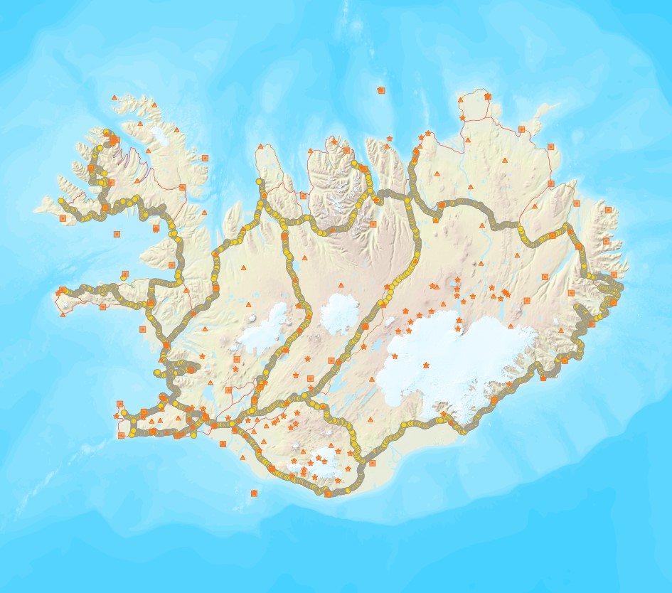
Spatial extent
Provided by
