 INSPIRE Geoportal
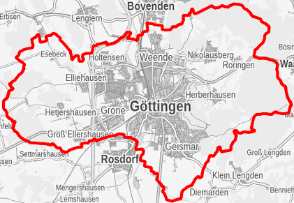
Bebauungspläne der Stadt Göttingen (Umringe)
Die Bebauungspläne der Stadt Göttingen regeln die mögliche Bebauung von parzellierten Grundstücken und definieren Nutzungen, die auf den Flächen bzw. in den jeweiligen Gebäuden zulässig sind bzw. weisen die Flächen aus, die von einer Bebauung frei zu haltenden sind. Die Bebauungspläne richten sich an Bauwillige, Architekten und alle anderen Interessenten, die sich einen Überblick über das jeweils geltende Planungsrecht verschaffen wollen. Auf der Grundlage der städtischen Geodaten werden die Umringe aller Geltungsbereiche der von den Gremien beschlossenen, gültigen und rechtskräftigen Bebauungspläne dargestellt. Somit kann ermittelt werden, auf welchen Flächen verbindliches Planungsrecht vorliegt.
Simple
- Date (Publication)
- 2019-07-01
- Citation identifier
- https://registry.gdi-de.org/id/de.ni.sg.goettingen/SpatialPlan_BPlan_dataset
- Point of contact
-
Organisation name Individual name Electronic mail address Role Stadt Göttingen
Mitarbeiter/innen Fachdienst "Stadt- und Verkehrsplanung"
Point of contact
-
GEMET - Concepts, version 4.2.3
-
-
Bebauungsplan
-
Plan
-
Planungsrecht
-
Bauland
-
Baugebiet
-
Bauleitplanung
-
Stadtplanung
-
Stadtentwicklung
-
-
GEMET - INSPIRE themes, version 1.0
-
-
Bodennutzung
-
- Theme
-
-
B-Plan
-
Bebauungspläne
-
inspireidentifiziert
-
opendata
-
Resource constraints
Resource constraints
Resource constraints
Resource constraints
Resource constraints
Resource constraints
Resource constraints
Resource constraints
Resource constraints
Resource constraints
Resource constraints
Resource constraints
Resource constraints
Resource constraints
Resource constraints
Resource constraints
Resource constraints
Resource constraints
Resource constraints
Resource constraints
- Classification
- Unclassified
- Use limitation
-
keine Einschränkung
- Access constraints
- Other restrictions
- Other constraints
- Es gelten keine Zugriffsbeschränkungen
- Use constraints
- Other restrictions
- Other constraints
-
Es gelten die Lizenzbedingungen "Datenlizenz Deutschland - Namensnennung - Version 2.0" bzw. "dl-de/by-2-0" ( https://www.govdata.de/dl-de/by-2-0) mit den dort geforderten Angaben zum Quellenvermerk. Als Rechteinhaber und Bereitsteller ist "Stadt Göttingen", sowie das Jahr des Datenbezugs in Klammern anzugeben. Beispiel für Quellenvermerk: Stadt Göttingen (2023) Datenlizenz Deutschland - Namensnennung - Version 2.0 ( https://www.govdata.de/dl-de/by-2-0).
- Other constraints
-
{"id":"dl-by-de/2.0","name":"Datenlizenz Deutschland Namensnennung 2.0","url":" https://www.govdata.de/dl-de/by-2-0","quelle":"Quelle: Stadt Göttingen (Jahr des letzten Datenbezugs)"}
- Spatial representation type
- Vector
- Language
- Deutsch
- Character set
- UTF8
- Topic category
-
- Planning cadastre
))
- Geographic identifier
- 031590160000
- Unique resource identifier
- EPSG:25832
- Distribution format
-
Name Version FileGDB
10
- Distributor contact
-
Organisation name Individual name Electronic mail address Role Stadt Göttingen
Mitarbeiter/innen Fachdienst "Stadt- und Verkehrsplanung"
Point of contact
- OnLine resource
-
Protocol Linkage Name https://geoportal.goettingen.de/MapSolution/apps/app/client/planauskunft
- Hierarchy level
- Dataset
Conformance result
- Date (Publication)
- 2010-12-08
- Pass
- Yes
- Statement
-
Die Planungsunterlagen zu den einzelnen B-Plänen werden im Fachdienst Stadt- und Verkehrsplanung der Stadt Göttingen erarbeitet.
Metadata
- File identifier
- 1785528c-c3e6-4215-b0cf-71d2d5ac87dc XML
- Metadata language
- Deutsch
- Character set
- UTF8
- Hierarchy level
- Dataset
- Date stamp
- 2023-11-08
- Metadata standard name
-
ISO 19115/19119
- Metadata author
-
Organisation name Individual name Electronic mail address Role Stadt Göttingen
Mitarbeiter/innen Fachdienst "Geoservice und Grundstücke"
Point of contact
Overviews
Spatial extent
Provided by
