INSPIRE Geoportal
Neophytenstandorte
Der Geodatensatz umfasst die bekannten Standorten von Neophyten in Liechtenstein. Gemäss Freisetzungsverordnung LGBl. 2011 Nr. 90 (FrSV) sind Mensch, Tier und Umwelt vor pathogenen oder gebietsfremden Organismen zu schützen.
Invasive gebietsfremde Pflanzen sind nicht-einheimische Pflanzen, die aus fremden Gebieten (meist aus anderen Kontinenten), absichtlich oder unabsichtlich, eingeführt wurden, die sich bei uns in der Natur etablieren (Vermehrung in freier Natur) und sich auf Kosten einheimischer Arten effizient ausbreiten.
Simple
-
Alternativtitel
-
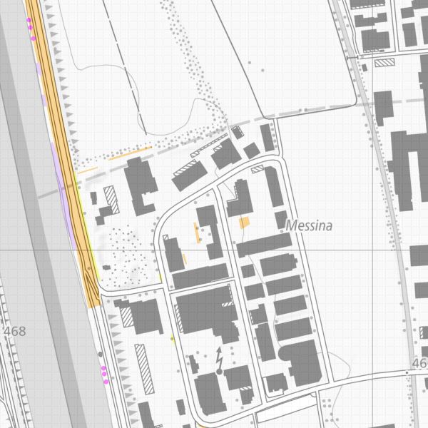
Karte der Neophytenstandorte (Liechtenstein)
-
Date (Création)Data (Creazione)Date (Creation)Datumsangaben (Erstellung)
- 2013-11-13
-
IdentificateurIdentificatoreCitation identifierIdentifikator
- https://metadata.geo.llv.li/1a7515a1-3353-45a2-9d41-d9b0061af89b
-
Zweck
-
Bekämpfung der Neophyten
-
EtatStatusStatusBearbeitungsstatus
-
FinaliséCompletatoCompletedAbgeschlossen
- Point of contact
-
Organisation name Individual name Electronic mail address Role Abt. Vermessung und Geoinformation (ATG)
Abt. Vermessung und Geoinformation (ATG)
Abt. Vermessung und Geoinformation (ATG)
Abt. Vermessung und Geoinformation (ATG)
Point de contactPunto di contattoPoint of contactAnsprechpartnerAmt für Umwelt
Office pour l'environnement
Ufficio per l'ambiente
Office for the Environment
Point de contactPunto di contattoPoint of contactAnsprechpartner
-
Fréquence de mise à jourFrequenza di aggiornamentoMaintenance and update frequencyÜberarbeitungsintervall
-
Lorsque nécessaireSecondo necessitàAs neededBei Bedarf
-
GEMET
-
-
Pflanzenart
espèce végétale
specie vegetale
plant species
-
Pflanzenbestand
population végétale
popolazione vegetale
plant population
-
Schutz der natürlichen Pflanzen- und Tierwelt
protection de la faune et de la flore
protezione della flora e della fauna
wildlife protection
-
-
geocat.ch
-
-
INSPIRE
INSPIRE
INSPIRE
INSPIRE
-
Neobiota
néobiote
neobiota
neobiota
-
-
GEMET - INSPIRE themes, version 1.0
-
-
Verteilung der Arten
Répartition des espèces
Distribuzione delle specie
Species distribution
-
-
Contraintes d'accèsVincoli di accessoAccess constraintsZugriffseinschränkungen
-
Autres restrictionsAltri vincoliOther restrictionsBenutzerdefinierte Einschränkungen
-
Andere Einschränkungen
-
no limitations to public access
-
Anwendungseinschränkungen
-
Zugangs- und Nutzungsbedingungen
-
Contraintes d'utilisationVincoli di fruibilitàUse constraintsNutzungseinschränkungen
-
Autres restrictionsAltri vincoliOther restrictionsBenutzerdefinierte Einschränkungen
-
Andere Einschränkungen
-
gebührenpflichtig
-
Type de représentation spatialeTipo di rappresentazione spazialeSpatial representation typeRäumliche Darstellungsart
-
VecteurDati vettorialiVectorVektor
-
Dénominateur de l'échelleDenominatoreDenominatorMassstabszahl
- 500
-
Langue de la ressourceLingua dei datiLanguageSprache
- Deutsch
-
Encodage des caractèresSet dei caratteri dei datiCharacter setZeichensatz
-
Utf8UTF8UTF8Utf8
-
Catégorie ISOTemaTopic categoryThematik
-
-
Sciences de la terre, géosciencesInformazioni geoscientificheGeoscientific informationGeowissenschaften
-
Étendue
Estensione
Extent
Ausdehnung
-
BeschreibungDescriptionDescrizioneDescription
-
Liechtenstein
Liechtenstein
Liechtenstein
Liechtenstein
))

-
Nom du système de référenceIdentificatore del sistema di riferimentoReference system identifierIdentifikator des Referenzsystems
-
http://www.opengis.net/def/crs/EPSG/0/21782http://www.opengis.net/def/crs/EPSG/0/4936http://www.opengis.net/def/crs/EPSG/0/4936http://www.opengis.net/def/crs/EPSG/0/4936
-
Nom du système de référenceIdentificatore del sistema di riferimentoReference system identifierIdentifikator des Referenzsystems
-
http://www.opengis.net/def/crs/EPSG/0/4936http://www.opengis.net/def/crs/EPSG/0/4936http://www.opengis.net/def/crs/EPSG/0/4936http://www.opengis.net/def/crs/EPSG/0/4936
-
Niveau topologieLivello di topologiaTopology levelTopologielevel
-
Topologie de réseau complèteGrafo planare completoFull planar graphFlächen
-
Type de géométries des objetsOggetto di tipo geometricoGeometric object typeGeometrietyp
-
PolygoneSuperficieSurfaceFläche
-
Nombre d'objets géométriquesConteggio oggetto geometricoGeometric object countAnzahl
- 1
- Distribution format
-
Name Version INTERLIS 1 (ITF)
AutoCAD DXF (DXF)
ESRI Shapefile (SHP)
- Distributor contact
-
Organisation name Individual name Electronic mail address Role Abt. Vermessung und Geoinformation (ATG)
Abt. Vermessung und Geoinformation (ATG)
Abt. Vermessung und Geoinformation (ATG)
Abt. Vermessung und Geoinformation (ATG)
Point de contactPunto di contattoPoint of contactAnsprechpartner
- OnLine resource
-
Protocol Linkage Name WWW:LINK
https://geodaten.llv.li/ Geodatenportal der Liechtensteinische Landesverwaltung
WWW:LINK
http://www.llv.li/#/1627/datenausgabe Homepage ATG, Datenausgabestelle
WWW:LINK-1.0-http--link
https://service.geo.llv.li/wmsli/service?service=WMS&language=ger&request=GetCapabilities OGC WMS Service der Liechtensteinen Landesverwaltung
WWW:LINK-1.0-http--link
https://service.geo.llv.li/wmsli/service?service=WMS&language=ger&request=GetCapabilities OGC WMS Service der Liechtensteinen Landesverwaltung
-
NiveauLivelloHierarchy levelBezugsebene
-
Jeu de donnéesDatasetDatasetDatenbestand
- Other
-
Alle Ebenen
Résultat de conformité
Conformità
Conformance result
Konformitätsergebnis
-
Date (Publication)Data (Pubblicazione)Date (Publication)Datumsangaben (Publikation)
- 2010-12-08
- Explanation
-
nicht geprüft
-
Degré de conformitéPassPassBestanden
- No
-
Erläuterung
-
Crowdsourcing
Metadata
-
Identifiant de la ficheIdentificatore del file di metadatiFile identifierMetadatensatzidentifikator
- 1a7515a1-3353-45a2-9d41-d9b0061af89b XML
-
LangueLingua dei metadatiMetadata languageSprache
- Deutsch
-
Jeu de caractèresSet dei caratteri dei metadatiCharacter setZeichensatz
-
Utf8UTF8UTF8Utf8
-
Type de ressourceLivello gerarchicoHierarchy levelHierarchieebene
-
Jeu de donnéesDatasetDatasetDatenbestand
-
Date des métadonnéesData dei metadatiDate stampDatum
- 2024-01-05T14:03:02.66Z
- Metadata standard name
-
GM03 2+
- Metadata author
-
Organisation name Individual name Electronic mail address Role Abt. Vermessung und Geoinformation (ATG)
Abt. Vermessung und Geoinformation (ATG)
Abt. Vermessung und Geoinformation (ATG)
Abt. Vermessung und Geoinformation (ATG)
Point de contactPunto di contattoPoint of contactAnsprechpartner
- Other language
-
Language Character encoding FrançaisFranceseFrenchFranzösischUtf8UTF8UTF8Utf8ItalienItalianoItalianItalienischUtf8UTF8UTF8Utf8AnglaisIngleseEnglishEnglischUtf8UTF8UTF8Utf8AllemandTedescoGermanDeutschUtf8UTF8UTF8Utf8