 INSPIRE Geoportal
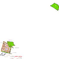
Selters(Westerwald) - Gleichen 1. Änderung
Bebauungspläne von Selters(Westerwald):Bebauungsplan "Gleichen 1. Änderung" der Stadt Selters
Simple
Identification info
- Date (Revision)
- 2023-11-28
- Point of contact
-
Organisation name Individual name Electronic mail address Role LVermGeo im Auftrag von Selters(Westerwald)
poststelle@vermkv.rlp poststelle@vermkv.rlp.de
Publisher
-
mapbender.2.registryId
-
-
2f23ed6e-0186-4c2b-8380-748389036509
-
- Keywords
-
-
Bebauungsplan
-
Selters(Westerwald)
-
Bplan
-
Bauleitplan
-
infoMapAccessService
-
inspireidentifiziert
-
- Access constraints
- Other restrictions
- Other constraints
- Es gelten keine Zugriffsbeschränkungen
- Use constraints
- Other restrictions
- Other constraints
-
Lizenz: dl-de-by-2.0 - Datenlizenz Deutschland Namensnennung 2.0 - https://www.govdata.de/dl-de/by-2-0 - Quellenvermerk: Source note required by license, but not given!
- Other constraints
-
{"id":"dl-de-by-2.0","name":"Datenlizenz Deutschland Namensnennung 2.0","url":"https:\/\/www.govdata.de\/dl-de\/by-2-0","quelle":"Source note required by license, but not given!"}
- Service Type
- view
- Service Version
-
OGC:WMS 1.1.1
))
- Coupling Type
- Tight
- Contains Operations
-
Operation Name Distributed Computing Platforms Connect Point GetCapabilities
Web services https://www.geoportal.rlp.de/mapbender/php/wms.php?inspire=1&layer_id=71254&withChilds=1&REQUEST=GetCapabilities&SERVICE=WMS
- Distribution format
-
Name Version
- OnLine resource
-
Protocol Linkage Name OGC:WMS-1.1.1-http-get-map
https://www.geoportal.rlp.de/mapbender/php/wms.php?inspire=1&layer_id=71254&withChilds=1&REQUEST=GetCapabilities&SERVICE=WMS BPlan.07143067.16.1
- Hierarchy level
- Service
- Other
-
Dienst
Conformance result
- Date (Publication)
- 2010-12-08
- Explanation
-
No explanation available
- Pass
- Yes
Conformance result
- Date (Publication)
- 2009-10-20
- Explanation
-
No explanation available
- Pass
- Yes
Conformance result
- Date (Publication)
- 2014-12-11
- Explanation
-
No explanation available
- Pass
- Yes
Conformance result
- Date (Publication)
- 2008-12-04
- Explanation
-
No explanation available
- Pass
- Yes
Conformance result
- Date (Publication)
- 2014-12-11
- Explanation
-
No explanation available
- Pass
- Yes
Conformance result
- Date (Publication)
- 2013-12-10
- Explanation
-
No explanation available
- Pass
- Yes
Conformance result
- Date (Publication)
- 2011-02-05
- Explanation
-
No explanation available
- Pass
- Yes
Conformance result
- Date (Publication)
- 2010-12-08
- Explanation
-
No explanation available
- Pass
- Yes
Metadata
- File identifier
- 32c18b2a-1f9f-4103-df6a-02c252c44f91 XML
- Metadata language
- Deutsch
- Character set
- UTF8
- Hierarchy level
- Service
- Hierarchy level name
-
Darstellungsdienst
- Date stamp
- 2023-11-30
- Metadata standard name
-
ISO19119
- Metadata standard version
-
2005/PDAM 1
- Metadata author
-
Organisation name Individual name Electronic mail address Role Verbandsgemeinde Selters
info@selters-ww.de
Point of contact
Overviews
Spatial extent
Provided by
