INSPIRE Geoportal
Wanderwege Liechtenstein
Hiking trails Liechtenstein
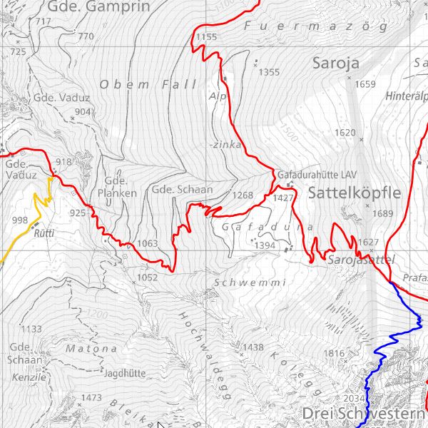
Das Amt für Umwelt, Abteilung Wald und Landschaft, ist zuständig für die Planung, den Bau, den Unterhalt und zur Kennzeichnung des Fuss- und Wanderwegnetzes. Die öffentlich zugänglichen Wanderwege enthalten Informationen über die Wanderrouten, mit Wegzeiten und Höhenprofil (inkl. Download für GPS-Geräte und Google Earth).
The Office for the Environment, Forest and Landscape Division, is responsible for the planning, construction, maintenance and labelling of the footpath and hiking trail network. The publicly accessible hiking trails contain information about the hiking routes, with route times and elevation profile (incl. download for GPS devices and Google Earth).
Simple
-
AlternativtitelAlternate title
-
Wanderwegnetz
Hiking trail network
-
Date (Création)Date (Creation)Data (Creazione)Datumsangaben (Erstellung)
- 2011-12-21
-
IdentificateurCitation identifierIdentificatoreIdentifikator
-
https://metadata.geo.llv.li/3c0df4fc-a93e-4e12-ae45-e54f1550bfb8
Wanderwege LiechtensteinHiking trails Liechtenstein2012-01-12
-
Gemeinsamer TitelTitolo collettivo
-
Wanderwege
Hiking trails
-
ZweckPurpose
-
Erfassung und Pflege der Wanderwege und Information für Wanderer.
Recording and maintenance of hiking trails and information for hikers.
-
EtatStatusStatusBearbeitungsstatus
-
Mise à jour continueOn goingIn corsoKontinuierliche Aktualisierung
- Point of contact
-
Organisation name Individual name Electronic mail address Role Amt für Tiefbau und Geoinformation
Amt für Tiefbau und Geoinformation
Civil Engineering and Geoinformation Office
Amt für Tiefbau und Geoinformation
Editeur (publication)PublisherEditoreHerausgeberAmt für Umwelt
Office pour l'environnement
Office for the Environment
Ufficio per l'ambiente
PropriétaireOwnerProprietarioEigentümer / Datenherr
-
Fréquence de mise à jourMaintenance and update frequencyFrequenza di aggiornamentoÜberarbeitungsintervall
-
Lorsque nécessaireAs neededSecondo necessitàBei Bedarf
- Resource format
-
Name Version ESRI Personal Geodatabase (Personal-GDB)
-
-
geocat.ch
-
-
Geodaten
géodonnées
geodata
geodati
-
OpenData
OpenData
OpenData
OpenData
-
INSPIRE
INSPIRE
INSPIRE
INSPIRE
-
-
GEMET
-
-
Wanderweg
sentier de randonnée
hiking trail
sentiero escursionistico
-
Freizeitnutzung
utilisation du temps libre
use of leisure time
uso del tempo libero
-
Bergsteigen
escalade
mountaineering
alpinismo
-
-
GEMET - INSPIRE themes, version 1.0
-
-
Verkehrsnetze
Réseaux de transport
Transport networks
Reti di trasporto
-
-
Spatial scope
-
-
National
Nationales
National
Nazionali
-
-
Anwendungseinschränkungen
-
keine
-
Contraintes d'accèsAccess constraintsVincoli di accessoZugriffseinschränkungen
-
Autres restrictionsOther restrictionsAltri vincoliBenutzerdefinierte Einschränkungen
-
Contraintes d'utilisationUse constraintsVincoli di fruibilitàNutzungseinschränkungen
-
Autres restrictionsOther restrictionsAltri vincoliBenutzerdefinierte Einschränkungen
-
Andere EinschränkungenAutres contraintesOther constraintsAltri vincoli
-
No limitations to public accessNo limitations to public accessNo limitations to public accessNo limitations to public access
-
Contraintes d'accèsAccess constraintsVincoli di accessoZugriffseinschränkungen
-
Autres restrictionsOther restrictionsAltri vincoliBenutzerdefinierte Einschränkungen
-
Contraintes d'utilisationUse constraintsVincoli di fruibilitàNutzungseinschränkungen
-
Autres restrictionsOther restrictionsAltri vincoliBenutzerdefinierte Einschränkungen
-
Andere EinschränkungenAutres contraintesOther constraintsAltri vincoli
-
No conditions to access and useNo conditions to access and useNo conditions to access and useNo conditions to access and use
-
Andere EinschränkungenAutres contraintesOther constraintsAltri vincoli
-
Opendata BY: Freie Nutzung. Quellenangabe ist Pflicht.Opendata BY: Utilisation libre. Obligation d’indiquer la source.Opendata BY: Open use. Must provide the source.Opendata BY: Libero utilizzo. Indicazione della fonte obbligatoria.
-
Type de représentation spatialeSpatial representation typeTipo di rappresentazione spazialeRäumliche Darstellungsart
-
VecteurVectorDati vettorialiVektor
-
Dénominateur de l'échelleDenominatorDenominatoreMaßstabszahl
- 10000
-
Langue de la ressourceLanguageLingua dei datiSprache
- Deutsch
-
Encodage des caractèresCharacter setSet dei caratteri dei datiZeichensatz
-
Utf8UTF8UTF8Utf8
-
Catégorie ISOTopic categoryTemaISO-Thematik
-
-
Infrastructures de transportTransportationTrasportoVerkehrswesen
-
Étendue
Extent
Estensione
Ausdehnung
-
BeschreibungDescriptionDescriptionDescrizione
-
Liechtenstein
Liechtenstein
Liechtenstein
Liechtenstein
))

-
Nom du système de référenceReference system identifierIdentificatore del sistema di riferimentoIdentifikator des Referenzsystems
-
http://www.opengis.net/def/crs/EPSG/0/2056
-
Nom du système de référenceReference system identifierIdentificatore del sistema di riferimentoIdentifikator des Referenzsystems
-
http://www.opengis.net/def/crs/EPSG/0/4936
-
Niveau topologieTopology levelLivello di topologiaTopologielevel
-
Topologie de réseauTopology 1DTopologia 1DLinien
-
Type de géométries des objetsGeometric object typeOggetto di tipo geometricoGeometrietyp
-
LigneCurveCurvaLinie
-
Nombre d'objets géométriquesGeometric object countConteggio oggetto geometricoAnzahl
- 300
- Distribution format
-
Name Version ESRI Personal Geodatabase (Personal-GDB)
-
OGC Geopackage (GPKG)
Distributeur
Distributor
Distributore
Vertriebsstelle
- Distributor contact
-
Organisation name Individual name Electronic mail address Role Abt. Vermessung und Geoinformation (ATG)
Abt. Vermessung und Geoinformation (ATG)
Surveying and Geoinformation Division
Abt. Vermessung und Geoinformation (ATG)
Point de contactPoint of contactPunto di contattoAnsprechpartner
- OnLine resource
-
Protocol Linkage Name WWW:LINK
https://geodaten.llv.li/ Geodatenportal der Liechtensteinischen Landesverwaltung
Geodata Portal of the National Administration
WWW:DOWNLOAD-URL
https://service.geo.llv.li/download/getfileByUUID.php?id=3c0df4fc-a93e-4e12-ae45-e54f1550bfb8 Zip Download über das Geodatenportal
Zip download via the geodata portal
OGC:WMS
https://service.geo.llv.li/service/wms?service=WMS&request=GetCapabilities llv.abi.wanderwege
-
NiveauHierarchy levelLivelloBezugsebene
-
Jeu de donnéesDatasetDatasetDatenbestand
Résultat de conformité
Conformance result
Conformità
Konformitätsergebnis
-
Titel
-
VERORDNUNG (EG) Nr. 1089/2010 DER KOMMISSION vom 23. November 2010 zur Durchführung der Richtlinie 2007/2/EG des Europäischen Parlaments und des Rates hinsichtlich der Interoperabilität von Geodatensätzen und -diensten
-
Date (Publication)Date (Publication)Data (Pubblicazione)Datumsangaben (Publikation)
- 2010-12-08
- Explanation
-
Gemäss INSPIRE Bestandteil des Themas Verkehrsnetze
-
Degré de conformitéPassPassBestanden
- No
-
Erläuterung
-
Konstruktiv auf Grundlage der Amtlichen vermessung
-
LangueLanguageLinguaSprache
- Deutsch
-
Inclus dans le jeu de donnéesIncluded with datasetIncluded with datasetIm Datenbestand enthalten
-
Titel
-
Datenmodell Wanderwege
-
Date (Création)Date (Creation)Data (Creazione)Datumsangaben (Erstellung)
- 2012-01-12
Metadata
-
Identifiant de la ficheFile identifierIdentificatore del file di metadatiMetadatensatzidentifikator
- 3c0df4fc-a93e-4e12-ae45-e54f1550bfb8 XML
-
LangueMetadata languageLingua dei metadatiSprache
- Deutsch
-
Jeu de caractèresCharacter setSet dei caratteri dei metadatiZeichensatz
-
Utf8UTF8UTF8Utf8
-
Type de ressourceHierarchy levelLivello gerarchicoHierarchieebene
-
Jeu de donnéesDatasetDatasetDatenbestand
-
Date des métadonnéesDate stampData dei metadatiDatum
- 2024-10-30T15:33:13.857Z
- Metadata standard name
-
GM03 2+
- Metadata author
-
Organisation name Individual name Electronic mail address Role Amt für Umwelt (LI)
Office de l'environnement
Amt für Umwelt
Amt für Umwelt
Point de contactPoint of contactPunto di contattoAnsprechpartner
- Other language
-
Language Character encoding FrançaisFrenchFranceseFranzösischUtf8UTF8UTF8Utf8AnglaisEnglishIngleseEnglischUtf8UTF8UTF8Utf8ItalienItalianItalianoItalienischUtf8UTF8UTF8Utf8AllemandGermanTedescoDeutschUtf8UTF8UTF8Utf8