 INSPIRE Geoportal
Loftgæðasvæði á Íslandi
Íslandi er skipt upp í loftgæðasvæði og bera heilbrigðiseftirlit viðkomandi svæða ábyrgð á því að ekki sé farið yfir mörk þar, og áætlunum um hvernig bregðast á við ef farið er yfir mörk.
Simple
- Date (Publication)
- 2016-01-01
- Citation identifier
- 4580c446-1be6-4481-bc94-4c3ed30ce5e2
- Point of contact
-
Organisation name Individual name Electronic mail address Role Umhverfisstofnun
Author
- Maintenance and update frequency
- Not planned
- Keywords
-
-
loftgæði
-
loftgæðasvæði
-
mengun
-
loftmengun
-
reglugerð
-
GSL
-
INSPIRE
-
Evrópuverkefni
-
-
Topic categories in accordance with EN ISO 19115
-
-
Environment
-
- Use constraints
- Other restrictions
- Other constraints
- No conditions apply to access and use
- Access constraints
- Other restrictions
- Spatial representation type
- Vector
- Language
- English
- Topic category
-
- Environment
N
S
E
W
))
- Reference system identifier
- http://www.opengis.net/def/crs/EPSG/0/8088
- Distribution format
-
Name Version ESRI Shapefile
1.0
- OnLine resource
- Hierarchy level
- Dataset
Conformance result
- Date (Publication)
- 2010-12-08
- Explanation
-
Validation has not been performed.
- Pass
- No
- Statement
-
Gögnin koma alfarið frá Umhverfisstofnun.
Metadata
- File identifier
- 4580c446-1be6-4481-bc94-4c3ed30ce5e2 XML
- Metadata language
- English
- Hierarchy level
- Dataset
- Date stamp
- 2023-02-13T11:08:49
- Metadata standard name
-
INSPIRE Metadata Implementing Rules
- Metadata standard version
-
Technical Guidelines based on EN ISO 19115 and EN ISO 19119 (Version 1.2)
- Metadata author
-
Organisation name Individual name Electronic mail address Role Umhverfisstofnun
Point of contact
Overviews
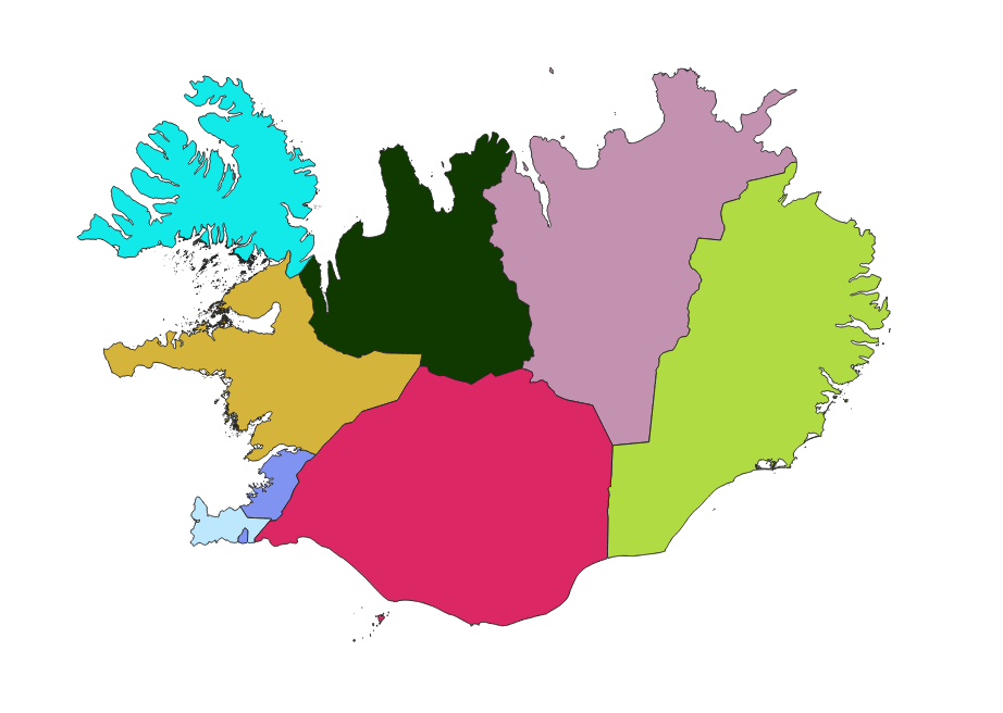
Smámynd loftgæðasvæði
Spatial extent
N
S
E
W
Provided by

Associated resources
Not available