 INSPIRE Geoportal
LAPRO2009_Arten_Biotope - LAPRO2009 - Erhaltung der Streuobstnutzung, kleinflächig
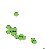
Der Kartendienst (WMS-Gruppe) stellt die Geodaten aus dem Landschaftsprogramm Saarland dar-Themenkarte_Arten-Biotope und Lebensraumverbund:Die noch vorhandenen Schwerpunkte der Streuobstnutzung werden im Landschaftsprogramm verortet und dargestellt sofern ein naturschutzfachliches Erfordernis zu deren Erhaltung/Sicherung gegeben ist. Deren Darstellung erfolgt bei kleinflächiger Ausformung (bis 7,5 ha) in Form eines Symbols und bei großflächiger Ausformung (größer als 7,5 ha) in der jeweiligen konkreten Fläche. Dieser shapefile enthält die kleinflächigen Streuobstbestände (Darstellung als Symbol).
Simple
Identification info
- Date (Revision)
- 2023-04-20
- Point of contact
-
Organisation name Individual name Electronic mail address Role Ministerium für Umwelt, Klima, Mobilität, Agrar und Verbraucherschutz
Geodatenzentrum@umwelt.saa Geodatenzentrum@umwelt.saarland.de
Publisher
- Keywords
-
-
Landschaftsprogramm 2009
-
infoMapAccessService
-
inspireidentifiziert
-
inspireidentifiziert
-
natur_landschaft
-
- Access constraints
- Other restrictions
- Other constraints
- INSPIRE: Keine Beschränkungen des öffentlichen Zugangs: Es existieren keine Beschränkungen des öffentlichen Zugangs zu Daten und Diensten
- Use constraints
- Other restrictions
- Other constraints
- Es gelten keine Bedingungen
- Service Type
- view
- Service Version
-
OGC:WMS 1.1.1
))
- Coupling Type
- Tight
- Contains Operations
-
Operation Name Distributed Computing Platforms Connect Point GetCapabilities
Web services https://geoportal.saarland.de/mapbender/php/wms.php?inspire=1&layer_id=34728&withChilds=1&REQUEST=GetCapabilities&SERVICE=WMS
- Distribution format
-
Name Version
- OnLine resource
-
Protocol Linkage Name OGC:WMS-1.1.1-http-get-map
https://geoportal.saarland.de/mapbender/php/wms.php?inspire=1&layer_id=34728&withChilds=1&REQUEST=GetCapabilities&SERVICE=WMS Erhaltung_Streuobstnutzung_klfl
- Hierarchy level
- Service
- Other
-
Dienst
Conformance result
- Date (Publication)
- 2010-12-08
- Explanation
-
No explanation available
- Pass
- Yes
Conformance result
- Date (Publication)
- 2009-10-20
- Explanation
-
No explanation available
- Pass
- Yes
Conformance result
- Date (Publication)
- 2014-12-11
- Explanation
-
No explanation available
- Pass
- Yes
Conformance result
- Date (Publication)
- 2008-12-04
- Explanation
-
No explanation available
- Pass
- Yes
Conformance result
- Date (Publication)
- 2014-12-11
- Explanation
-
No explanation available
- Pass
- Yes
Conformance result
- Date (Publication)
- 2013-12-10
- Explanation
-
No explanation available
- Pass
- Yes
Conformance result
- Date (Publication)
- 2011-02-05
- Explanation
-
No explanation available
- Pass
- Yes
Conformance result
- Date (Publication)
- 2010-12-08
- Explanation
-
No explanation available
- Pass
- Yes
Metadata
- File identifier
- 4725ea07-2493-4d39-154a-07fe483609e3 XML
- Metadata language
- Deutsch
- Character set
- UTF8
- Hierarchy level
- Service
- Hierarchy level name
-
Darstellungsdienst
- Date stamp
- 2023-04-20
- Metadata standard name
-
ISO19119
- Metadata standard version
-
2005/PDAM 1
- Metadata author
-
Organisation name Individual name Electronic mail address Role GDI-Saarland
gdi-sl@lvgl.saarland.de sl@lvgl.saa gdi-sl@lvgl.saarland.de
Point of contact
Overviews
Spatial extent
Provided by
