 INSPIRE Geoportal
Skurðir LBHÍ
Unnið er að samantekt um skurðakortlagninguna þar sem gerð verður grein fyrir markmiðum, grunnmyndum, aðferðum og niðurstöðum. Samantektin verður birt í riti LbhÍ.
Mælikvarði / Appropriate scale 1:2000 - 1:5000
Summary for the ditchmap will be prepared as a LbhÍ report.
Simple
- Date (Creation)
- 2021-11-10
- Citation identifier
- {1C9025A8-A867-4F39-AA4E-302310C14FDA}
- Point of contact
-
Organisation name Individual name Electronic mail address Role Landbúnaðarháskóli Íslands
Point of contact
- Keywords
-
-
skurðir
-
skurðakort
-
vatnafar
-
ditches
-
ditchmap
-
hydrography
-
GSL
-
INSPIRE
-
- Use constraints
- Other restrictions
- Other constraints
-
Ekki má selja þessi gögn / This data may not be sold
Leita skal samþykkis fyrir birtingu gagnana / Approval must be sought for publication of the data. Contact person: fanney@lbhi.is fanney@lbhi.is
- Access constraints
- Other restrictions
- Other constraints
- no limitations to public access
- Spatial representation type
- Vector
- Denominator
- 5000
- Language
- ice
- Topic category
-
- Inland waters
))
- Reference system identifier
- http://www.opengis.net/def/crs/EPSG/0/3057
- Distribution format
-
Name Version ESRI Shapefile
1.0
- OnLine resource
-
Protocol Linkage Name WWW:LINK-1.0-http--link
https://skurdakortlagning.lbhi.is/ Upplýsingar um skurðakortlagningu
WWW:LINK-1.0-http--link
https://kort.lmi.is/ Landupplýsingagátt
OGC:WMS
https://gis.is/geoserver/lbhi/wms?request=getcapabilities skurdir
OGC:WFS-1.0.0-http-get-capabilities
https://gis.is/geoserver/lbhi/wfs?request=getcapabilities&version=1.1.0 lbhi:skurdir
WWW:LINK-1.0-http--link
https://gis.lbhi.is/portal/apps/webappviewer/index.html?id=7c1134a79cc34c628ec0994c9beec898 Kortaverfsjá LBHÍ
WWW:LINK-1.0-http--link
https://lbhi.maps.arcgis.com/home/item.html?id=9d7c929f6c2749a7b191054cc0b9e13a Lýsigögn frá LBHÍ
- Hierarchy level
- Dataset
Conformance result
- Date (Publication)
- 2010-12-08
- Explanation
-
Validation has not been performed.
- Pass
- No
- Statement
-
Skurðirnir voru upphaflega hnitaðir inn á loftmyndagrunn Loftmynda ehf á árunum 2018 og 2019. Uppdrátturinn var svo yfirfarinn á vettvangi og með hliðsjón af gervitunglamyndunum sem voru aðgengilegar í Basemap, ArcPro, árin 2020 og 2021. Uppdrátturinn var gerður í tengslum við upplýsingagjöf Íslands vegna rammasamnings Sameinuðu þjóðanna um losun gróðurhúslofttegunda vegna landnýtingar.
The ditches were originally coordinated into aerial image from Loftmyndir ehf. The map was then reviewed in the field and with regard go the satellite images that were available in Basemap, ArcGis Pro in the years 2020 and 2021. The map was made in connection with Iceland´s provision of information regarding United Nations Framework Convention of Greenhouse Gas Emissions for Land Use.
Metadata
- File identifier
- 4889661e-0d0c-4205-a90e-246c6b477110 XML
- Metadata language
- English
- Hierarchy level
- Dataset
- Date stamp
- 2023-02-02T11:42:33
- Metadata standard name
-
INSPIRE Metadata Implementing Rules
- Metadata standard version
-
Technical Guidelines based on EN ISO 19115 and EN ISO 19119 (Version 1.2)
- Metadata author
-
Organisation name Individual name Electronic mail address Role Landbúnaðarháskóli Íslands
Point of contact
Overviews
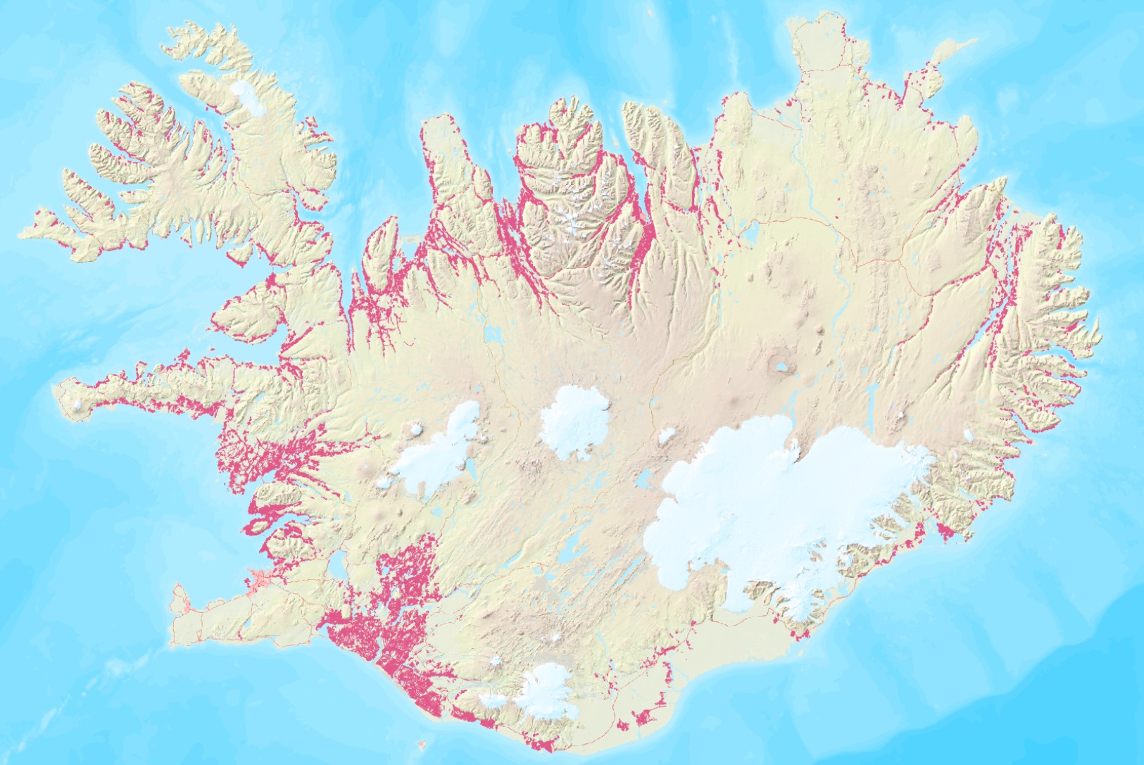
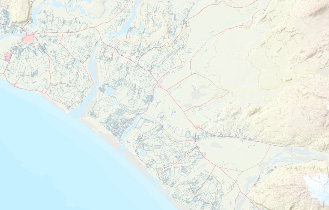
Spatial extent
Provided by
