 INSPIRE Geoportal
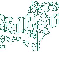
LAPRO2009_ Kulturlandschaft_Erholungsvorsorge - LAPRO2009 - Festlegung von Grünzügen
Der Kartendienst (WMS-Gruppe) stellt die Geodaten aus dem Landschaftsprogramm Saarland die Themenkarte Kulturlandschaft,Erholungsvorsorge,Freiraumentwicklung dar.:Regionale Grünzüge dienen in der überörtlichen Landschaftsplanung der Sicherung zusammenhängender multifunktionaler Freiräume im Ordnungsraum, insbesondere in der Kernzone des Verdichtungsraumes. Sie tragen zu einem kleinräumigen Ausgleich der Umweltbelastungen innerhalb des Ordnungsraumes bei und bündeln die vielfältigen Funktionen des Naturschutzes, des Boden- und Klimaschutzes sowie der Naherholung (insbesondere der Stadtranderholung) auf engem Raum. s. Landschaftsprogramm Saarland, Kapitel 8.8
Simple
Identification info
- Date (Revision)
- 2023-04-20
- Point of contact
-
Organisation name Individual name Electronic mail address Role Ministerium für Umwelt, Klima, Mobilität, Agrar und Verbraucherschutz
Geodatenzentrum@umwelt.saa Geodatenzentrum@umwelt.saarland.de
Publisher
- Keywords
-
-
Landschaftsprogramm 2009
-
infoMapAccessService
-
inspireidentifiziert
-
inspireidentifiziert
-
natur_landschaft
-
- Access constraints
- Other restrictions
- Other constraints
- INSPIRE: Keine Beschränkungen des öffentlichen Zugangs: Es existieren keine Beschränkungen des öffentlichen Zugangs zu Daten und Diensten
- Use constraints
- Other restrictions
- Other constraints
- Es gelten keine Bedingungen
- Service Type
- view
- Service Version
-
OGC:WMS 1.1.1
))
- Coupling Type
- Tight
- Contains Operations
-
Operation Name Distributed Computing Platforms Connect Point GetCapabilities
Web services https://geoportal.saarland.de/mapbender/php/wms.php?inspire=1&layer_id=37519&withChilds=1&REQUEST=GetCapabilities&SERVICE=WMS
- Distribution format
-
Name Version
- OnLine resource
-
Protocol Linkage Name OGC:WMS-1.1.1-http-get-map
https://geoportal.saarland.de/mapbender/php/wms.php?inspire=1&layer_id=37519&withChilds=1&REQUEST=GetCapabilities&SERVICE=WMS Festlegung_Gruenzuegen
- Hierarchy level
- Service
- Other
-
Dienst
Conformance result
- Date (Publication)
- 2010-12-08
- Explanation
-
No explanation available
- Pass
- Yes
Conformance result
- Date (Publication)
- 2009-10-20
- Explanation
-
No explanation available
- Pass
- Yes
Conformance result
- Date (Publication)
- 2014-12-11
- Explanation
-
No explanation available
- Pass
- Yes
Conformance result
- Date (Publication)
- 2008-12-04
- Explanation
-
No explanation available
- Pass
- Yes
Conformance result
- Date (Publication)
- 2014-12-11
- Explanation
-
No explanation available
- Pass
- Yes
Conformance result
- Date (Publication)
- 2013-12-10
- Explanation
-
No explanation available
- Pass
- Yes
Conformance result
- Date (Publication)
- 2011-02-05
- Explanation
-
No explanation available
- Pass
- Yes
Conformance result
- Date (Publication)
- 2010-12-08
- Explanation
-
No explanation available
- Pass
- Yes
Metadata
- File identifier
- 498bcde3-43b7-1c7c-5eb0-aa05c1125c85 XML
- Metadata language
- Deutsch
- Character set
- UTF8
- Hierarchy level
- Service
- Hierarchy level name
-
Darstellungsdienst
- Date stamp
- 2023-04-20
- Metadata standard name
-
ISO19119
- Metadata standard version
-
2005/PDAM 1
- Metadata author
-
Organisation name Individual name Electronic mail address Role GDI-Saarland
gdi-sl@lvgl.saarland.de sl@lvgl.saa gdi-sl@lvgl.saarland.de
Point of contact
Overviews
Spatial extent
Provided by
