 INSPIRE Geoportal
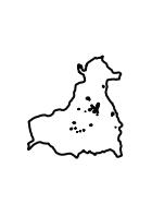
Flächennutzungspläne Bad Zwetsen - Geltungsbereiche FNP Bad Zwesten
Der Darstellungsdienst zeigt die Geltungsbereiche der rechtskräftigen Flächennutzungspläne der Gemeinde Bad Zwesten (Schwalm-Eder-Kreis) inklusive der Verknüpfung auf Pläne und Dokumente. Dies ist ein Web Map Service der Gemeinde Bad Zwesten.:Geltungsbereiche der Flächennutzungspläne der Gemeinde Bad Zwesten im Schwalm-Eder-Kreis
Simple
Identification info
- Date (Revision)
- 2022-10-19
- Point of contact
-
Organisation name Individual name Electronic mail address Role Gemeindevorstand Bad Zwesten
Publisher
-
mapbender.2.registryId
-
-
1c349fea-924b-488f-b6a2-e896f40ac897
-
- Keywords
-
-
Bodennutzung
-
Bauleitplanung
-
Stadtentwicklung
-
Flächennutzung
-
infoMapAccessService
-
inspireidentifiziert
-
inspireidentifiziert
-
- Access constraints
- Other restrictions
- Use constraints
- Other restrictions
- Other constraints
-
andere Beschränkungen - Die Nutzung ohne vertragliche Vereinbarung mit der Gemeinde Bad Zwesten ist nur für nicht kommerzielle Zwecke erlaubt. Die Daten dienen der Orientierung. Für rechtsverbindliche Auskünfte wenden Sie sich bitte an die zuständige Stadt bzw. Gemeinde oder an die untere Bauaufsichtsbehörde. Es besteht kein Anspruch auf Vollständigkeit.
- Service Type
- view
- Service Version
-
OGC:WMS 1.1.1
))
- Coupling Type
- Tight
- Contains Operations
-
Operation Name Distributed Computing Platforms Connect Point GetCapabilities
Web services https://www.geoportal.hessen.de/mapbender/php/wms.php?inspire=1&layer_id=53400&withChilds=1&REQUEST=GetCapabilities&SERVICE=WMS
- Distribution format
-
Name Version
- OnLine resource
-
Protocol Linkage Name OGC:WMS-1.1.1-http-get-map
https://www.geoportal.hessen.de/mapbender/php/wms.php?inspire=1&layer_id=53400&withChilds=1&REQUEST=GetCapabilities&SERVICE=WMS badzwesten_fplaene_umringe
- Hierarchy level
- Service
- Other
-
Dienst
Conformance result
- Date (Publication)
- 2010-12-08
- Explanation
-
No explanation available
- Pass
- Yes
Conformance result
- Date (Publication)
- 2009-10-20
- Explanation
-
No explanation available
- Pass
- Yes
Conformance result
- Date (Publication)
- 2014-12-11
- Explanation
-
No explanation available
- Pass
- Yes
Conformance result
- Date (Publication)
- 2008-12-04
- Explanation
-
No explanation available
- Pass
- Yes
Conformance result
- Date (Publication)
- 2014-12-11
- Explanation
-
No explanation available
- Pass
- Yes
Conformance result
- Date (Publication)
- 2013-12-10
- Explanation
-
No explanation available
- Pass
- Yes
Conformance result
- Date (Publication)
- 2011-02-05
- Explanation
-
No explanation available
- Pass
- Yes
Conformance result
- Date (Publication)
- 2010-12-08
- Explanation
-
No explanation available
- Pass
- Yes
Metadata
- File identifier
- 59cb39e9-b026-f967-970f-407ee9cb23b7 XML
- Metadata language
- Deutsch
- Character set
- UTF8
- Hierarchy level
- Service
- Hierarchy level name
-
Darstellungsdienst
- Date stamp
- 2023-11-16
- Metadata standard name
-
ISO19119
- Metadata standard version
-
2005/PDAM 1
- Metadata author
-
Organisation name Individual name Electronic mail address Role BAD ZWESTEN
Point of contact
Overviews
Spatial extent
Provided by
