INSPIRE Geoportal
Wasserschutzzonen und Grundwasserschutzgebiete des planerischen Gewässerschutzes
Water protection zones and groundwater protection areas for water protection planning
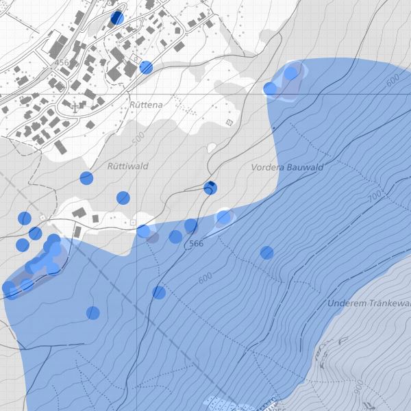
Wasserschutzzonen und Grundwasserschutzgebiete gemäss Gewässerschutzgesetz (LGBl. 2003 Nr. 159). In Gewässerschutzzonen und Grundwasserschutzgebiet gelten besondere Vorschriften für die landwirtschaftliche und bauliche Nutzung. Wasserschutzzonen sind unterteilt in Fassungsbereich S1, engere Schutzzone S2, weiter Schutzzone S3, Schutzareal und Zustroembereich.
Water protection zones and groundwater protection areas in accordance with the Water Protection Act (LGBl. 2003 No. 159). Special regulations for agricultural and constructional use apply in water protection zones and groundwater protection areas. Water protection zones are divided into catchment area S1, narrower protection zone S2, wider protection zone S3, protection area and tributary area.
Simple
-
AlternativtitelAlternate title
-
Planerischer Gewässerschutz, Wasserschutzzonen und Grundwasserschutzgebiete
Planned water protection, water protection zones and groundwater protection areas
-
Date (Publication)Data (Pubblicazione)Date (Publication)Datumsangaben (Publikation)
- 2006-03-17
-
IdentificateurIdentificatoreCitation identifierIdentifikator
- https://metadata.geo.llv.li/6b6ffa6b-8c8c-4a6a-988b-0bd8e102f12f
-
ZweckPurpose
-
Gewässerschutz, Umweltschutz
Water protection, environmental protection
-
EtatStatusStatusBearbeitungsstatus
-
FinaliséCompletatoCompletedAbgeschlossen
- Point of contact
-
Organisation name Individual name Electronic mail address Role Amt für Tiefbau und Geoinformation
Amt für Tiefbau und Geoinformation
Amt für Tiefbau und Geoinformation
Civil Engineering and Geoinformation Office
Editeur (publication)EditorePublisherHerausgeberAmt für Umwelt
Office pour l'environnement
Ufficio per l'ambiente
Office for the Environment
PropriétaireProprietarioOwnerEigentümer / Datenherr
-
Fréquence de mise à jourFrequenza di aggiornamentoMaintenance and update frequencyÜberarbeitungsintervall
-
Lorsque nécessaireSecondo necessitàAs neededBei Bedarf
-
GEMET
-
-
Gewässerschutz
conservation de l'eau
conservazione delle acque
water conservation
-
Gewässer
eaux (géographie)
acque (geografia)
water (geographic)
-
-
GEMET - INSPIRE themes, version 1.0
-
-
Schutzgebiete
Sites protégés
Siti protetti
Protected sites
-
-
geocat.ch
-
-
Gewässerschutzbereich
secteur de protection des eaux
settore di protezione delle acque
water protection sector
-
OpenData
OpenData
OpenData
OpenData
-
INSPIRE
INSPIRE
INSPIRE
INSPIRE
-
-
Spatial scope
-
-
National
Nationales
Nazionali
National
-
Contraintes sur la ressource
Vincoli sulla risorsa
Resource constraints
Ressourceneinschränkungen
-
Anwendungseinschränkungen
-
keine
-
Contraintes d'accèsVincoli di accessoAccess constraintsZugriffseinschränkungen
-
Autres restrictionsAltri vincoliOther restrictionsBenutzerdefinierte Einschränkungen
-
Contraintes d'utilisationVincoli di fruibilitàUse constraintsNutzungseinschränkungen
-
Autres restrictionsAltri vincoliOther restrictionsBenutzerdefinierte Einschränkungen
-
Andere EinschränkungenAutres contraintesAltri vincoliOther constraints
-
No limitations to public accessNo limitations to public accessNo limitations to public accessNo limitations to public access
-
Contraintes d'accèsVincoli di accessoAccess constraintsZugriffseinschränkungen
-
Autres restrictionsAltri vincoliOther restrictionsBenutzerdefinierte Einschränkungen
-
Contraintes d'utilisationVincoli di fruibilitàUse constraintsNutzungseinschränkungen
-
Autres restrictionsAltri vincoliOther restrictionsBenutzerdefinierte Einschränkungen
-
Andere EinschränkungenAutres contraintesAltri vincoliOther constraints
-
No conditions to access and useNo conditions to access and useNo conditions to access and useNo conditions to access and use
-
Andere EinschränkungenAutres contraintesAltri vincoliOther constraints
-
Opendata BY: Freie Nutzung. Quellenangabe ist Pflicht.Opendata BY: Utilisation libre. Obligation d’indiquer la source.Opendata BY: Libero utilizzo. Indicazione della fonte obbligatoria.Opendata BY: Open use. Must provide the source.
-
Type de représentation spatialeTipo di rappresentazione spazialeSpatial representation typeRäumliche Darstellungsart
-
VecteurDati vettorialiVectorVektor
-
Langue de la ressourceLingua dei datiLanguageSprache
- Deutsch
-
Encodage des caractèresSet dei caratteri dei datiCharacter setZeichensatz
-
Utf8UTF8UTF8Utf8
-
Catégorie ISOTemaTopic categoryISO-Thematik
-
-
Eaux intérieures, HydrographieAcque interneInland watersBinnengewässer
-
Étendue
Estensione
Extent
Ausdehnung
-
BeschreibungDescriptionDescrizioneDescription
-
Liechtenstein
Liechtenstein
Liechtenstein
Liechtenstein
))

-
Nom du système de référenceIdentificatore del sistema di riferimentoReference system identifierIdentifikator des Referenzsystems
-
http://www.opengis.net/def/crs/EPSG/0/2056
-
Nom du système de référenceIdentificatore del sistema di riferimentoReference system identifierIdentifikator des Referenzsystems
-
http://www.opengis.net/def/crs/EPSG/0/4936
-
Niveau topologieLivello di topologiaTopology levelTopologielevel
-
Topologie de réseau complèteGrafo planare completoFull planar graphFlächen
-
Type de géométries des objetsOggetto di tipo geometricoGeometric object typeGeometrietyp
-
PolygoneSuperficieSurfaceFläche
-
Nombre d'objets géométriquesConteggio oggetto geometricoGeometric object countAnzahl
- 20
- Distribution format
-
Name Version INTERLIS 1 (ITF)
ESRI Shapefile (SHP)
AutoCAD DXF (DXF)
- Distributor contact
-
Organisation name Individual name Electronic mail address Role Abt. Vermessung und Geoinformation (ATG)
Abt. Vermessung und Geoinformation (ATG)
Abt. Vermessung und Geoinformation (ATG)
Surveying and Geoinformation Division
Point de contactPunto di contattoPoint of contactAnsprechpartner
- OnLine resource
-
Protocol Linkage Name WWW:LINK
https://service.geo.llv.li/ Geodatenportal
Geodata Portal
WWW:LINK-1.0-http--link
https://service.geo.llv.li/wmsli/service?service=WMS&language=ger&request=GetCapabilities OGC WMS Service der Liechtensteinen Landesverwaltung
OGC-WMS Service of the National Administration
WWW:DOWNLOAD-URL
https://service.geo.llv.li/download/getfileByUUID.php?id=6b6ffa6b-8c8c-4a6a-988b-0bd8e102f12f Zip Download über das Geodatenportal
Zip download via the geodata portal
OGC Web Map Service
https://service.geo.llv.li/wmsli/service?service=WMS&language=ger&request=GetCapabilities li.au.pg_schutzzone
-
NiveauLivelloHierarchy levelBezugsebene
-
Jeu de donnéesDatasetDatasetDatenbestand
Résultat de conformité
Conformità
Conformance result
Konformitätsergebnis
-
Titel
-
VERORDNUNG (EG) Nr. 1089/2010 DER KOMMISSION vom 23. November 2010 zur Durchführung der Richtlinie 2007/2/EG des Europäischen Parlaments und des Rates hinsichtlich der Interoperabilität von Geodatensätzen und -diensten
-
Date (Publication)Data (Pubblicazione)Date (Publication)Datumsangaben (Publikation)
- 2010-12-08
- Explanation
-
Gemäss INSPIRE Bestandteil der Themen "Gewässernetz" sowie "Versorgungswirtschaft und staatliche Dienste" sowie "Bewirtschaftungsgebiete/Schutzgebiete/geregelte Gebiete und Berichterstattungseinheiten"
-
Degré de conformitéPassPassBestanden
- No
-
Erläuterung
-
Konstruktion auf der Grundlage der Amtlichen Vermessung
-
Inclus dans le jeu de donnéesIncluded with datasetIncluded with datasetIm Datenbestand enthalten
-
Titel
-
Datenmodell Planerischer Gewässerschutz Version 1
-
Date (Création)Data (Creazione)Date (Creation)Datumsangaben (Erstellung)
- 2007-07-03
Metadata
-
Identifiant de la ficheIdentificatore del file di metadatiFile identifierMetadatensatzidentifikator
- 6b6ffa6b-8c8c-4a6a-988b-0bd8e102f12f XML
-
LangueLingua dei metadatiMetadata languageSprache
- Deutsch
-
Jeu de caractèresSet dei caratteri dei metadatiCharacter setZeichensatz
-
Utf8UTF8UTF8Utf8
-
Type de ressourceLivello gerarchicoHierarchy levelHierarchieebene
-
Jeu de donnéesDatasetDatasetDatenbestand
-
Date des métadonnéesData dei metadatiDate stampDatum
- 2024-10-30T15:55:17.267Z
- Metadata standard name
-
GM03 2+
- Metadata author
-
Organisation name Individual name Electronic mail address Role Amt für Umwelt (LI)
Office de l'environnement
Amt für Umwelt
Amt für Umwelt
Point de contactPunto di contattoPoint of contactAnsprechpartner
- Other language
-
Language Character encoding FrançaisFranceseFrenchFranzösischUtf8UTF8UTF8Utf8ItalienItalianoItalianItalienischUtf8UTF8UTF8Utf8AnglaisIngleseEnglishEnglischUtf8UTF8UTF8Utf8AllemandTedescoGermanDeutschUtf8UTF8UTF8Utf8