INSPIRE Geoportal
Gravimetrischer Atlas der Schweiz 1:100000
Atlas gravimétrique de la Suisse 1:100000
Atlante gravimetrico della Svizzera 1:100000
Gravimetric Atlas of Switzerland 1:100000
Atlas gravimetric da la Svizra 1:100000
In 22 Blättern werden die Bouguer-Anomalien für die Schweiz dargestellt. Als Bouguer-Anomalie bezeichnet man die Differenz zwischen der in einem bestimmten Punkt auf der Erdoberfläche gemessenen Schwere und jenem Schwerewert, welchen man für eine schalenförmig homogene Erde am selben Punkt erwarten würde. Die Berechnungen der Schwereanomalien der Erdkruste basieren auf der internationalen Schwereformel von 1967. Die Geländeeinwirkung wurde mit einer konstanten Dichte von 2670kg/m3 bis 167 km (Zone O2 nach Hayford) berücksichtigt.- Der Gravimetrische Atlas der Schweiz (GRAV100) ist eine Publikation der Schweizerischen Geophysikalischen Kommission (Organ der Akademie der Naturwissenschaften).
Les anomalies de Bouguer sont représentées sur 22 feuilles couvrant l’ensemble du territoire suisse. On nomme anomalie de Bouguer la différence entre l’intensité de la pesanteur mesurée en un point donnée de la surface terrestre et la valeur calculée au même point d’un modèle de Terre idéale, dotée d’un croûte homogène. Les calculs des anomalies gravitaires de la croûte terrestre se basent sur la formule internationale de gravité de 1967. L'incidence de la topographie a été prise en compte avec une densité constante de 2670 kg / m3 jusqu’à 167 km (zone O2 de Hayford).- L'Atlas gravimétrique de la Suisse (GRAV100) est une publication de la Commission suisse de géophysique (organe de l'Académie suisse des sciences naturelles).
L’atlante riproduce i valori delle anomalie di Bouguer su 22 fogli che coprono tutto il territorio svizzero. L’anomalia di Bouguer esprime la differenza tra la gravità misurata e il relativo valore teorico per un modello terrestre ideale a crosta omogenea, tenuto conto di diversi parametri quali l’altitudine, la latitudine e l’influenza della topografia. I calcoli delle anomalie di gravità della crosta terrestre si basano sulla formula internazionale di gravità del 1967. L’incidenza della topografia è stata considerata con una densità costante di 2670 kg/m3 fino a 167 km (zona O2 di Hayford). L’Atlante gravimetrico della Svizzera (GRAV100) è una pubblicazione della Commissione svizzera di geofisica (organo dell’Accademia svizzera di scienze naturali).
The Bouguer anomalies for Switzerland are shown on 22 sheets. A Bouguer anomaly is the difference between the gravity measured at a particular point on the Earth's surface and the gravity value expected at the same point for an Earth model with a homogeneous crust. Gravity anomalies in the Earth's crust are calculated using the International Gravity Formula of 1967. Topographic effects are taken into account using a constant density of 2670 kg/m3 to a depth of 167 km (Hayford Zone O2). The Gravimetric Atlas of Switzerland (GRAV100) is a publication of the Swiss Geophysical Commission (part of the Swiss Academy of Sciences).
En 22 fegls vegnan preschentadas las anomalias da Bouguer per la Svizra. Anomalias da Bouguer numnan ins la differenza tranter la gravitad ch'è vegnida mesirada en in punct fixà sin la surfatscha da la terra e la valur da la gravitad calculada en il medem punct per in model terrester ideal cun crusta da terra omogena. Las calculaziuns da las anomalias da la gravitad da la crusta da la terra sa basan sin la furmla internaziunala da gravitad da l'onn 1967. L'influenza da la topografia è vegnida resguardada cun ina densitad constanta da 2670 kg/m3 fin ad ina distanza da 167 km (zona O2 tenor Hayford). – L'Atlas gravimetric da la Svizra (GRAV100) vegn publitgà da la Cumissiun svizra da geofisica (Organ da l'Academia svizra da las scienzas natiralas).
Simple
-
AlternativtitelAutres appellations ou acronymesTitolo alternativoAlternate titleAlternate title
-
Gravimetrischer Atlas 100
Atlas gravimétrique 100
Atlante gravimetrico 100
Gravimetric Atlas 100
Atlas gravimetric 100
-
Date (Révision)Data (Revisione)Date (Revision)Date (Revision)Datumsangaben (Überarbeitung)
- 2002-12-31
-
Date (Création)Data (Creazione)Date (Creation)Date (Creation)Datumsangaben (Erstellung)
- 1994-01-01T00:00:00
-
IdentificateurIdentificatoreCitation identifierCitation identifierIdentifikator
- ch.swisstopo.geologie-gravimetrischer_atlas
Identificateur
Identificatore
Citation identifier
Citation identifier
Identifikator
-
Forme de la présentationFormato di presentazionePresentation formPresentation formPräsentationsform
-
Carte papierMappa cartaceaHardcopy mapHardcopy mapAnaloge Karte
-
Gemeinsamer TitelTitre collectifTitolo collettivo
-
Geophysikalisches Kartenwerk
Cartes géophysiques
Carte geofisiche
-
ZweckBut
-
Übersicht über das Schwerefeld in der Schweiz
Vue d'ensemble du champ gravimétrique en Suisse
-
EtatStatusStatusStatusBearbeitungsstatus
-
FinaliséCompletatoCompletedCompletedAbgeschlossen
- Point of contact
-
Organisation name Individual name Electronic mail address Role Bundesamt für Landestopografie swisstopo
Office fédéral de topographie swisstopo
Ufficio federale di topografia swisstopo
Federal Office of Topography swisstopo
Uffizi federal da topografia swisstopo
DistributeurDistributoreDistributorDistributorVertriebSchweizerische Geophysikalische Kommission
Commission suisse de géophysique
Swiss Geophysical Commission
Swiss Geophysical Commission
A l’origine deIdeatoreOriginatorOriginatorUrheberBundesamt für Landestopografie swisstopo
Office fédéral de topographie swisstopo
Ufficio federale di topografia swisstopo
Federal Office of Topography swisstopo
Uffizi federal da topografia swisstopo
Point de contactPunto di contattoPoint of contactPoint of contactAnsprechpartnerBundesamt für Landestopografie swisstopo
Office fédéral de topographie swisstopo
Ufficio federale di topografia swisstopo
Federal Office of Topography swisstopo
Uffizi federal da topografia swisstopo
PropriétaireProprietarioOwnerOwnerEigentümer / Datenherr
-
Fréquence de mise à jourFrequenza di aggiornamentoMaintenance and update frequencyMaintenance and update frequencyÜberarbeitungsintervall
-
Lorsque nécessaireSecondo necessitàAs neededAs neededBei Bedarf
-
geocat.ch
-
-
Aufbewahrungs- und Archivierungsplanung AAP - Bund
Planification de la conservation et de l'archivage AAP - Conféderation
Pianificazione della conservazione e dell’archiviazione AAP - Confederazione
Conservation and archiving planning AAP - Confederation
-
Geobasisdaten
géodonnées de base
geodati di base
official geodata
-
Geophysikalische Karte
carte géophysique
carta geofisica
geophysical map
-
Gravimetrie
gravimétrie
gravimetria
gravimetry
-
Bouguer-Anomalie
anomalie de bouguer
anomalie di bouguer
bouguer anomaly
-
opendata.swiss
opendata.swiss
opendata.swiss
opendata.swiss
opendata.swiss
-
-
GEMET
-
-
Geophysik
géophysique
geofisica
geophysics
-
-
GEMET - INSPIRE themes, version 1.0
-
-
Geologie
Géologie
Geologia
Geology
-
-
geocat.ch
-
-
BGDI Bundesgeodaten-Infrastruktur
IFDG l’Infrastructure Fédérale de données géographiques
IFDG Infrastruttura federale dei dati geografici
FSDI Federal Spatial Data Infrastructure
-
-
Type de représentation spatialeTipo di rappresentazione spazialeSpatial representation typeSpatial representation typeRäumliche Darstellungsart
-
paperMappaperMappaperMappaperMappaperMap
-
Dénominateur de l'échelleDenominatoreDenominatorDenominatorMaßstabszahl
- 100000
-
Langue de la ressourceLingua dei datiLanguageLanguageSprache
- Deutsch
-
Langue de la ressourceLingua dei datiLanguageLanguageSprache
- Français
-
Encodage des caractèresSet dei caratteri dei datiCharacter setCharacter setZeichensatz
-
Utf8UTF8UTF8UTF8Utf8
-
Catégorie ISOTemaTopic categoryTopic categoryISO-Thematik
-
-
Sciences de la terre, géosciencesInformazioni geoscientificheGeoscientific informationGeoscientific informationGeowissenschaften
-
Étendue
Estensione
Extent
Extent
Ausdehnung
-
BeschreibungDescriptionDescrizioneDescriptionDescription
-
Schweiz
Suisse
Svizzera
Switzerland
Svizra
))

-
Nom du système de référenceIdentificatore del sistema di riferimentoReference system identifierReference system identifierIdentifikator des Referenzsystems
-
Referenzsystem entsprechend der zugrundeliegenden topographischen Karte (CH1903)
- Distribution format
-
Name Version nan
- OnLine resource
-
Protocol Linkage Name MAP:Preview
https://map.geo.admin.ch/?layers=ch.swisstopo.geologie-gravimetrischer_atlas Vorschau map.geo.admin.ch
Aperçu map.geo.admin.ch
Previsione map.geo.admin.ch
Preview map.geo.admin.ch
OGC:WMS
https://wms.geo.admin.ch/?SERVICE=WMS&VERSION=1.3.0&REQUEST=GetCapabilities&lang=de ch.swisstopo.geologie-gravimetrischer_atlas
ch.swisstopo.geologie-gravimetrischer_atlas
ch.swisstopo.geologie-gravimetrischer_atlas
ch.swisstopo.geologie-gravimetrischer_atlas
ch.swisstopo.geologie-gravimetrischer_atlas
OGC:WMTS
https://wmts.geo.admin.ch/EPSG/3857/1.0.0/WMTSCapabilities.xml?lang=de ch.swisstopo.geologie-gravimetrischer_atlas
ch.swisstopo.geologie-gravimetrischer_atlas
ch.swisstopo.geologie-gravimetrischer_atlas
ch.swisstopo.geologie-gravimetrischer_atlas
ch.swisstopo.geologie-gravimetrischer_atlas
- OnLine resource
-
Protocol Linkage Name WWW:LINK
https://shop.swisstopo.admin.ch/de/products/maps/geology/GRAVI WWW:DOWNLOAD-URL
https://data.geo.admin.ch/ch.swisstopo.geologie-gravimetrischer_atlas/data.zip
- OnLine resource
-
Protocol Linkage Name CHTOPO:specialised-geoportal
http://map.geologieportal.ch OPENDATA:SWISS
https://opendata.swiss/de/perma/732cb247-8307-4cc7-8c31-b1c505a94633@bundesamt-fur-landestopografie-swisstopo Permalink opendata.swiss
Permalink opendata.swiss
Permalink opendata.swiss
Permalink opendata.swiss
-
NiveauLivelloHierarchy levelHierarchy levelBezugsebene
-
Jeu de donnéesDatasetDatasetDatasetDatenbestand
-
Erläuterung
-
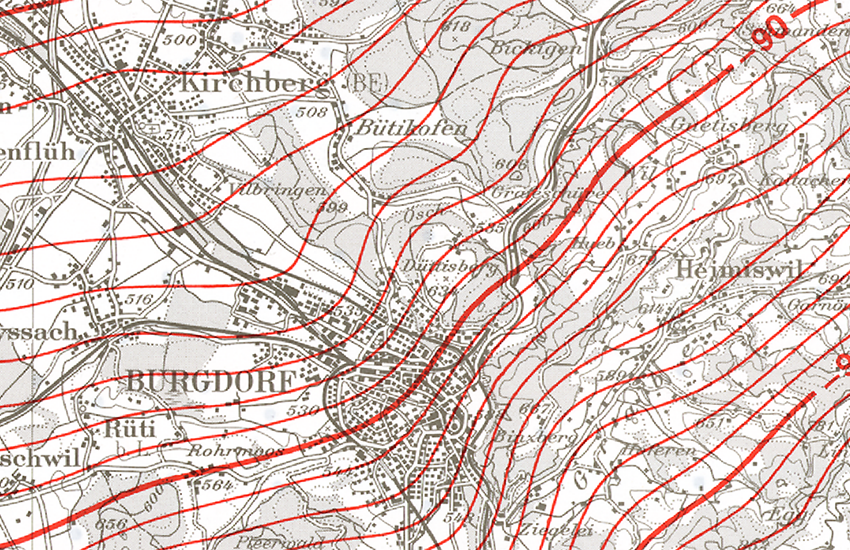
Die Blätter des Gravimetrischen Atlas, mit dem Blattschnitt der Landeskarte 1:100 000, geben Auskunft über das Schwerefeld der Schweiz.
Metadata
-
Identifiant de la ficheIdentificatore del file di metadatiFile identifierFile identifierMetadatensatzidentifikator
- 732cb247-8307-4cc7-8c31-b1c505a94633 XML
-
LangueLingua dei metadatiMetadata languageMetadata languageSprache
- Deutsch
-
Jeu de caractèresSet dei caratteri dei metadatiCharacter setCharacter setZeichensatz
-
Utf8UTF8UTF8UTF8Utf8
-
Type de ressourceLivello gerarchicoHierarchy levelHierarchy levelHierarchieebene
-
Jeu de donnéesDatasetDatasetDatasetDatenbestand
-
Date des métadonnéesData dei metadatiDate stampDate stampDatum
- 2022-04-06T09:10:11
- Metadata standard name
-
GM03 2+
- Metadata author
-
Organisation name Individual name Electronic mail address Role Bundesamt für Landestopografie swisstopo
Office fédéral de topographie swisstopo
Ufficio federale di topografia swisstopo
Federal Office of Topography swisstopo
Uffizi federal da topografia swisstopo
Point de contactPunto di contattoPoint of contactPoint of contactAnsprechpartner
- Other language
-
Language Character encoding FrançaisFranceseFrenchFrenchFranzösischUtf8UTF8UTF8UTF8Utf8ItalienItalianoItalianItalianItalienischUtf8UTF8UTF8UTF8Utf8AnglaisIngleseEnglishEnglishEnglischUtf8UTF8UTF8UTF8Utf8RomancheRomancioRomanshRomanshRätoromanischUtf8UTF8UTF8UTF8Utf8AllemandTedescoGermanGermanDeutschUtf8UTF8UTF8UTF8Utf8