INSPIRE Geoportal
Lagefixpunkte LFP1 (Landesvermessung)
Points fixes planimétriques (PFP1) (mensuration nationale)
Punti fissi planimetrici PFP1 (misurazione nazionale)
Planimetric control Points LFP1 (National Survey)
Puncts fixs planimetrics PFP1 (mesiraziun naziunala)
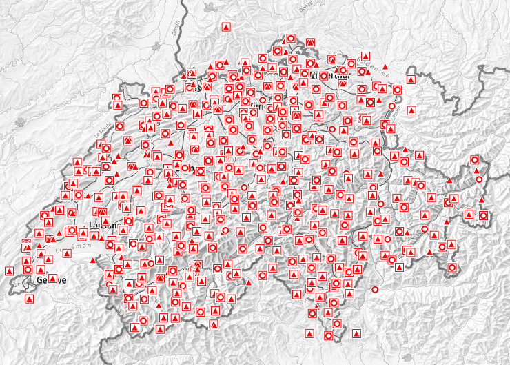
Vermessungspunkte bilden die Grundlage aller Daten mit Raumbezug. Die so genannten Fixpunkte werden für alle vermessungstechnischen Arbeiten genutzt, die eine zuverlässige und präzise Bestimmung erfordern. Unter einem Lagefixpunkt versteht man einen dauerhaft mit einem Stein oder einem Bolzen (zum Teil unter Schacht) versicherten Punkt mit bekannten Koordinaten und eventuell bekannter Höhe. Die Landesvermessung (swisstopo) ist für die Lagefixpunkte der Kategorie 1 zuständig. Es gibt verschiedene Typen: * Die Lagefixpunkte der Kategorie 1 (LFP1) bilden den Lagebezugsrahmen für sämtliche Vermessungsarbeiten in der Schweiz. Die LV03-Koordinaten der historischen Lagefixpunkte wurden zu Beginn des 20. Jahrhunderts mittels Triangulation bestimmt. * Die Transformationsstützpunkte (TSP1) sind Lagefixpunkte, welche über präzise gemessene Koordinaten sowohl im Bezugsrahmen LV03 wie auch LV95 verfügen. * Die EUREF Punkte sind Lagefixpunkte des europäischen GNSS-Referenznetzes EUREF (European Reference Frame). * Die LV95 Punkte sind Lagefixpunkte, welche die Grundlage für den neuen Bezugsrahmen LV95 bilden. Die Koordinaten dieser Punkte wurden sehr präzise mittels GNSS bestimmt. Da ein Lagefixpunkt mehreren Typen zugeordnet werden kann, sind überlagernde Symbole auf der Karte möglich.
Les points de mensuration constituent la base de toutes les données à référence spatiale. L’utilisation des points dits fixes est recommandée pour tous les travaux techniques nécessitant des mesures fiables et précises d’ouvrages. Par point fixe planimétrique, on entend un point matérialisé de façon durable à l'aide d'une borne ou d'une cheville (parfois située dans un regard) dont les coordonnées et éventuellement l'altitude sont connues. La mensuration nationale (swisstopo) est responsable des points fixes planimétriques de première catégorie. Il en existe plusieurs types: * Les points fixes planimétriques de la première catégorie (PFP1) composent le cadre de référence planimétrique de tous les travaux de mensuration effectués en Suisse. Les coordonnées MN03 des points fixes planimétriques historiques ont été déterminées par triangulation au début du 20ème siècle. * Les points d’appui pour la transformation (PAT1) sont des points fixes planimétriques dont les coordonnées ont été mesurées de façon précise dans les cadres de références MN03 et MN95. * Les points EUREF sont des points fixes planimétriques du réseau de référence GNSS européen EUREF (European Reference Frame). * Les points MN95 sont des points fixes planimétriques servant de base pour le nouveau cadre de référence MN95. Leurs coordonnées ont été mesurées de façon précise par GNSS. Puisqu'un point fixe peut être à la fois de plusieurs types, les symboles de la légende peuvent être superposés sur la carte.
I punti di misurazione costituiscono la base di tutti i dati a riferimento spaziale. L’utilizzo dei punti cosiddetti fissi è raccomandato per tutti i lavori tecnici che necessitano di misure affidabili e precise nelle zone considerate. Per punto fisso planimetrico s'intende un punto assicurato durevolmente con un cippo o un bollone (talvolta sotto chiusino) con coordinate conosciute e eventualmente altezza conosciuta. I punti fissi planimetrici della prima categoria sono di responsabilità della confederazione (swisstopo). Ne esistono di diversi tipi: * I punti fissi della prima categoria (PFP1) costituiscono la base per tutti i lavori di misurazione in Svizzera. Le coordinate MN03 dei punti fissi planimetrici storici sono state determinate tramite triangolazione all’inizio del 20esimo secolo. * I punti d'appoggio per la trasformazione (PAT1) sono dei punti misurati in modo preciso nei quadri di riferimento MN03 e MN95. * I punti EUREF sono punti fissi planimetrici della rete di riferimento GNSS europea EUREF (European Reference Frame). * I punti MN95 sono dei punti fissi planimetrici che servono da base per il nuovo quadro di riferimento MN95. Le loro coordinate sono state misurate in maniera precisa secondo il metodo GNSS. Siccome a volte un punto fisso può essere di differenti tipi, i simboli della leggenda possono sovrapporsi sulla carta.
All spatial data is based on measurement points. It is recommended to use the so-called fixed control points for all technical works which need reliable and accurate position measurements. A planimetric fixed control point ("Lagefixpunkte" in german) is a surveyed point permanently marked with a stone monument or a bolt (sometimes covered by a manhole) with known coordinates and potentially height. The Swiss national land survey is responsible for the first category of planimetric fixed control points. There are several types of those: * Planimetric fixed points of the first categorie LFP1 provide the reference framework for all survey work in Switzerland. LV03 coordinates from historical fixed control points have been established by triangulation at the beginning of the 20th century. * TSP1 pass points (“Transformationsstützpunkte” in german) are very accurately measured surveying points in both reference frames LV03 and LV95, . * EUREF points are planimetric fixed points from the European GNSS reference network EUREF (European Reference Frame). * LV95 points are planimetric fixed points used as basis for the new reference frame LV95. Their coordinates have been with GNSS precisely measured. Since a planimetric fixed points can be simultaneously from different types, the symbols of this layer can be overlayed.
Puncts da mesiraziun furman la basa da tut las datas che sa refereschan al territori. Ils uschenumnads puncts fixs vegnan duvrads per tut las lavurs tecnicas che basegnan ina mesiraziun fidada ed exacta. In punct fix planimetric è in punct ch'è designà permanentamain cun in crap u cun in bullun (per part en in tumbin), dal qual ins enconuscha las coordinatas ed eventualmain l'autezza. La mesiraziun naziunala (swisstopo) è responsabla per ils puncts fixs planimetrics da la categoria 1 (PFP1). I dat differents tips: * Ils puncts fixs planimetrics da la categoria 1 (PFP1) furman il rom da referenza planimetric per tut las lavurs da mesiraziun en Svizra. Las coordinatas da la MN03 dals puncts fixs planimetrics istorics èn vegnidas determinadas cun agid da la triangulaziun il cumenzament dal 20avel tschientaner. * Ils puncts da sustegn per la transfurmaziun (PST1) èn puncts fixs planimetrics cun coordinatas exactas tant en il rom da referenza MN03 sco er MN95. * Ils puncts EUREF èn puncts fixs planimetrics da la rait da referenza da GNSS europeica EUREF (European Reference Frame). * Ils puncts da la MN95 èn puncts fixs planimetrics che furman la basa per il nov rom da referenza MN95. Las coordinatas da quests puncts èn vegnidas determinadas en moda fitg exacta cun agid da GNSS. Cunquai ch'in punct fix planimetric po vegnir attribuì a plirs tips, èsi pussaivel ch'ils simbols èn surpostads sin la charta.
Simple
-
AlternativtitelAutres appellations ou acronymesTitolo alternativoAlternate titleAlternate title
-
Lagefixpunkte LFP1
Points fixes planimétriques PFP1
Punti fissi planimetrici PFP1
Planimetric control points LFP1
Puncts fixs planimetrics PFP1
-
Date (Révision)Data (Revisione)Date (Revision)Date (Revision)Datumsangaben (Überarbeitung)
- 2007-09-20
-
Date (Création)Data (Creazione)Date (Creation)Date (Creation)Datumsangaben (Erstellung)
- 1860-01-01T00:00:00
-
IdentificateurIdentificatoreCitation identifierCitation identifierIdentifikator
- ch.swisstopo.fixpunkte-lfp1
Identificateur
Identificatore
Citation identifier
Citation identifier
Identifikator
-
Gemeinsamer TitelTitre collectifTitolo collettivoCollective title
-
Lagefixpunkte LFP1, HFP1 (Landesvermessung)
Points fixes (PFP1, PFA1) (mensuration nationale )
Punti fissi planimetrici PFP1, PFA1 (misurazione nazionale)
Planimetric control Points LFP1 (National Survey)
-
EtatStatusStatusStatusBearbeitungsstatus
-
Mise à jour continueIn corsoOn goingOn goingKontinuierliche Aktualisierung
- Point of contact
-
Organisation name Individual name Electronic mail address Role Bundesamt für Landestopografie swisstopo
Office fédéral de topographie swisstopo
Ufficio federale di topografia swisstopo
Federal Office of Topography swisstopo
Uffizi federal da topografia swisstopo
PropriétaireProprietarioOwnerOwnerEigentümer / DatenherrBundesamt für Landestopografie swisstopo, Vermessung
Office fédéral de topographie, mensuration
Ufficio federale di topografia swisstopo, misurazione
Federal office of topography swisstopo, survey
Bundesamt für Landestopografie swisstopo, Vermessung
Point de contactPunto di contattoPoint of contactPoint of contactAnsprechpartner
-
Fréquence de mise à jourFrequenza di aggiornamentoMaintenance and update frequencyMaintenance and update frequencyÜberarbeitungsintervall
-
userDefineduserDefineduserDefineduserDefineduserDefined
-
Autre fréquence de mise à jourFrequenza di manutenzione definita dall'utenteUser defined maintenance frequencyUser defined maintenance frequencyBenutzerdefiniertes Pflegeintervall
-
P12Y0M0DT0H0M0S
-
AnmerkungRemarque sur la mise à jour
-
Der Unterhalt der LFP1 / HFP1 unterliegt der periodischen Nachführung (PNF), wobei nach eingegangener Schadenmeldungen die Mängel laufend behoben werden.
La maintenance des PFP1 et PFA1 es sous la mise à jour périodique (MAP), ainsi les déficiences seront traites suivant les déclarations de dégâts,
-
geocat.ch
-
-
Koordinate
coordonnée
coordinate
coordinate
-
Bezugsrahmen
cadre de référence
quadro di riferimento
reference frame
-
Landesvermessung
mensuration nationale
misurazione nazionale
national survey
-
Aufbewahrungs- und Archivierungsplanung AAP - Bund
Planification de la conservation et de l'archivage AAP - Conféderation
Pianificazione della conservazione e dell’archiviazione AAP - Confederazione
Conservation and archiving planning AAP - Confederation
-
Geobasisdaten
géodonnées de base
geodati di base
official geodata
-
Landeskoordinaten
coordonnées nationales
coordinate nazionali
national coordinates
-
-
GEMET
-
-
Geodäsie
géodésie
geodesia
geodesy
-
-
GEMET - INSPIRE themes, version 1.0
-
-
Höhe
Altitude
Elevazione
Elevation
-
Koordinatenreferenzsysteme
Référentiels de coordonnées
Sistemi di coordinate
Coordinate reference systems
-
-
geocat.ch
-
-
opendata.swiss
opendata.swiss
opendata.swiss
opendata.swiss
opendata.swiss
-
-
geocat.ch
-
-
BGDI Bundesgeodaten-Infrastruktur
IFDG l’Infrastructure Fédérale de données géographiques
IFDG Infrastruttura federale dei dati geografici
FSDI Federal Spatial Data Infrastructure
-
-
Type de représentation spatialeTipo di rappresentazione spazialeSpatial representation typeSpatial representation typeRäumliche Darstellungsart
-
VecteurDati vettorialiVectorVectorVektor
-
Langue de la ressourceLingua dei datiLanguageLanguageSprache
- Deutsch
-
Langue de la ressourceLingua dei datiLanguageLanguageSprache
- Français
-
Langue de la ressourceLingua dei datiLanguageLanguageSprache
- Italiano
-
Encodage des caractèresSet dei caratteri dei datiCharacter setCharacter setZeichensatz
-
Utf8UTF8UTF8UTF8Utf8
-
Catégorie ISOTemaTopic categoryTopic categoryThematik
-
-
LocalisationPosizioneLocationLocationOrtsangaben
-
Étendue
Estensione
Extent
Extent
Ausdehnung
-
BeschreibungDescriptionDescrizioneDescription
-
Topografisches Landschaftsmodell
Modèle topographique du paysage
Modello topografico del paesaggio
Topographic Landscape Model
))

-
Identifiant géographiqueidentificatore GeograficoGeographic identifierGeographic identifierGeografischer Identifikator
-
TLMMTPMTPTLMnull
-
Nom du système de référenceIdentificatore del sistema di riferimentoReference system identifierReference system identifierIdentifikator des Referenzsystems
-
CH1903
-
Nom du système de référenceIdentificatore del sistema di riferimentoReference system identifierReference system identifierIdentifikator des Referenzsystems
-
CH1903+
-
Nom du système de référenceIdentificatore del sistema di riferimentoReference system identifierReference system identifierIdentifikator des Referenzsystems
-
CHTRS95
-
Type de géométries des objetsOggetto di tipo geometricoGeometric object typeGeometric object typeGeometrietyp
-
PointPuntoPointPointPunkt
-
Nombre d'objets géométriquesConteggio oggetto geometricoGeometric object countGeometric object countAnzahl
- 600
-
Type de géométries des objetsOggetto di tipo geometricoGeometric object typeGeometric object typeGeometrietyp
-
PointPuntoPointPointPunkt
-
Nombre d'objets géométriquesConteggio oggetto geometricoGeometric object countGeometric object countAnzahl
- 8500
-
Type de géométries des objetsOggetto di tipo geometricoGeometric object typeGeometric object typeGeometrietyp
-
PointPuntoPointPointPunkt
-
Nombre d'objets géométriquesConteggio oggetto geometricoGeometric object countGeometric object countAnzahl
- 210
- Distribution format
-
Name Version N/A
N/A
- OnLine resource
-
Protocol Linkage Name MAP:Preview
https://map.geo.admin.ch/?layers=ch.swisstopo.fixpunkte-lfp1 Vorschau map.geo.admin.ch
Aperçu map.geo.admin.ch
Previsione map.geo.admin.ch
Preview map.geo.admin.ch
OGC:WMS
https://wms.geo.admin.ch/?SERVICE=WMS&VERSION=1.3.0&REQUEST=GetCapabilities&lang=de ch.swisstopo.fixpunkte-lfp1
ch.swisstopo.fixpunkte-lfp1
ch.swisstopo.fixpunkte-lfp1
ch.swisstopo.fixpunkte-lfp1
ch.swisstopo.fixpunkte-lfp1
- OnLine resource
-
Protocol Linkage Name WWW:LINK
https://www.cadastre.ch/de/manual-av/topic/points.html#zustndigkeiten-fixpunktdatenservice-fpds
- OnLine resource
-
Protocol Linkage Name CHTOPO:specialised-geoportal
https://map.geo.admin.ch/?X=190000.00&Y=660000.00&zoom=1&topic=ech&lang=de&bgLayer=ch.swisstopo.pixelkarte-farbe&layers=ch.swisstopo.fixpunkte-lfp1 ESRI:REST
https://api3.geo.admin.ch/rest/services/api/MapServer/ch.swisstopo.fixpunkte-lfp1 RESTful API von geo.admin.ch
RESTful API de geo.admin.ch
RESTful API da geo.admin.ch
RESTful API from geo.admin.ch
RESTful API dad geo.admin.ch
OPENDATA:SWISS
https://opendata.swiss/de/perma/7a49183b-9766-40dd-936c-fb09fdded185@bundesamt-fur-landestopografie-swisstopo Permalink opendata.swiss
Permalink opendata.swiss
Permalink opendata.swiss
Permalink opendata.swiss
-
LangueLinguaLanguageLanguageSprache
- Deutsch
-
LangueLinguaLanguageLanguageSprache
- Français
-
Inclus dans le jeu de donnéesIncluded with datasetIncluded with datasetIncluded with datasetIm Datenbestand enthalten
-
Date (Publication)Data (Pubblicazione)Date (Publication)Date (Publication)Datumsangaben (Publikation)
- 2004-06-04
-
Weitere InformationenAutres informations de référenceAltri dettagli
Metadata
-
Identifiant de la ficheIdentificatore del file di metadatiFile identifierFile identifierMetadatensatzidentifikator
- 7a49183b-9766-40dd-936c-fb09fdded185 XML
-
LangueLingua dei metadatiMetadata languageMetadata languageSprache
- Deutsch
-
Jeu de caractèresSet dei caratteri dei metadatiCharacter setCharacter setZeichensatz
-
Utf8UTF8UTF8UTF8Utf8
-
Type de ressourceLivello gerarchicoHierarchy levelHierarchy levelHierarchieebene
-
Jeu de donnéesDatasetDatasetDatasetDatenbestand
-
Date des métadonnéesData dei metadatiDate stampDate stampDatum
- 2023-03-16T14:27:16.005Z
- Metadata standard name
-
GM03 2+
- Metadata author
-
Organisation name Individual name Electronic mail address Role Bundesamt für Landestopografie swisstopo, Vermessung
Office fédéral de topographie, mensuration
Ufficio federale di topografia swisstopo, misurazione
Federal office of topography swisstopo, survey
Bundesamt für Landestopografie swisstopo, Vermessung
Point de contactPunto di contattoPoint of contactPoint of contactAnsprechpartner
- Other language
-
Language Character encoding FrançaisFranceseFrenchFrenchFranzösischUtf8UTF8UTF8UTF8Utf8ItalienItalianoItalianItalianItalienischUtf8UTF8UTF8UTF8Utf8AnglaisIngleseEnglishEnglishEnglischUtf8UTF8UTF8UTF8Utf8RomancheRomancioRomanshRomanshRätoromanischUtf8UTF8UTF8UTF8Utf8AllemandTedescoGermanGermanDeutschUtf8UTF8UTF8UTF8Utf8