 INSPIRE Geoportal
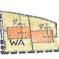
Sankt Katharinen (Landkreis Neuwied) - Im Königsfeld 1. Änderung
Bebauungspläne von Sankt Katharinen (Landkreis Neuwied):Durch die Verschiebung der überbaubaren Fläche in nördliche Richtung soll erreicht werden, dass die geplanten Gebäude eine bessere Besonnung erhalten. Dadurch werden die unterhalb der beiden Grundstücke gelegenen Flurstücke nicht benachteiligt.
Simple
Identification info
- Date (Revision)
- 2023-11-28
- Point of contact
-
Organisation name Individual name Electronic mail address Role LVermGeo im Auftrag von Sankt Katharinen (Landkreis Neuwied)
poststelle@vermkv.rlp poststelle@vermkv.rlp.de
Publisher
-
mapbender.2.registryId
-
-
2f23ed6e-0186-4c2b-8380-748389036509
-
- Keywords
-
-
Bebauungsplan
-
Sankt Katharinen (Landkreis Neuwied)
-
Bplan
-
Bauleitplan
-
infoMapAccessService
-
inspireidentifiziert
-
- Access constraints
- Other restrictions
- Other constraints
- Es gelten keine Zugriffsbeschränkungen
- Use constraints
- Other restrictions
- Other constraints
-
Lizenz: cc-by-nc-nd-3.0 - Creative Commons: Namensnennung - Keine kommerzielle Nutzung - Keine Bearbeitungen 3.0 Deutschland - http://creativecommons.org/licenses/by-nc-nd/3.0/de/
- Other constraints
-
{"id":"cc-by-nc-nd-3.0","name":"Creative Commons: Namensnennung - Keine kommerzielle Nutzung - Keine Bearbeitungen 3.0 Deutschland","url":"http:\/\/creativecommons.org\/licenses\/by-nc-nd\/3.0\/de\/"}
- Service Type
- view
- Service Version
-
OGC:WMS 1.1.1
))
- Coupling Type
- Tight
- Contains Operations
-
Operation Name Distributed Computing Platforms Connect Point GetCapabilities
Web services https://www.geoportal.rlp.de/mapbender/php/wms.php?inspire=1&layer_id=72053&withChilds=1&REQUEST=GetCapabilities&SERVICE=WMS
- Distribution format
-
Name Version
- OnLine resource
-
Protocol Linkage Name OGC:WMS-1.1.1-http-get-map
https://www.geoportal.rlp.de/mapbender/php/wms.php?inspire=1&layer_id=72053&withChilds=1&REQUEST=GetCapabilities&SERVICE=WMS BPlan.07138068.6.1
- Hierarchy level
- Service
- Other
-
Dienst
Conformance result
- Date (Publication)
- 2010-12-08
- Explanation
-
No explanation available
- Pass
- Yes
Conformance result
- Date (Publication)
- 2009-10-20
- Explanation
-
No explanation available
- Pass
- Yes
Conformance result
- Date (Publication)
- 2014-12-11
- Explanation
-
No explanation available
- Pass
- Yes
Conformance result
- Date (Publication)
- 2008-12-04
- Explanation
-
No explanation available
- Pass
- Yes
Conformance result
- Date (Publication)
- 2014-12-11
- Explanation
-
No explanation available
- Pass
- Yes
Conformance result
- Date (Publication)
- 2013-12-10
- Explanation
-
No explanation available
- Pass
- Yes
Conformance result
- Date (Publication)
- 2011-02-05
- Explanation
-
No explanation available
- Pass
- Yes
Conformance result
- Date (Publication)
- 2010-12-08
- Explanation
-
No explanation available
- Pass
- Yes
Metadata
- File identifier
- 8bb191b1-3320-cd51-3db2-2aaebe5ad2b6 XML
- Metadata language
- Deutsch
- Character set
- UTF8
- Hierarchy level
- Service
- Hierarchy level name
-
Darstellungsdienst
- Date stamp
- 2023-11-30
- Metadata standard name
-
ISO19119
- Metadata standard version
-
2005/PDAM 1
- Metadata author
-
Organisation name Individual name Electronic mail address Role Bereichsadmin
francesca.stueber@vg-linz.de
Point of contact
Overviews
Spatial extent
Provided by
