 INSPIRE Geoportal
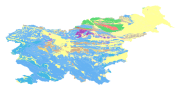
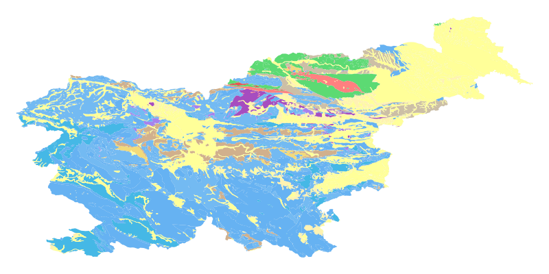
eENVplus GeoZS 1M Geološka karta
The harmonized geological map of Slovenia at a scale of 1:1,000,000 is a simplified version of the 1:250,000 scale Geological Map of Slovenia (Buser, 2009). The latter was compiled from the Basic Geological Map of Slovenia at a scale of 1: 100,000 (contributed by various authors between 1960's and 1980's and updated with new information gathered by S. Buser). The map is basically lithostratigraphic. The two layers incorporated in the map are lithostratigraphic units and major faults. The faults depicted on the map were selected using two criteria; regional extent and tectonic importance. The map presented here was edited specifically for the purpose of the OneGeology-Europe project by M. Bavec, M. Novak, M. Poljak, M. Trajanova and D. Skaberne.
Simple
-
Date (Publication)
- 2015-01-01
-
Date (Revision)
- 2015-01-01
-
Date (Creation)
- 2015-01-01
-
Citation identifier
- SI.GEOZS.EENVPLUS.1M.GU / fa9333ef-8cbe-4976-b30c-352648c94037
- Point of contact
-
Organisation name Individual name Electronic mail address Role Geološki zavod Slovenije
info@geo-zs.si
OwnerGeological Survey of Slovenia
Matevž Novak, PhD
matevz.novak@geo-zs.si
Point of contactGeološki zavod Slovenije
info@geo-zs.si
Custodian
-
ThIST - Italian Thesaurus of Earth Sciences (Version: Linked Data 1.0)
-
-
construction materials
-
sedimentary rocks
-
sediments
-
igneous rocks
-
metamorphic rocks
-
tectonic elements
-
faults
-
foliation
-
geochronology
-
stratigraphic units
-
lithology
-
lithostratigraphic unit
-
relative age
-
stratigraphy
-
geology
-
geologic maps
-
depositional environment
-
-
GEMET (version 3.1, 2012-07-20)
-
-
natural environment
-
geological process
-
-
INSPIRE feature concept dictionary (Version: Linked Data 1.0)
-
-
Geologic Event
-
Geologic Feature
-
Geologic Unit
-
-
EARTh- Enviromental Applications Reference THesaurus (Version: Linked Data 1.5)
-
-
*geolithological constituents*
-
-
GEMET - INSPIRE themes, version 1.0
-
-
Geology
-
- Keywords
-
-
eENVplus
-
INSPIRE
-
- Keywords
-
-
EP09
-
-
Discipline
-
-
geologija
-
-
Spatial scope
-
-
Nacionalno
-
-
Use limitation
-
Podatki so dostopni pod Creative Commons - Attribution 4.0 International (CC BY 4.0) licenco. ( https://creativecommons.org/licenses/by/4.0)
-
Access constraints
-
Other restrictions
- Other constraints
-
(e) intellectual property rights
-
Other constraints
-
Podatki so dostopni pod Creative Commons - Attribution 4.0 International (CC BY 4.0) licenco. ( https://creativecommons.org/licenses/by/4.0)
-
Spatial representation type
-
Vector
-
Denominator
- 1000000
-
Language
- English
-
Topic category
-
-
Geoscientific information
-
))
- Begin date
- 2015-01-01
- End date
- 2016-12-31
-
Reference system identifier
- http://www.opengis.net/def/crs/EPSG/0/4258
- Distribution format
-
Name Version WFS
1.1.0
-
Transfer size
- 0
- OnLine resource
-
Protocol Linkage Name WWW:LINK-1.0-http--link
https://mapserver.geo-zs.si/cgi-bin/eenvplus-geozs? OGC:WMS-1.3.0-http-get-capabilities
https://mapserver.geo-zs.si/cgi-bin/eenvplus-geozs? eENVplus_1M_surface_GeologicUnit
-
Hierarchy level
-
Dataset
Conformance result
-
Date (Publication)
- 2010-12-08
- Explanation
-
See the referenced specification
-
Pass
- No
- Statement
-
percentCoverage=100;geometricHarmonization=100;thematicHarmonization=100;geometricHarmonizationDescription;thematicHarmonizationDescription;
Metadata
-
File identifier
- 8d74bd25-dc36-4562-81a9-70cf026d2619 XML
-
Metadata language
- English
-
Character set
-
UTF8
-
Hierarchy level
-
Dataset
-
Date stamp
- 2022-12-09T15:08:13
- Metadata standard name
-
ISO19115
- Metadata standard version
-
2003/Cor.1:2006
- Metadata author
-
Organisation name Individual name Electronic mail address Role Geološki zavod Slovenije
Matija Krivic
matija.krivic@geo-zs.si
Point of contact
- Other language
-
Language Character encoding SlovenianUTF8
Overviews
Spatial extent
Provided by
