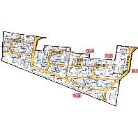
Wörth am Rhein - Blumenviertel
Bebauungspläne von Wörth am Rhein:Bebauungsplan "Blumenviertel" der Stadt Wörth am Rhein, Ortsbezirk Wörth
Simple
Identification info
- Date (Revision)
- 2023-11-28
- Point of contact
-
Organisation name Individual name Electronic mail address Role LVermGeo im Auftrag von Wörth am Rhein
poststelle@vermkv.rlp poststelle@vermkv.rlp.de
Publisher
-
mapbender.2.registryId
-
-
2f23ed6e-0186-4c2b-8380-748389036509
-
- Keywords
-
-
Bebauungsplan
-
Wörth am Rhein
-
Bplan
-
Bauleitplan
-
infoMapAccessService
-
inspireidentifiziert
-
- Access constraints
- Other restrictions
- Other constraints
-
Bei der Veröffentlichung der Bauleitpläne der Stadt Wörth am Rhein im Geoportal.rlp handelt es sich um ein unverbindliches zusätzliches Informationsangebot der Stadtverwaltung Wörth am Rhein, für dessen Richtigkeit und Aktualität von der Stadt Wörth am Rhein keine Gewährleistung übernommen wird. Haftungsansprüche können nicht geltend gemacht werden. Rechtsverbindliche Aussagen über die Zulässigkeit einzelner Bauvorhaben und Nutzungen können aus den zur Verfügung gestellten Daten nicht abgeleitet werden. Es wird deshalb dringend empfohlen, vor Entscheidungen und besonders vor vermögenswirksamen Dispositionen wie z.B. Grundstücksverträgen eine Auskunft zu der im jeweiligen Einzelfall beabsichtigten Baumaßnahme bzw. Nutzung bei der Stadtverwaltung Wörth a.Rh. einzuholen. Für ergänzende Beratung und Erläuterung der Bauleitpläne wenden Sie sich an die MitarbeiterInnen der Bauverwaltung der Stadt Wörth am Rhein.
- Use constraints
- Other restrictions
- Other constraints
-
Lizenz: dl-de-by-2.0 - Datenlizenz Deutschland Namensnennung 2.0 - https://www.govdata.de/dl-de/by-2-0 - Quellenvermerk: Source note required by license, but not given!
- Other constraints
-
{"id":"dl-de-by-2.0","name":"Datenlizenz Deutschland Namensnennung 2.0","url":"https:\/\/www.govdata.de\/dl-de\/by-2-0","quelle":"Source note required by license, but not given!"}
- Service Type
- view
- Service Version
-
OGC:WMS 1.1.1
))
- Coupling Type
- Tight
- Contains Operations
-
Operation Name Distributed Computing Platforms Connect Point GetCapabilities
Web services https://www.geoportal.rlp.de/mapbender/php/wms.php?inspire=1&layer_id=71267&withChilds=1&REQUEST=GetCapabilities&SERVICE=WMS
- Distribution format
-
Name Version
- OnLine resource
-
Protocol Linkage Name OGC:WMS-1.1.1-http-get-map
https://www.geoportal.rlp.de/mapbender/php/wms.php?inspire=1&layer_id=71267&withChilds=1&REQUEST=GetCapabilities&SERVICE=WMS BPlan.07334501.8.0
- Hierarchy level
- Service
- Other
-
Dienst
Conformance result
- Date (Publication)
- 2010-12-08
- Explanation
-
No explanation available
- Pass
- Yes
Conformance result
- Date (Publication)
- 2009-10-20
- Explanation
-
No explanation available
- Pass
- Yes
Conformance result
- Date (Publication)
- 2014-12-11
- Explanation
-
No explanation available
- Pass
- Yes
Conformance result
- Date (Publication)
- 2008-12-04
- Explanation
-
No explanation available
- Pass
- Yes
Conformance result
- Date (Publication)
- 2014-12-11
- Explanation
-
No explanation available
- Pass
- Yes
Conformance result
- Date (Publication)
- 2013-12-10
- Explanation
-
No explanation available
- Pass
- Yes
Conformance result
- Date (Publication)
- 2011-02-05
- Explanation
-
No explanation available
- Pass
- Yes
Conformance result
- Date (Publication)
- 2010-12-08
- Explanation
-
No explanation available
- Pass
- Yes
Metadata
- File identifier
- 8f98c377-e3c6-871d-6e36-0930c86429fe XML
- Metadata language
- Deutsch
- Character set
- UTF8
- Hierarchy level
- Service
- Hierarchy level name
-
Darstellungsdienst
- Date stamp
- 2023-11-30
- Metadata standard name
-
ISO19119
- Metadata standard version
-
2005/PDAM 1
- Metadata author
-
Organisation name Individual name Electronic mail address Role Stadt Wörth
Point of contact
Overviews

Spatial extent
))
Provided by

 INSPIRE Geoportal