INSPIRE Geoportal
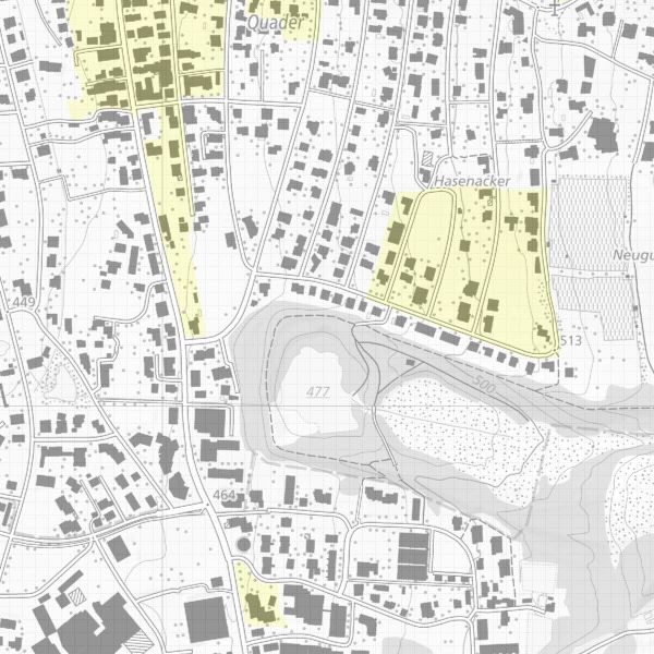
Archäologische Perimeter
Gebiete mit vermuteten oder nachgewiesenen archäologischen Fundstellen Liechtensteins. Innerhalb des archäologischen Perimeters ist im Baubewilligungsverfahren mit Auflagen zu rechnen. Zudem sind die Daten wegen dem Schutz von Kulturgütern ausserhalb des Baugebietes nicht öffentlich.
Simple
-
Date (Création)Data (Creazione)Date (Creation)Datumsangaben (Erstellung)
- 2000-01-01
-
IdentificateurIdentificatoreCitation identifierIdentifikator
- https://metadata.geo.llv.li/941ab829-1128-4798-a545-2cd29e7ce611
- Cited responsible party
-
Organisation name Individual name Electronic mail address Role Amt für Kultur
Amt für Kultur
Amt für Kultur
Amt für Kultur
Point de contactPunto di contattoPoint of contactAnsprechpartner
-
Zweck
-
Übersicht und Informationsquelle für Behörden und Private
-
EtatStatusStatusBearbeitungsstatus
-
Mise à jour continueIn corsoOn goingKontinuierliche Aktualisierung
- Point of contact
-
Organisation name Individual name Electronic mail address Role Amt für Kultur
Amt für Kultur
Amt für Kultur
Amt für Kultur
Point de contactPunto di contattoPoint of contactAnsprechpartner
-
Fréquence de mise à jourFrequenza di aggiornamentoMaintenance and update frequencyÜberarbeitungsintervall
-
ContinueContinuoContinualKontinuierlich
- Resource format
-
Name Version INTERLIS 1 (ITF)
-
GEMET
-
-
Archäologie
archéologie
archeologia
archaeology
-
-
GEMET - INSPIRE themes, version 1.0
-
-
Schutzgebiete
Sites protégés
Siti protetti
Protected sites
-
-
geocat.ch
-
-
INSPIRE
INSPIRE
INSPIRE
INSPIRE
-
-
Spatial scope
-
-
National
Nationales
Nazionali
National
-
-
Anwendungseinschränkungen
-
Zugangs- und Nutzungsbedingungen
-
Contraintes d'accèsVincoli di accessoAccess constraintsZugriffseinschränkungen
-
Autres restrictionsAltri vincoliOther restrictionsBenutzerdefinierte Einschränkungen
-
Contraintes d'utilisationVincoli di fruibilitàUse constraintsNutzungseinschränkungen
-
Autres restrictionsAltri vincoliOther restrictionsBenutzerdefinierte Einschränkungen
-
Andere EinschränkungenAutres contraintesOther constraints
-
gebührenpflichtAccès restreint.Access restricted.
-
Anwendungseinschränkungen
-
Zugangs- und Nutzungsbedingungen
-
Contraintes d'accèsVincoli di accessoAccess constraintsZugriffseinschränkungen
-
Autres restrictionsAltri vincoliOther restrictionsBenutzerdefinierte Einschränkungen
-
Contraintes d'utilisationVincoli di fruibilitàUse constraintsNutzungseinschränkungen
-
Autres restrictionsAltri vincoliOther restrictionsBenutzerdefinierte Einschränkungen
-
Andere EinschränkungenAutres contraintesOther constraints
-
Kostenpflichtig.Service payant.Subject to a fee.
-
Type de représentation spatialeTipo di rappresentazione spazialeSpatial representation typeRäumliche Darstellungsart
-
VecteurDati vettorialiVectorVektor
-
Langue de la ressourceLingua dei datiLanguageSprache
- Deutsch
-
Encodage des caractèresSet dei caratteri dei datiCharacter setZeichensatz
-
Utf8UTF8UTF8Utf8
-
Catégorie ISOTemaTopic categoryThematik
-
-
SociétéSocietàSocietyGesellschaft
-
Étendue
Estensione
Extent
Ausdehnung
-
BeschreibungDescriptionDescrizioneDescription
-
Liechtenstein
Liechtenstein
Liechtenstein
Liechtenstein
))

-
Niveau topologieLivello di topologiaTopology levelTopologielevel
-
Topologie de réseau complèteGrafo planare completoFull planar graphFlächen
-
Type de géométries des objetsOggetto di tipo geometricoGeometric object typeGeometrietyp
-
PolygoneSuperficieSurfaceFläche
-
Nombre d'objets géométriquesConteggio oggetto geometricoGeometric object countAnzahl
- 200
- Distribution format
-
Name Version INTERLIS 1 (ITF)
AutoCAD DXF (DXF)
ESRI Shapefile (SHP)
- Distributor contact
-
Organisation name Individual name Electronic mail address Role Abt. Vermessung und Geoinformation (ATG)
Abt. Vermessung und Geoinformation (ATG)
Abt. Vermessung und Geoinformation (ATG)
Abt. Vermessung und Geoinformation (ATG)
Point de contactPunto di contattoPoint of contactAnsprechpartner
- OnLine resource
-
Protocol Linkage Name WWW:LINK
https://www.llv.li/inhalt/1809/amtsstellen/archaologie eGovernment der Landesverwaltung
WWW:LINK-1.0-http--link
https://service.geo.llv.li/wmsli/service?service=WMS&language=ger&request=GetCapabilities OGC WMS Service der Liechtensteinen Landesverwaltung
-
NiveauLivelloHierarchy levelBezugsebene
-
Jeu de donnéesDatasetDatasetDatenbestand
Résultat de conformité
Conformità
Conformance result
Konformitätsergebnis
-
Date (Publication)Data (Pubblicazione)Date (Publication)Datumsangaben (Publikation)
- 2010-12-08
- Explanation
-
nicht geprüft
-
Degré de conformitéPassPassBestanden
- No
-
Erläuterung
-
Konstruktion auf der Grundlage der Grundstücksgrenzen, parzellenschaft
-
Inclus dans le jeu de donnéesIncluded with datasetIncluded with datasetIm Datenbestand enthalten
-
Date (Création)Data (Creazione)Date (Creation)Datumsangaben (Erstellung)
- 2001-12-10
Metadata
-
Identifiant de la ficheIdentificatore del file di metadatiFile identifierMetadatensatzidentifikator
- 941ab829-1128-4798-a545-2cd29e7ce611 XML
-
LangueLingua dei metadatiMetadata languageSprache
- Deutsch
-
Jeu de caractèresSet dei caratteri dei metadatiCharacter setZeichensatz
-
Utf8UTF8UTF8Utf8
-
Type de ressourceLivello gerarchicoHierarchy levelHierarchieebene
-
Jeu de donnéesDatasetDatasetDatenbestand
-
Date des métadonnéesData dei metadatiDate stampDatum
- 2023-03-07T13:50:32.88Z
- Metadata standard name
-
GM03 2+
- Metadata author
-
Organisation name Individual name Electronic mail address Role Abt. Vermessung und Geoinformation (ATG)
Abt. Vermessung und Geoinformation (ATG)
Abt. Vermessung und Geoinformation (ATG)
Abt. Vermessung und Geoinformation (ATG)
Point de contactPunto di contattoPoint of contactAnsprechpartner
- Other language
-
Language Character encoding FrançaisFranceseFrenchFranzösischUtf8UTF8UTF8Utf8ItalienItalianoItalianItalienischUtf8UTF8UTF8Utf8AnglaisIngleseEnglishEnglischUtf8UTF8UTF8Utf8AllemandTedescoGermanDeutschUtf8UTF8UTF8Utf8