 INSPIRE Geoportal
Kataster nepremičnin
Realestate cadastre
Kataster nepremičnin je zasnovan kot uradna evidenca podatkov o parcelah, stavbah in delih stavb, ki omogoča vpis stvarnih pravic na njih (ali njihovih delih) v zemljiški knjigi. Kataster nepremičnin je temeljna evidenca podatkov Republike Slovenije o položaju, obliki, fizičnih in drugih lastnostih parcel, stavb in delov stavb, ki izkazuje dejansko stanje nepremičnin.
Kataster nepremičnin je sestavljen iz vpisanih podatkov o parcelah, stavbah in delih stavb ter zbirke listin. Vpisani podatki o parcelah, stavbah in delih stavb ter zbirka listin se hranijo trajno. V katastru nepremičnin se vodijo podatki o območjih stavbnih pravic in podatki o območjih izvrševanja stvarnih služnosti ali nepravih stvarnih služnosti.
V katastru nepremičnin so, kot podatkovni sloji, tudi podatki o katastrskih občinah, dejanskih rabah zemljišč, območjih bonitete zemljišč v sloju območij bonitete zemljišč in sloj začasnih vpisov (območja stavbne pravice in podatki o območju izvrševanja stvarne služnosti ali neprave stvarne služnosti, preden o njih odloči zemljiška knjiga).
The realestate cadastre is designed as an official record of data on plots, buildings and parts of buildings, which enables the registration of real rights on them (or their parts) in the land register. The realestate cadastre is the fundamental record of the Republic of Slovenia's data on the location, shape, physical and other characteristics of plots, buildings and parts of buildings, which shows the actual state of real estate.
The realestate cadastre consists of registered data on plots of land, buildings and parts of buildings, as well as a collection of documents. The entered data on plots, buildings and parts of buildings, as well as the collection of documents, are kept permanently. The realestate cadastre contains data on the areas of building rights and data on the areas of enforcement of servitudes or illegal servitudes.
In the realestate cadastre, as data layers, there are also data on cadastral municipalities, actual land use, areas of land creditworthiness in the layer of land creditworthiness areas and a layer of temporary entries (areas of building rights and data on the area of enforcement of easement in rem or illegal easement in rem before decided by the land register).
Simple
-
Date (Creation)Date (Creation)
- 2022-04-04
-
Citation identifierCitation identifier
-
SI.GURS.KN/affacb68-fbc3-4a1e-9fae-02cfecb46882affacb68-fbc3-4a1e-9fae-02cfecb46882
- Point of contact
-
Organisation name Individual name Electronic mail address Role Geodetska uprava Republike Slovenije
CustodianCustodianGeodetska uprava Republike Slovenije
DistributorDistributor
-
Maintenance and update frequencyMaintenance and update frequency
-
ContinualContinual
-
GEMET - INSPIRE themes, version 1.0
-
-
Katastrske parcele
Cadastral parcels
-
Stavbe
Buildings
-
-
Spatial scope
-
-
Nacionalno
National
-
- Keywords
-
-
Katastrske parcele
-
- Keywords
-
-
Stavbe
-
-
Access constraintsAccess constraints
-
Other restrictionsOther restrictions
-
Use constraintsUse constraints
-
Other restrictionsOther restrictions
-
Other constraints
-
Splošni pogoji uporabe geodetskih podatkov: https://www.e-prostor.gov.si/dostopi/javni-dostop/?acitem=1821-1822
-
Spatial representation typeSpatial representation type
-
VectorVector
-
LanguageLanguage
- slv
-
Character setCharacter set
-
UTF8UTF8
-
Topic categoryTopic category
-
-
Planning cadastrePlanning cadastre
-
))
-
Reference system identifierReference system identifier
-
http://www.opengis.net/def/crs/EPSG/0/3794
- Distribution format
-
Name Version ESRI Shapefile
1.0
- OnLine resource
-
Hierarchy levelHierarchy level
-
DatasetDataset
Conformance result
Conformance result
-
TitleTitle
-
Uredba Komisije (EU) št. 1089/2010 z dne 23. novembra 2010 o izvajanju Direktive 2007/2/ES Evropskega parlamenta in Sveta glede medopravilnosti zbirk prostorskih podatkov in storitev v zvezi s prostorskimi podatki
Commission regulation (EU) No 1089/2010 of 23 November 2010 implementing Directive 2007/2/EC of the European Parliament and of the Council as regards interoperability of spatial data sets and services
-
Date (Publication)Date (Publication)
- 2010-12-08
- Codespace
-
EU
-
Explanation
-
Glej referenčni predpis
-
PassPass
- Yes
Conformance result
Conformance result
-
TitleTitle
-
Zakon o katastru nepremičnin
Real Estate Cadastre Act
-
Date (Publication)Date (Publication)
- 2021-04-09
-
Citation identifierCitation identifier
-
SOP
/
2021-01-10472021-01-1047
-
Explanation
-
Glej referenčni predpis
-
PassPass
- Yes
Conformance result
Conformance result
-
TitleTitle
-
Pravilnik o evidenci državne meje
Rules on the national border register
-
Date (Publication)Date (Publication)
- 2021-07-19
-
Citation identifierCitation identifier
-
SOP
/
2021-01-25412021-01-2541
-
Explanation
-
Glej referenčni predpis
-
PassPass
- Yes
Conformance result
Conformance result
-
TitleTitle
-
Pravilnik o potrdilih iz katastra nepremičnin in registra naslovov
Rules on certificates from the real estate cadastre and the register of addresses
-
Date (Publication)Date (Publication)
- 2021-07-19
-
Citation identifierCitation identifier
-
SOP
/
2021-01-25422021-01-2542
-
Explanation
-
Glej referenčni predpis
-
PassPass
- Yes
Conformance result
Conformance result
-
TitleTitle
-
Pravilnik o podrobnejšem načinu oštevilčevanja in označevanja stanovanj in poslovnih prostorov
Rules on a more detailed method of numbering and marking apartments and business premises
-
Date (Publication)Date (Publication)
- 2021-07-19
-
Citation identifierCitation identifier
-
SOP
/
2021-01-25432021-01-2543
-
Explanation
-
Glej referenčni predpis
-
PassPass
- Yes
Conformance result
Conformance result
-
TitleTitle
-
Pravilnik o načinu vpisa in izbrisa upravljavcev v kataster nepremičnin
Rules on the method of entry and deletion of managers in the real estate cadaster
-
Date (Publication)Date (Publication)
- 2021-07-19
-
Citation identifierCitation identifier
-
SOP
/
2021-01-25442021-01-2544
-
Explanation
-
Glej referenčni predpis
-
PassPass
- Yes
Conformance result
Conformance result
-
TitleTitle
-
Pravilnik o katastrskih občinah
Rules on cadastre municipalties
-
Date (Publication)Date (Publication)
- 2021-09-01
-
Citation identifierCitation identifier
-
SOP
/
2021-01-28102021-01-2810
-
Explanation
-
Glej referenčni predpis
-
PassPass
- Yes
Conformance result
Conformance result
-
TitleTitle
-
Pravilnik o Komisiji za strokovno presojo v katastrskih postopkih
Rules on the Commissional for professional assessment in cadastral procedures
-
Date (Publication)Date (Publication)
- 2021-09-24
-
Citation identifierCitation identifier
-
SOP
/
2021-01-29282021-01-2928
-
Explanation
-
Glej referenčni predpis
-
PassPass
- Yes
Conformance result
Conformance result
-
TitleTitle
-
Uredba o dejanskih rabah zemljišč
Decree on existing land use
-
Date (Publication)Date (Publication)
- 2021-11-05
-
Citation identifierCitation identifier
-
SOP
/
2021-01-34242021-01-3424
-
Explanation
-
Glej referenčni predpis
-
PassPass
- Yes
Conformance result
Conformance result
-
TitleTitle
-
Pravilnik o podrobnejši vsebini registra prostorskih enot
Rules on the detailed content of the register of spatial units
-
Date (Publication)Date (Publication)
- 2021-11-05
-
Citation identifierCitation identifier
-
SOP
/
2021-01-34272021-01-3427
-
Explanation
-
Glej referenčni predpis
-
PassPass
- Yes
Conformance result
Conformance result
-
TitleTitle
-
Pravilnik o izpitu za bonitiranje zemljišč in o pooblastilu za bonitiranje
Rules on the Land Rating Exam and the Power to Implement Land Rating
-
Date (Publication)Date (Publication)
- 2021-12-15
-
Citation identifierCitation identifier
-
SOP
/
2021-01-38922021-01-3892
-
Explanation
-
Glej referenčni predpis
-
PassPass
- Yes
Conformance result
Conformance result
-
TitleTitle
-
Pravilnik o vodenju podatkov katastra nepremičnin
Rules on the management of real estate cadastre data
-
Date (Publication)Date (Publication)
- 2022-03-23
-
Citation identifierCitation identifier
-
SOP
/
2022-01-07862022-01-0786
-
Explanation
-
Glej referenčni predpis
-
PassPass
- Yes
-
StatementStatement
-
Vir podatkov za parcele so bili ob vzpostavitvi evidence nekdanjega zemljiškega katastra zemljiškokatastrski načrti različnih meril. Relativna natančnost med objekti je odvisna predvsem od merila osnovnih katastrskih načrtov in ustreza grafični natančnosti (0.2 mm × merilo načrta). Absolutna natančnost je odvisna od vrste katastra, načina izmere in merila katastrskega načrta.
Vir podatkov za stavbe so bili ob vzpostavitvi evidence nekdanjega katastra stavb fotogrametrični zajem, terenski zajem, prevzem podatkov iz drugih evidenc. Položajna natančnost je odvisna od metode zajema koordinat; terenska meritev: 0-12 cm, fotogrametrični zajem: 0-50 cm, iz temeljnih topografskih načrtov (TTN): 0-150 cm, iz grafičnih podatkov zemljiškega katastra (ZK) nad 150 cm, terenski zajem brez navezave na mrežo: nad 150 cm, odmera stavbišča: 0-12 cm, zajem podatkov iz registra prostorskih enot (RPE): 0-150 cm.
Vzdrževanje katastra nepremičnin poteka preko posamičnih postopkov evidentiranja sprememb podatkov z različnimi vrstami katastrskih postopkov, ki se izvajajo na podlagi pobude različnih subjektov (investitorji, lastniki, uporabniki, upravniki, države, občine,…), po uradni dolžnosti, na podlagi pravnomočnih sodnih odločb in drugih aktov ter na podlagi sprememb iz povezanih baz podatkov (registra prostorskih enot, registra naslovov, evidence državne meje, zemljiške knjige, centralnega registra prebivalstva, poslovnega registra, evidence dejanske rabe zemljišč, PIS,…).
Kataster nepremičnin je vzpostavljen skladno z Zakonom o katastru nepremičnin - ZKN. Podatki v digitalni obliki so vzpostavljeni za celotno območje Republike Slovenije. Zbirka podatkov se vodi v državnem ETRS koordinatnem sistemu D96/TM.
When the records of the former land cadastre were established, the source of data for the parcels were land cadastral plans of various scales. The relative accuracy between objects depends mainly on the scale of the basic cadastral plans and corresponds to the graphic accuracy (0.2 mm × scale of the plan). The absolute accuracy depends on the type of cadastre, the method of measurement and the scale of the cadastral plan.
The source of data for buildings, when the records of the former cadastre of buildings were established, were photogrammetric survey, field survey, data acquisition from other records. Positional accuracy depends on the coordinate capture method; field measurement: 0-12 cm, photogrammetric survey: 0-50 cm, from basic topographic plans (TTN): 0-150 cm, from graphic data of the land cadastre (ZK) over 150 cm, field survey without connection to the grid: over 150 cm, measurement of the building site: 0-12 cm, data capture from the register of spatial units (RPE): 0-150 cm.
The maintenance of the real estate cadastre takes place through individual procedures for recording data changes with various types of cadastral procedures, which are carried out on the basis of the initiative of various entities (investors, owners, users, administrators, states, municipalities, etc.), by official duty, on the basis of final court decisions and other acts and on the basis of changes from related databases (register of spatial units, register of addresses, state border records, land registry, central population register, business register, records of actual land use, PIS,...).
The real estate cadastre is established in accordance with the Real Estate Cadastre Act - ZKN. The data in digital format is established for the entire territory of the Republic of Slovenia. The database is maintained in the national ETRS coordinate system D96/TM.
Metadata
-
File identifierFile identifier
- 9a8fd241-9162-407c-94e7-c98e05766881 XML
-
Metadata languageMetadata language
- slv
-
Character setCharacter set
-
MD_CharacterSetCode_utf8MD_CharacterSetCode_utf8
-
Hierarchy levelHierarchy level
-
DatasetDataset
-
Date stampDate stamp
- 2024-12-08T22:34:46
- Metadata standard name
-
ISO 19115:2003/19139
- Metadata standard version
-
1.0
- Metadata author
-
Organisation name Individual name Electronic mail address Role Geodetska uprava Republike Slovenije
Point of contactPoint of contact
- Other language
-
Language Character encoding EnglishEnglishUTF8UTF8SlovenianSlovenianUTF8UTF8
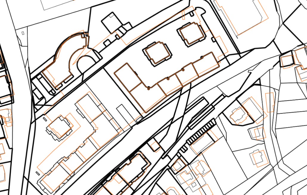
Overviews
Spatial extent
Provided by
