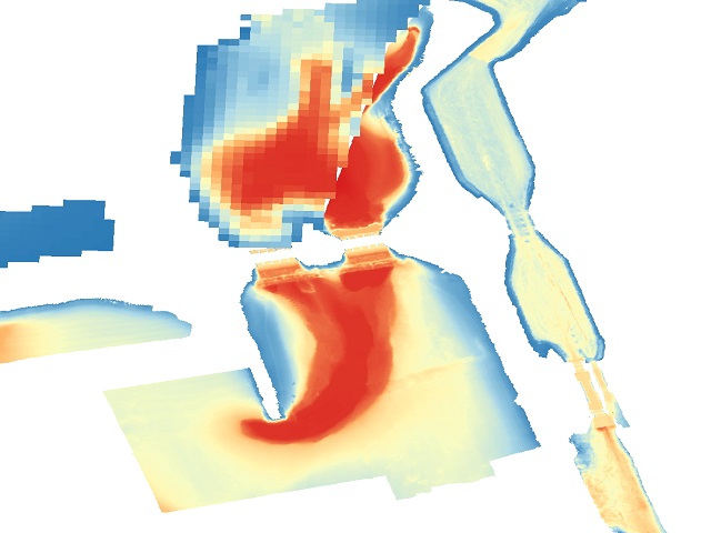
Bathymetrie Nederland - binnenwateren
Tot 1 meter grid resolutie geinterpoleerd grid van waarden uit dieptemetingen van de hydrografische opnemingsvaartuigen opgeslagen in het Landelijk Opslagsysteem Lodingen. Deze dataset geeft een moment opname van de bodemligging van de binnenwateren Van de grens met Duitsland tot de basislijn van de Nederlandse kust en sluit aan bij Bathymetrie van de Noordzee.
Simple
- Date (Creation)
- 2022-06-01
- Date (Publication)
- 2022-06-01
- Edition
-
2.0
- Purpose
-
Actueel beeld van de bodemhoogte
- Status
- On going
- Point of contact
-
Organisation name Individual name Electronic mail address Role Rijkswaterstaat
Owner
- Maintenance and update frequency
- biAnnually
- Date of next update
- 2025-01-15
- Keywords
-
- HVD
-
Bathymetrie
-
Bodemhoogte
-
loding
-
multibeam
-
Survey
-
DSM
-
ADN
- User contact info
-
Organisation name Individual name Electronic mail address Role User
- Use limitation
-
Geen gebruiksbeperkingen
- Access constraints
- Other restrictions
- Other constraints
- Geen beperkingen
- Other constraints
- Geen beperkingen
- Access constraints
- Other restrictions
- Other constraints
- geen beperkingen
- Classification
- Unclassified
- Spatial representation type
- Grid
- Distance
- 1 meters
- Language
- Nederlands; Vlaams
- Character set
- UTF8
- Topic category
-
- Elevation
))
- Geographic identifier
- Nederland
- Begin date
- 2016-01-01
- End date
- 2024-12-11
Vertical extent
- Minimum value
- -6.75
- Maximum value
- 322.0
- Supplemental Information
- Distribution format
-
Name Version Elevation Grid Coverage GML application schema 5.0
- Distributor contact
-
Organisation name Individual name Electronic mail address Role Rijkswaterstaat
Distributor
- OnLine resource
- Hierarchy level
- Dataset
- Other
-
dataset
Domain consistency
- Measure identification
- Commission Regulation (EU) No 1089/2010 of 23 November 2010 implementing Directive 2007/2/EC of the European Parliament and of the Council as regards interoperability of spatial data sets and services
Conformance result
- Date (Publication)
- 2010-12-08
- Explanation
-
De hier gehanteerde domeinen wijken af van de domeinen uit de dataspecificaties van INSPlRE
- Pass
- No
Conformance result
- Date (Publication)
- 2024-01-31
- Explanation
-
De data wijkt af van de dataspecificaties op dit thema van INSPlRE
- Pass
- No
Quantitative result
- Value
- volledig
Quantitative result
- Value
- onbekend
- Statement
-
Geproduceerd in het kader van INSPIRE dienstverlening RWS. Het bestand is een aggregatie en intepolatie van beschikbare bodemhoogte metingen in Landelijke Opslag Lodingen Rijkswaterstaat. Voor meer informatie vraag om een productbeschrijving.
- Description
-
Gebaseerd op multibeam lodingen en RWS meetprogramma en singlebeam lodingen uit JARKUS-lodingen.
- Date / Time
- 2024-12-01T00:00:00
- Processor
-
Organisation name Individual name Electronic mail address Role Rijkswaterstaat
Custodian
Content Information
Metadata
- File identifier
- 9d973c4a-ef03-4785-b7f6-942e86b385f7 XML
- Metadata language
- Nederlands; Vlaams
- Character set
- UTF8
- Hierarchy level
- Dataset
- Date stamp
- 2024-12-15
- Metadata standard name
-
ISO 19115
- Metadata standard version
-
Nederlands metadata profiel op ISO 19115 voor geografie 2.1.0
- Metadata author
-
Organisation name Individual name Electronic mail address Role Rijkswaterstaat
Servicedesk Data
Point of contact
Overviews

Spatial extent
))
Provided by

 INSPIRE Geoportal