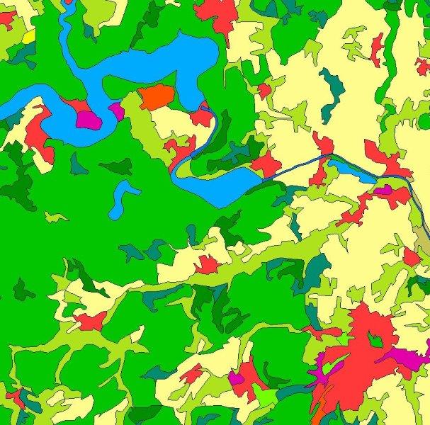
INSPIRE-WFS CORINE Land Cover – 5ha (2018)
INSPIRE Direct Access Download Service for CORINE Land Cover – 5ha. This service provides from CORINE Land Cover 5ha (CLC5) transformed datasets for the INSPIRE theme Land Cover. The data provided through this service covers the area of Germany.
Simple
Identification info
- Alternate title
-
wfs_clc5_2018_inspire
- Date (Creation)
- 2020-05-20T17:20:59.064+02:00
- Point of contact
-
Organisation name Individual name Electronic mail address Role Federal Agency for Cartography and Geodesy
dlz@bkg.bun dlz@bkg.bund.de
Point of contact Federal Agency for Cartography and Geodesy
mailbox@bkg.bun mailbox@bkg.bund.de
Resource provider
- Maintenance and update frequency
- Not planned
- Update scope
- Service
-
GEMET - Concepts, version 3.1
-
-
land cover
-
- Keywords
-
-
INSPIRE
-
BKG
-
Germany
-
Deutschland
-
CLC5
-
CORINE Land Cover 5 ha
-
INSPIRE-WFS_Land-Cover
-
DownloadService
-
WFS
-
-
Service Classification, version 1.0
-
-
infoFeatureAccessService
-
- Keywords
-
-
inspireidentifiziert
-
- Access constraints
- Other restrictions
- Other constraints
- no limitations to public access
- Use constraints
- Other restrictions
- Other constraints
-
This data may be used without restriction and free of charge pursuant to the Ordinance for the Establishment of the Conditions of Use regarding the Provision of Federal Spatial Data (Verordnung zur Festlegung der Nutzungsbestimmungen für die Bereitstellung von Geodaten des Bundes – GeoNutzV) as published on March 19, 2013 (Bundesgesetzblatt Jahrgang 2013 Teil I Nr. 14). For more details see: https://sg.geodatenzentrum.de/web_public/gdz/lizenz/eng/geonutzv.pdf. Please include the required reference to the source when using the data.
- Other constraints
-
Quellenvermerk: © GeoBasis-DE / BKG < year of last data download >
- Service Type
- download
- Service Version
-
OGC:WFS 2.0
- Extent type code
- Yes
- Geographic identifier
- Bundesrepublik Deutschland (000000000000)
))
- Code
- 000000000000
- Coupling Type
- Tight
- Contains Operations
-
Operation Name Distributed Computing Platforms Connect Point GetCapabilities
HTTPGet https://sgx.geodatenzentrum.de/wfs_clc5_2018_inspire? DescribeFeatureType
HTTPGet https://sgx.geodatenzentrum.de/wfs_clc5_2018_inspire? GetFeature
HTTPPost HTTPGet https://sgx.geodatenzentrum.de/wfs_clc5_2018_inspire https://sgx.geodatenzentrum.de/wfs_clc5_2018_inspire?
- Operates On
- Unique resource identifier
- EPSG 4258: ETRS89 / geographisch
- Unique resource identifier
- EPSG 4839: ETRS89 / LCC Germany (N-E)
- Unique resource identifier
- EPSG 3045: ETRS89 / UTM Zone 33N (N-E)
- Unique resource identifier
- EPSG 3044: ETRS89 / UTM Zone 32N (N-E)
- Unique resource identifier
- EPSG 32633: WGS 84 / UTM Zone 33N
- Unique resource identifier
- EPSG 32632: WGS 84 / UTM Zone 32N
- Unique resource identifier
- EPSG 5650: ETRS89 / UTM Zone 33N (zE-N)
- Unique resource identifier
- EPSG 4647: ETRS89 / UTM Zone 32N (zE-N)
- Unique resource identifier
- EPSG 25833: ETRS89 / UTM Zone 33N
- Unique resource identifier
- EPSG 25832: ETRS89 / UTM Zone 32N
- Unique resource identifier
- EPSG 5679: DHDN / Gauss-Krüger Zone 5 (E-N)
- Unique resource identifier
- EPSG 5678: DHDN / Gauss-Krüger Zone 4 (E-N)
- Unique resource identifier
- EPSG 5677: DHDN / Gauss-Krüger Zone 3 (E-N)
- Unique resource identifier
- EPSG 5676: DHDN / Gauss-Krüger Zone 2 (E-N)
- Unique resource identifier
- EPSG 31469: DHDN / Gauss-Krüger Zone 5
- Unique resource identifier
- EPSG 31468: DHDN / Gauss-Krüger Zone 4
- Unique resource identifier
- EPSG 31467: DHDN / Gauss-Krüger Zone 3
- Unique resource identifier
- EPSG 31466: DHDN / Gauss-Krüger Zone 2
- Unique resource identifier
- EPSG 3035: ETRS89 / LAEA Europe
- Unique resource identifier
- EPSG 3034: ETRS89 / LCC Europe
- Unique resource identifier
- EPSG 3857: WGS 84 / Pseudo-Mercator
- Unique resource identifier
- EPSG 4326: WGS 84 / geographisch
- Distribution format
-
Name Version
- OnLine resource
-
Protocol Linkage Name https://mis.bkg.bund.de/csw?REQUEST=GetRecordById&SERVICE=CSW&VERSION=2.0.2&id=4CE24067-37A0-4395-A641-64CC80121470 INSPIRE Land Cover CLC5 2018
- OnLine resource
-
Protocol Linkage Name https://sgx.geodatenzentrum.de/wfs_clc5_2018_inspire?SERVICE=WFS&Request=GetCapabilities Dienst "INSPIRE-WFS CORINE Land Cover – 5ha (2018)" (GetCapabilities)
- Hierarchy level
- Service
- Other
-
3
Conformance result
- Date (Publication)
- 2009-10-20
- Explanation
-
see the referenced specification
- Pass
- Yes
Metadata
- File identifier
- C2A51061-577A-4512-81E0-23FAC7C9393F XML
- Metadata language
- English
- Character set
- UTF8
- Hierarchy level
- Service
- Hierarchy level name
-
service
- Date stamp
- 2023-11-07
- Metadata standard name
-
ISO19119
- Metadata standard version
-
2005/PDAM 1
- Metadata author
-
Organisation name Individual name Electronic mail address Role Federal Agency for Cartography and Geodesy
dlz@bkg.bun dlz@bkg.bund.de
Point of contact
Overviews

Spatial extent
))
Provided by

 INSPIRE Geoportal