 INSPIRE Geoportal
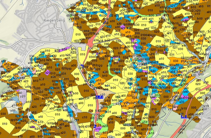
Staatswald Bestände Saarland
Waldbestände des SaarForst Landesbetriebes (Staatswald) Die Aussengrenzen (Besitzgrenzen) des Staatswaldes wurden an die ALK angeglichen und sind damit katasterscharf. Die Innengrenzen (Abgrenzungen der Waldbestände eines Eigentümers untereinander) sind anhand der DGK5 und der digitalen Orthofotos mit 40 cm Bodenauflösung digitalisiert. Neben zahlreichen datenbankinternen Attributen ist folgendes Attribut entscheidend: Bestandsname ; landesweit besitzerübergreifend eindeutiger Schlüssel. Felder und ihre Bedeutung: BESTAND: Bestand; ALTSTR: Altersstruktur BALTER: Alter mittel; BALTERMI: Bestandsalter bis; BALTERMA: Bestandsalter von; BEFE: Befundeinheit; BESTLAGE: Lage der Teilfläche; BESTSTR: Bestandesstruktur; ENTWST: Entwicklungsstufe; BESTNAM: Bestandesname; UFLAECHE: Unterfläche; BEFAHRB: Befahrbarkeit in %; DAT: Datum; FLAECHE: Fläche in ha; SEEH: Seehöhe; ARTV_BA: Artenvielfalt der Baumarten; ARTV_BV: Artenvielfalt der Bodenvegetation; BEHVEG1: Behindernde Vegetation 1; BEHVEG2: Behindernde Vegetation 2; BETR_KL: Betriebsklasse; BEST_TYP: Bestandestyp; C: Sonderfeld; D: Driglichkeit; EINZELB: Schützenswerte Einzelbäume; EXPMA: Exposition bis; EXPMI: Exposition von; EXPOS: Exposition; FEINER: Erschließung in %; FORM: Baumform; GATTER: Gatter in %; GELFOMA: Geländeform bis; GELFOMI: Geländeform von; H_PFLZ: Pflegezustand; HOEHLE: Höhlenreichtum; HORIZ: Horizontale Strukturvielfalt; KALK: Kalkung; KONTRNUA: Kontrollnutzungsart; NEIG: Neigung; TOTHOLZ: Totholz stehend; ENTSTEH: Tothol liegend; VERTI: Vertikale Strukturvielfalt; WUCHSB: Wuchsbezirk; WUCHSG: Wuchsgebiet; BESCHRIFT: ; HBA: Dominierende Baumartengruppen; BU: Ateil Buche in %; BL: Anteil Fläche temp. ohne Baumbewuchs in %; DOU: Anteil Douglasie in %; ELB: Anteil Edellaubbäume in %; KI: Anteil Kiefer in %; EI: Anteil Eiche in %; FI: Anteil Fichte in %; LAE: Anteil Lärche in %; SALH: Summe der Laubhölzer in %; SLB: Anteil sonstiger Laubbäume in %; SANH: Summe der Nadelbäume in %; SNB:Anteil sonstiger Nadelbäume in %; UFL: Bestand; SHAPE_Area: Flächengröße ha;
Simple
- Date (Creation)
- 2011-09-01
- Date (Revision)
- 2015-04-28
- Citation identifier
- https://registry.gdi-de.org/id/de.sl/ada0c624-f2f8-4cec-a64b-7719650c6ac4
- Point of contact
-
Organisation name Individual name Electronic mail address Role Ministerium für Umwelt, Klima, Mobilität, Agrar und Verbraucherschutz
Referat D/6 Waldentwicklung, Waldökologie Forstplanung
poststelle@umwelt.saa poststelle@umwelt.saarland.de
Point of contact
- Resource format
-
Name Version filegdb-featureClass
10.0
-
GEMET - INSPIRE themes, version 1.0
-
-
Bewirtschaftungsgebiete/Schutzgebiete/geregelte Gebiete und Berichterstattungseinheiten
-
Bodennutzung
-
-
GEMET - Concepts, version 2.4
-
-
Planungsunterlagen/Kataster
-
- Keywords
-
-
geoportal
-
inspireidentifiziert
-
Forst
-
- Place
-
-
Saarland
-
-
mapbender.2.inspireWholeArea
-
-
2500
-
-
mapbender.2.inspireActualCoverage
-
-
2500
-
-
Spatial scope
-
-
Regional
-
Resource constraints
Resource constraints
Resource constraints
Resource constraints
Resource constraints
Resource constraints
Resource constraints
Resource constraints
Resource constraints
Resource constraints
Resource constraints
Resource constraints
Resource constraints
Resource constraints
Resource constraints
Resource constraints
Resource constraints
Resource constraints
Resource constraints
Resource constraints
Resource constraints
- Classification
- Unclassified
- Use limitation
-
Es gelten keine Bedingungen.
- Access constraints
- Other restrictions
- Other constraints
- Es gelten keine Zugriffsbeschränkungen
- Use constraints
- Other restrictions
- Other constraints
- Es gelten keine Bedingungen
- Other constraints
-
Die Daten unterliegen dem Urheberrecht. Jede Vervielfältigung bedarf einer Genehmigung. Die Nutzung für kommerzielle Zwecke ist nicht gestattet. Ein Quellenvermerk ist stets und bei jedweder Art der Nutzung erforderlich. Das LVGL übernimmt keine Haftung für die Vollständigkeit und die Fehlerfreiheit der Geofachdaten. Insbesondere übernimmt das LVGL keine Gewähr dafür, dass die Geofachdaten den Anforderungen und Zwecken des Nutzers genügen. Die Verantwortung für die richtige Auswahl und die Folgen der Benutzung der Geofachdaten sowie der damit beabsichtigten oder erzielten Ergebnisse trägt der Nutzer. Des Weiteren verweisen wir auf die geltenden Nutzungsbedingungen für Geofachdaten des Landesamtes für Vermessung, Geoinformation und Landentwicklung (LVGL). https://www.shop.lvgl.saarland.de/cloud/index.php/s/Nutzungsbedingungen_Geofachdaten#pdfviewer
- Spatial representation type
- Vector
- Denominator
- 5000
- Language
- Deutsch
- Character set
- UTF8
- Topic category
-
- Planning cadastre
))
- Geographic identifier
- Saarland
- Geographic identifier
- 100000000000
- Unique resource identifier
- EPSG:31466
- Distribution format
-
Name Version Esri Shape
1.0
- Distributor contact
-
Organisation name Individual name Electronic mail address Role Ministerium für Umwelt, Klima, Mobilität, Agrar und Verbraucherschutz
Referat D/6 Waldentwicklung, Waldökologie Forstplanung
poststelle@umwelt.saa poststelle@umwelt.saarland.de
Distributor
- Distributor contact
-
Organisation name Individual name Electronic mail address Role Ministerium für Umwelt, Klima, Mobilität, Agrar und Verbraucherschutz
Referat E/6 Geodatenzentrum
Geodatenzentrum@umwelt.saa Geodatenzentrum@umwelt.saarland.de
Distributor
- OnLine resource
-
Protocol Linkage Name https://geoportal.saarland.de/layer/view/36794
- OnLine resource
-
Protocol Linkage Name https://geoportal.saarland.de/arcgis/services/Internet/Forstwirtschaft/MapServer/WFSServer?VERSION=1.1.0&REQUEST=GetCapabilities&SERVICE=WFS
- Hierarchy level
- Dataset
Conformance result
- Date (Publication)
- 2010-12-08
- Explanation
-
Die Daten wurden mit dem EU-Validator überprüft.
- Pass
- No
- Statement
-
Ansprechpartner: Referat D/6 Waldentwicklung, Waldökologie Forstplanung
Metadata
- File identifier
- ada0c624-f2f8-4cec-a64b-7719650c6ac4 XML
- Metadata language
- Deutsch
- Character set
- UTF8
- Hierarchy level
- Dataset
- Date stamp
- 2023-06-13
- Metadata standard name
-
ISO19115
- Metadata standard version
-
2003/Cor.1:2006
- Metadata author
-
Organisation name Individual name Electronic mail address Role Ministerium für Umwelt, Klima, Mobilität, Agrar und Verbraucherschutz
Referat E/6 Geodatenzentrum
Geodatenzentrum@umwelt.saa Geodatenzentrum@umwelt.saarland.de
Point of contact
- Dataset URI
-
M:\suis\GDZ_GDB.gdb?ResourceName=Bestaende_Staatsw
Overviews
Spatial extent
Provided by
