INSPIRE Geoportal
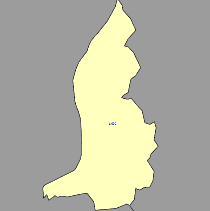
INSPIRE Statistical Units - NUTS regions Liechtenstein
Die NUTS-Klassifikation (Systematik der Gebietseinheiten für die Statistik) ist ein hierarchisches System zur Untergliederung der Wirtschaftsräume der EU und des Vereinigten Königreichs
Base
- Titolo alternativo
-
INSPIRE Statistical Unit NUTS Regions Liechtenstein
- Data (Creazione)
- 2016-02-21T00:00:00
- Identificatore
- https://metadata.geo.llv.li/b57f591d-ee98-45dd-b3ab-6969e5868ff1
- Finalità
-
Umsetzung INSPIRE
- Status
- In corso
- Punto di contatto
-
Nome dell'ente Nome del responsabile E-mail Ruolo Abt. Vermessung und Geoinformation (ATG)
Punto di contatto
- Frequenza di aggiornamento
- Secondo necessità
-
GEMET
-
-
raster
-
base di dati
-
-
geocat.ch
-
-
INSPIRE
-
-
GEMET - INSPIRE themes, version 1.0
-
-
Unità statistiche
-
-
GEMET themes
-
-
ricerca
-
geografia
-
-
Spatial scope
-
-
Nazionali
-
- Vincoli di accesso
- Altri vincoli
- Altri vincoli
- no limitations to public access
- Limitazione d’uso
-
Zugangs- und Nutzungsbedingungen
- Vincoli di fruibilità
- Altri vincoli
- Altri vincoli
-
gebührenpflichtig
- Tipo di rappresentazione spaziale
- Dati vettoriali
- Denominatore
- 500
- Lingua dei dati
- Deutsch
- Set dei caratteri dei dati
- UTF8
- Tema
-
- Mappe di base
Estensione
- Descrizione
-
Liechtenstein
))

- Identificatore del sistema di riferimento
- http://www.opengis.net/def/crs/EPSG/0/21782
- Identificatore del sistema di riferimento
- http://www.opengis.net/def/crs/EPSG/0/4258
- Livello di topologia
- Grafo planare completo
- Oggetto di tipo geometrico
- Superficie
- Conteggio oggetto geometrico
- 100
- Formato di distribuzione
-
Name Versione formato Geographic Markup Language (GML)
ESRI Shapefile (SHP)
- Distributore
-
Nome dell'ente Nome del responsabile E-mail Ruolo Abt. Vermessung und Geoinformation (ATG)
Punto di contatto
- Risorsa online
-
Protocollo Sito Name WWW:LINK
https://geodaten.llv.li Geodatenportal der Liechtensteinische Landesverwaltung
WWW:LINK
https://www.llv.li/de/landesverwaltung/amt-fuer-tiefbau-und-geoinformation/geodateninfrastruktur/datenausgabe Homepage ATG, Datenausgabestelle
OGC Web Map Service
https://service.geo.llv.li/mapserver/INSPIRE?service=WMS&request=GetCapabilities SU
ATOM Syndication Format
https://service.geo.llv.li/atom/service.xml INSPIRE Download Service (ATOM)
- Livello
- Dataset
- Altro
-
Alle Ebenen
Consistenza di dominio
Conformità
- Titolo
-
Commission Regulation (EU) No 1089/2010 of 23 November 2010 implementing Directive 2007/2/EC of the European Parliament and of the Council as regards interoperability of spatial data sets and services
- Data (Pubblicazione)
- 2010-12-08
- Spiegazione
-
INSPIRE Konformität
- Pass
- Yes
Conformità
- Titolo
-
D2.8.II.2 INSPIRE Data Specification on Land Cover – Technical Guidelines
- Data (Creazione)
- 2013-12-10
- Spiegazione
-
konform
- Pass
- Yes
- Genealogia del dato – Processo di produzione
-
Die Daten wurden aus dem Fachdatenmodellen auf die INSPIRE Struktur übersetzt
Metadato
- Identificatore del file di metadati
- b57f591d-ee98-45dd-b3ab-6969e5868ff1 XML
- Lingua dei metadati
- Deutsch
- Set dei caratteri dei metadati
- UTF8
- Livello gerarchico
- Dataset
- Data dei metadati
- 2024-04-29T14:43:40.934Z
- Nome dello Standard dei metadati
-
GM03 2+
- Contatto
-
Nome dell'ente Nome del responsabile E-mail Ruolo Abt. Vermessung und Geoinformation (ATG)
Punto di contatto
- Altra lingua
-
Lingua Codifica dei caratteri Francese UTF8 Italiano UTF8 Inglese UTF8 Romancio UTF8 Tedesco UTF8