 INSPIRE Geoportal
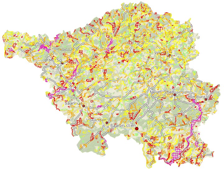
Arten- und Biotopschutzprogramm Saarland - Kernflächen
Es handelt sich um die in ihrem aktuellen Bestand bereits besonders wertvollen Flächen, die in den Bestands- und Bewertungskarten flächenscharf dargestellt und bewertet wurden. Nach den vorhandenen Informationen über Biotopstruktur und Ausbildung wurden gemäß dem Ziele-Katalog Entwicklungsziele zugeordnet.
Simple
- Date (Creation)
- 1998-03-01
- Citation identifier
- https://registry.gdi-de.org/id/de.sl/b5add210-9452-473c-b918-5d98df3c142a
- Point of contact
-
Organisation name Individual name Electronic mail address Role Ministerium für Umwelt, Klima, Mobilität, Agrar und Verbraucherschutz
Referat D/2 Arten- und Biotopschutz, Zentrum für Biodokumentation
poststelle@umwelt.saa poststelle@umwelt.saarland.de
Point of contact Ministerium für Umwelt, Klima, Mobilität, Agrar und Verbraucherschutz
Postanschrift Ministerium für Umwelt, Klima, Mobilität, Agrar und Verbraucherschutz
poststelle@umwelt.saa poststelle@umwelt.saarland.de
Resource provider
- Resource format
-
Name Version filegdb-featureClass
10.0
-
GEMET - INSPIRE themes, version 1.0
-
-
Lebensräume und Biotope
-
-
GEMET - Concepts, version 2.4
-
-
Biologie
-
- Keywords
-
-
geoportal
-
inspireidentifiziert
-
ABSP
-
-
mapbender.2.inspireWholeArea
-
-
2500
-
-
mapbender.2.inspireActualCoverage
-
-
2500
-
- Place
-
-
Saarland
-
-
Spatial scope
-
-
Regional
-
Resource constraints
Resource constraints
Resource constraints
Resource constraints
Resource constraints
Resource constraints
Resource constraints
Resource constraints
Resource constraints
Resource constraints
Resource constraints
Resource constraints
Resource constraints
Resource constraints
Resource constraints
Resource constraints
- Classification
- Unclassified
- Use limitation
-
Maßstabsbeschränkung im Darstellungsdienst, Geoportal. Es gelten keine Bedingungen.
- Access constraints
- Other restrictions
- Other constraints
- Es gelten keine Zugriffsbeschränkungen
- Use constraints
- Other restrictions
- Other constraints
- Es gelten keine Bedingungen
- Other constraints
-
Die Daten unterliegen dem Urheberrecht. Jede Vervielfältigung bedarf einer Genehmigung. Die Nutzung für kommerzielle Zwecke ist nicht gestattet. Ein Quellenvermerk ist stets und bei jedweder Art der Nutzung erforderlich. Das LVGL übernimmt keine Haftung für die Vollständigkeit und die Fehlerfreiheit der Geofachdaten. Insbesondere übernimmt das LVGL keine Gewähr dafür, dass die Geofachdaten den Anforderungen und Zwecken des Nutzers genügen. Die Verantwortung für die richtige Auswahl und die Folgen der Benutzung der Geofachdaten sowie der damit beabsichtigten oder erzielten Ergebnisse trägt der Nutzer. Des Weiteren verweisen wir auf die geltenden Nutzungsbedingungen für Geofachdaten des Landesamtes für Vermessung, Geoinformation und Landentwicklung (LVGL). https://www.shop.lvgl.saarland.de/cloud/index.php/s/Nutzungsbedingungen_Geofachdaten#pdfviewer
- Spatial representation type
- Vector
- Denominator
- 25000
- Language
- Deutsch
- Character set
- UTF8
- Topic category
-
- Biota
))
- Geographic identifier
- Saarland
- Geographic identifier
- 100000000000
- Unique resource identifier
- EPSG:31466
- Geometric object type
- Curve
- Distribution format
-
Name Version Esri Shape
1.0
- Distributor contact
-
Organisation name Individual name Electronic mail address Role Ministerium für Umwelt, Klima, Mobilität, Agrar und Verbraucherschutz
Referat E/6 Geodatenzentrum
Geodatenzentrum@umwelt.saa Geodatenzentrum@umwelt.saarland.de
Distributor
- OnLine resource
-
Protocol Linkage Name https://geoportal.saarland.de/layer/view/34963
- OnLine resource
-
Protocol Linkage Name https://geoportal.saarland.de/arcgis/services/Internet/Arten_Biotopschutz/MapServer/WFSServer?VERSION=1.1.0&REQUEST=GetCapabilities&SERVICE=WFS
- Hierarchy level
- Dataset
Conformance result
- Date (Publication)
- 2010-12-08
- Explanation
-
Die Daten wurden mit dem EU-Validator überprüft.
- Pass
- No
- Statement
-
Es lagen hier für die tatsächlich recherchierten Art- und Biotopdaten zugrunde. Aus der Überlagerung ableitend wurde die unmittelbare Erhaltung der Ziel-Arten/Ziel-Lebensgemeinschaften erforderlichen funktionalen Habitatteilflächen zusammengefasst und als Flächeneinheit (Kernflächen) abgegrenzt.
Metadata
- File identifier
- b5add210-9452-473c-b918-5d98df3c142a XML
- Metadata language
- Deutsch
- Character set
- UTF8
- Hierarchy level
- Dataset
- Date stamp
- 2023-06-12
- Metadata standard name
-
ISO19115
- Metadata standard version
-
2003/Cor.1:2006
- Metadata author
-
Organisation name Individual name Electronic mail address Role Ministerium für Umwelt, Klima, Mobilität, Agrar und Verbraucherschutz
Referat E/6 Geodatenzentrum
Geodatenzentrum@umwelt.saa Geodatenzentrum@umwelt.saarland.de
Point of contact
- Dataset URI
-
M:\suis\SUIS_GDB.gdb?ResourceName=ABSP_Flaechen
Overviews
Spatial extent
Provided by
