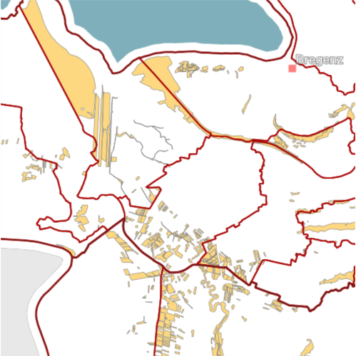
Biotopinventar Vorarlberg
Das Vorarlberger Biotopinventar erfasst und beschreibt die besonders wertvollen Lebensräume (Biotope) Vorarlbergs.
Folgende Kriterien sind für die Aufnahme in das Biotopinventar entscheidend: Natürlichkeitsgrad, Seltenheit, Vorkommen geschützter Arten (Tier- und Pflanzenarten), Vorkommen gefährdeter Arten und Lebensgemeinschaften, Ökologische Wohlfahrtswirkung, Landschaftsplanerische Bedeutung, Landeskulturelle Bedeutung, Wissenschaftliche Bedeutung
Die Ersterhebung der Biotope Vorarlbergs erfolgte 1984 bis 1989. Die Aktualisierung des Inventares wurde von 2005 bis 2009 durchgeführt.
Weiterführende Informationen (Gemeindeberichte, Fotos und Artenlisten) sind im VOGIS-Atlas und auf der Homepage des Landes abrufbar.
Ist für INSPIRE gemeldet.
gesetzliche Grundlage: Gesetz über Naturschutz und Landschaftsentwicklung, § 6
Datenquelle: biotope.shp
Felder und Datentypen der Attributtabelle:
Name (String), aggregierter Lebensraumtyp – AGG_LRTYP (String), Biotopnummer - BIOTOPNR (String), eindeutiger Flächencode - BIOTOPCODE (String)
Simple
- Date (Creation)
- 2010-01-19
- Date (Revision)
- 2019-07-08T12:00:00
- Citation identifier
- https://data.inspire.gv.at/0025/b71983fb-3e5e-411f-a8cb-8b5c3aec1722
- Point of contact
-
Organisation name Individual name Electronic mail address Role Vorarlberg, Amt d. LReg., Abteilung IVe - Umwelt- und Klimaschutz
Point of contact Vorarlberg, Amt d. LReg., Abteilung IVe - Umwelt- und Klimaschutz
Custodian Vorarlberg, Landesamt für Vermessung und Geoinformation, Abteilung Geoinformation
Publisher Vorarlberg, Amt d. LReg., Abteilung IVe - Umwelt- und Klimaschutz
Owner
-
VOGIS-Thema
-
-
Naturschutz
-
-
VOGIS-Unterthema
-
-
Inventar
-
-
GEMET - INSPIRE themes, version 1.0
-
-
Lebensräume und Biotope
-
- Keywords
-
-
Biotope
-
-
GEMET - Concepts, version 3.1
-
-
Biosphäre
-
Biotop
-
Lebensraum
-
Biogeographie
-
-
Spatial scope
- Access constraints
- Other restrictions
- Use constraints
- Other restrictions
- Other constraints
- Namensnennung 4.0 International (CC BY 4.0)
- Other constraints
-
(c) Land Vorarlberg
- Spatial representation type
- Vector
- Denominator
- 5000
- Language
- Deutsch
- Topic category
-
- Biota
))
- Begin date
- 2013-01-01
- End date
- 2017-03-31
- Reference system identifier
- http://www.opengis.net/def/crs/EPSG/0/31254
- Reference system identifier
- http://www.opengis.net/def/crs/EPSG/0/3035
- Reference system identifier
- http://www.opengis.net/def/crs/EPSG/0/4036
- Distribution format
-
Name Version ESRI Shapefile
-
- OnLine resource
-
Protocol Linkage Name OGC:WMS-http-get-capabilities
http://vogis.cnv.at/inspire-download/biotope_epsg_3035_uuid_b71983fb-3e5e-411f-a8cb-8b5c3aec1722_getcapabilities.xml Darstellungsdienst Biotopinventar Vorarlberg
WWW:DOWNLOAD-1.0-http--download
http://vogis.cnv.at/inspire-download/biotope_epsg_3035_uuid_b71983fb-3e5e-411f-a8cb-8b5c3aec1722_atom.xml Downloaddienst Biotopinventar Vorarlberg
OGC:WMS-http-get-capabilities
http://vogis.cnv.at/geoserver/vogis/biotope/wms?service=wms&request=Getcapabilities Geoserver-WMS
OGC:WFS-http-get-capabilities
http://vogis.cnv.at/geoserver/vogis/biotope/wfs?service=wfs&request=Getcapabilities Geoserver-WFS
WWW:DOWNLOAD-1.0-http--download
http://vogis.cnv.at/geoserver/vogis/biotope/ows?service=WFS&version=1.0.0&request=GetFeature&typeName=biotope&maxFeatures=50000&outputFormat=SHAPE-ZIP Shapefile-Download
- Hierarchy level
- Dataset
Domain consistency
- Measure identification
- INSPIRE / Conformity_001
Conformance result
- Date (Publication)
- 2010-12-08
- Explanation
-
siehe Referenzdokument (INSPIRE Technical Guidelines)
- Pass
- Yes
- Statement
-
Hersteller: Amt der Landesregierung, Abteilung IVe - Umwelt- und Klimaschutz
Metadata
- File identifier
- b71983fb-3e5e-411f-a8cb-8b5c3aec1722 XML
- Metadata language
- Deutsch
- Hierarchy level
- Dataset
- Date stamp
- 2023-11-24T09:02:51
- Metadata standard name
-
ISO19115
- Metadata standard version
-
2003/Cor.1:2006
- Metadata author
-
Organisation name Individual name Electronic mail address Role Vorarlberg, Landesamt für Vermessung und Geoinformation, Abteilung Geoinformation
Point of contact
Overviews

Spatial extent
))
Provided by

 INSPIRE Geoportal