INSPIRE Geoportal
Einteilung Geologischer Atlas 25 Vektor
Découpage atlas géologique 25 Vecteur
Divisione atlante geologico 25 Vettoriale
Division geological atlas 25 Vector
Divisiun atlas geologic 25 Vectur
Die Blätter des Geologischen Atlas der Schweiz (GA25) geben detailliert Auskunft über die obersten Schichten des Untergrundes. Die geologischen Formationen werden mittels Farben, Signaturen und Symbolen nach ihrem Alter, ihrer stofflichen Beschaffenheit und ihrer Lagerung (Tektonik) dargestellt. Zu jedem Kartenblatt wird ein Erläuterungsheft publiziert, in welchem die Formationen sowie die geologischen Besonderheiten des betreffenden Gebietes beschrieben sind. Von den ca. 220 geplanten Kartenblättern sind etwas mehr als zwei Drittel bereits erschienen.
Les feuilles de l'Atlas géologique de la Suisse (GA25) fournissent des renseignements détaillés sur les couches superficielles du sous-sol. Les formations géologiques sont représentées au moyen de couleurs, et de figurés en fonction de leur âge, de la nature de leurs substances et de leurs relations stratigraphiques (tectonique). Chaque feuille de l'atlas est publiée avec une notice explicative décrivant les formations et les particularités géologiques du secteur concernée. Des 220 cartes géologiques prévues, deux gros tiers sont déjà publiés.
I fogli dell'Atlante geologico della Svizzera (GA25) forniscono informazioni dettagliate sugli strati superiori del sottosuolo. Le formazioni geologiche vengono rappresentate a colori e corredate da simboli e sigle in funzione della loro età, della natura della loro composizione e della loro stratificazione (tettonica). Per ogni foglio della carta viene pubblicato un quaderno esplicativo in cui sono descritte le formazioni e le particolarità geologiche della rispettiva zona. Dei circa 220 fogli della carta ne è già stata pubblicata due terzi.
The sheets of the Geological Atlas of Switzerland (GA25) give detailed information about the uppermost layers of the subsurface structure. Geological formations are represented by colours, conventional signs and symbols, which correspond to their age, composition and tectonic structure. For each sheet, an explanatory booklet is also published, in which the geological formations and special features of the study area are described. Over two thirds of the 220 map sheets that are planned have already been published.
Ils fegls da l'Atlas geologic da la Svizra (GA25) infurmeschan detagliadamain davart las stresas superiuras dal sutterren. Las furmaziuns geologicas vegnan preschentadas cun agid da colurs, signaturas e simbols tenor lur vegliadetgna, lur cumposiziun materiala e lur giaschament (tectonica). Tar mintga fegl vegn publitgà in carnet cun explicaziuns che descrivan las furmaziuns sco er las particularitads geologicas dal territori pertutgà. Dals ca. 220 fegls previs èn gia cumparids bundant 2/3.
Simple
-
AlternativtitelAutres appellations ou acronymesTitolo alternativoAlternate titleAlternate title
-
Einteilung GA25 Vektor
Découpage GA25 Vecteur
Divisione GA25 Vettoriale
Division GA25 Vector
Divisiun GA25 Vectur
-
Date (lastRevision)Data (lastRevision)Date (lastRevision)Date (lastRevision)Datumsangaben (lastRevision)
- 2020-02-27
-
IdentificateurIdentificatoreCitation identifierCitation identifierIdentifikator
- ch.swisstopo.geologie-geologischer_atlas_vector.metadata
Identificateur
Identificatore
Citation identifier
Citation identifier
Identifikator
-
Forme de la présentationFormato di presentazionePresentation formPresentation formPräsentationsform
-
Carte numériqueMappa digitaleDigital mapDigital mapDigitale Karte
-
Gemeinsamer TitelTitre collectifTitolo collettivo
-
Geologisches Kartenwerk
Cartes géologiques
Carte geologiche
-
ZweckBut
-
Detailliert Auskunft über den obersten Bereich des Untergrundes der Schweiz
Renseignements détaillés sur les couches supérieures du sous-sol de la Suisse
-
EtatStatusStatusStatusBearbeitungsstatus
-
En cours de créationIn fase di sviluppoUnder developmentUnder developmentIn Erstellung
- Point of contact
-
Organisation name Individual name Electronic mail address Role Bundesamt für Landestopografie swisstopo
Office fédéral de topographie swisstopo
Ufficio federale di topografia swisstopo
Federal Office of Topography swisstopo
Uffizi federal da topografia swisstopo
DistributeurDistributoreDistributorDistributorVertriebBundesamt für Landestopografie swisstopo
Office fédéral de topographie swisstopo
Ufficio federale di topografia swisstopo
Federal Office of Topography swisstopo
Uffizi federal da topografia swisstopo
Point de contactPunto di contattoPoint of contactPoint of contactAnsprechpartnerBundesamt für Landestopografie swisstopo
Office fédéral de topographie swisstopo
Ufficio federale di topografia swisstopo
Federal Office of Topography swisstopo
Uffizi federal da topografia swisstopo
PropriétaireProprietarioOwnerOwnerEigentümer / Datenherr
-
Fréquence de mise à jourFrequenza di aggiornamentoMaintenance and update frequencyMaintenance and update frequencyÜberarbeitungsintervall
-
IrrégulièreIrregolareIrregularIrregularUnregelmässig
-
geocat.ch
-
-
Aufbewahrungs- und Archivierungsplanung AAP - Bund
Planification de la conservation et de l'archivage AAP - Conféderation
Pianificazione della conservazione e dell’archiviazione AAP - Confederazione
Conservation and archiving planning AAP - Confederation
-
Geologische Karte
carte géologique
carta geologica
geologic map
-
Geobasisdaten
géodonnées de base
geodati di base
official geodata
-
e-geo.ch
e-geo.ch
e-geo.ch
e-geo.ch
-
-
GEMET - INSPIRE themes, version 1.0
-
-
Geologie
Géologie
Geologia
Geology
-
-
GEMET
-
-
Geologischer Prozess
processus géologique
processi geologici
geological process
-
Geomorphologie
géomorphologie
geomorfologia
geomorphology
-
Tektonik
tectonique
tettonica
tectonics
-
Sedimentation (geologisch)
sédimentation
sedimentazione (geologia)
sedimentation (geology)
-
Geowissenschaften
sciences de la terre
scienze della terra
earth science
-
Gestein
pierre
pietra (edilizia)
stone
-
-
geocat.ch
-
-
BGDI Bundesgeodaten-Infrastruktur
IFDG l’Infrastructure Fédérale de données géographiques
IFDG Infrastruttura federale dei dati geografici
FSDI Federal Spatial Data Infrastructure
-
-
Identificateur du jeu de données aggrégéIdentificatore aggregato del datasetAggregate DatasetindentifierAggregate DatasetindentifierIdentifikator
- 258814a5-8fcf-47df-b0c6-160602b0078c
-
Type d'associationTipo di associazioneAssociation TypeAssociation TypeAssoziationstyp
-
Référence mèreRiferimento a dataset principaleLarger work citationLarger work citationÜbergeordneter Datenbestand
-
Type de représentation spatialeTipo di rappresentazione spazialeSpatial representation typeSpatial representation typeRäumliche Darstellungsart
-
VecteurDati vettorialiVectorVectorVektor
-
Type de représentation spatialeTipo di rappresentazione spazialeSpatial representation typeSpatial representation typeRäumliche Darstellungsart
-
paperMappaperMappaperMappaperMappaperMap
-
Dénominateur de l'échelleDenominatoreDenominatorDenominatorMassstabszahl
- 25000
-
Langue de la ressourceLingua dei datiLanguageLanguageSprache
- Deutsch
-
Langue de la ressourceLingua dei datiLanguageLanguageSprache
- Français
-
Encodage des caractèresSet dei caratteri dei datiCharacter setCharacter setZeichensatz
-
Utf8UTF8UTF8UTF8Utf8
-
Catégorie ISOTemaTopic categoryTopic categoryThematik
-
-
Sciences de la terre, géosciencesInformazioni geoscientificheGeoscientific informationGeoscientific informationGeowissenschaften
-
Étendue
Estensione
Extent
Extent
Ausdehnung
-
BeschreibungDescriptionDescrizioneDescription
-
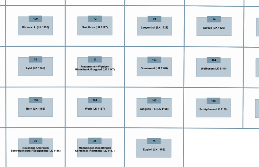
Landeskarte 1:25'000
Carte nationale 1:25'000
Carta nazionale 1:25'000
National Map 1:25'000
))

-
Identifiant géographiqueidentificatore GeograficoGeographic identifierGeographic identifierGeografischer Identifikator
-
LK25CN25CN25NM25CN25
-
ZusatzinformationInformations supplémentaires
-
Einige Karten sind vergriffen, einige Karten im Vektorformat erhältlich.
Quelques cartes sont épuisé, quelques cartes sont disponible en version jeux de données vectorielles.
-
Nom du système de référenceIdentificatore del sistema di riferimentoReference system identifierReference system identifierIdentifikator des Referenzsystems
-
Referenzsystem entsprechend der zugrundeliegenden topographischen Karte (CH1903)Système de référence conformément à la carte topographique sous-jacente (CH1903)
- Distribution format
-
Name Version ESRI Shapefile
-
- OnLine resource
-
Protocol Linkage Name MAP:Preview
https://map.geo.admin.ch/?layers=ch.swisstopo.geologie-geologischer_atlas_vector.metadata Vorschau map.geo.admin.ch
Aperçu map.geo.admin.ch
Previsione map.geo.admin.ch
Preview map.geo.admin.ch
OGC:WMS
https://wms.geo.admin.ch/?SERVICE=WMS&VERSION=1.3.0&REQUEST=GetCapabilities&lang=de ch.swisstopo.geologie-geologischer_atlas_vector.metadata
ch.swisstopo.geologie-geologischer_atlas_vector.metadata
ch.swisstopo.geologie-geologischer_atlas_vector.metadata
ch.swisstopo.geologie-geologischer_atlas_vector.metadata
ch.swisstopo.geologie-geologischer_atlas_vector.metadata
ESRI:REST
https://api3.geo.admin.ch/rest/services/api/MapServer/ch.swisstopo.geologie-geologischer_atlas_vector.metadata RESTful API von geo.admin.ch
RESTful API de geo.admin.ch
RESTful API da geo.admin.ch
RESTful API from geo.admin.ch
RESTful API dad geo.admin.ch
- OnLine resource
-
Protocol Linkage Name WWW:LINK
https://www.swisstopo.admin.ch/de/geodata/geology/maps/ga25/vector.html
- OnLine resource
-
Protocol Linkage Name WWW:DOWNLOAD-URL
https://www.swisstopo.admin.ch/de/geodata/geology/maps/ga25/vector.html
- OnLine resource
-
Protocol Linkage Name CHTOPO:specialised-geoportal
-
-
NiveauLivelloHierarchy levelHierarchy levelBezugsebene
-
Jeu de donnéesDatasetDatasetDatasetDatenbestand
-
ErläuterungGénéralités sur la provenance
-
Als topografische Grundlage dient die Landeskarte 1:25'000. Zu jedem Kartenblatt wird ein Erläuterungsheft publiziert, in welchem die Formationen sowie die geologischen Besonderheiten des betreffenden Gebietes beschrieben sind.
C'est la carte nationale au 1:25'000 qui sert de fond topographique à cette série en cours d'élaboration. Chaque feuille de l'atlas est publiée avec une notice explicative décrivant les formations et les particularités géologiques du secteur concernée.
Metadata
-
Identifiant de la ficheIdentificatore del file di metadatiFile identifierFile identifierMetadatensatzidentifikator
- bea72085-38cb-4938-bbcb-9f06458d2bfa XML
-
LangueLingua dei metadatiMetadata languageMetadata languageSprache
- Deutsch
-
Jeu de caractèresSet dei caratteri dei metadatiCharacter setCharacter setZeichensatz
-
Utf8UTF8UTF8UTF8Utf8
-
Type de ressourceLivello gerarchicoHierarchy levelHierarchy levelHierarchieebene
-
Jeu de donnéesDatasetDatasetDatasetDatenbestand
-
Date des métadonnéesData dei metadatiDate stampDate stampDatum
- 2023-08-30T05:59:26.032Z
- Metadata standard name
-
GM03 2+
- Metadata author
-
Organisation name Individual name Electronic mail address Role Bundesamt für Landestopografie swisstopo
Office fédéral de topographie swisstopo
Ufficio federale di topografia swisstopo
Federal Office of Topography swisstopo
Uffizi federal da topografia swisstopo
Point de contactPunto di contattoPoint of contactPoint of contactAnsprechpartner
- Other language
-
Language Character encoding FrançaisFranceseFrenchFrenchFranzösischUtf8UTF8UTF8UTF8Utf8ItalienItalianoItalianItalianItalienischUtf8UTF8UTF8UTF8Utf8AnglaisIngleseEnglishEnglishEnglischUtf8UTF8UTF8UTF8Utf8RomancheRomancioRomanshRomanshRätoromanischUtf8UTF8UTF8UTF8Utf8AllemandTedescoGermanGermanDeutschUtf8UTF8UTF8UTF8Utf8