 INSPIRE Geoportal
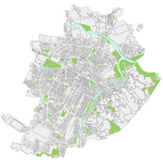
Dati di base - Carta di sintesi - Aree
Il dataset contiene gli elementi areali dell'intero territorio comunale relativi ai temi: aree verdi, fiumi, isolati e passerelle.
Simple
- Date (Revision)
- 2023-09-30
- Date (Creation)
- 2016-04-01
- Citation identifier
- c_l219:8045c82e-906a-4822-a3ee-98dea87d8ffd
- Cited responsible party
-
Organisation name Individual name Electronic mail address Role Comune di Torino
geoportale@comune.tor geoportale@comune.torino.it
Owner
- Presentation form
- Digital map
- Issue identification
-
c_l219:8045c82e-906a-4822-a3ee-98dea87d8ffd
- Point of contact
-
Organisation name Individual name Electronic mail address Role Comune di Torino
geoportale@comune.tor geoportale@comune.torino.it
Point of contact
- Maintenance and update frequency
- Annually
- Keywords
-
-
RNDT
-
- Keywords
-
-
EU
-
- Keywords
-
-
fiumi
-
passerelle
-
- Access constraints
- Other restrictions
- Other constraints
- no limitations to public access
- Use constraints
- Other restrictions
- Other constraints
- Spatial representation type
- Vector
- Denominator
- 1000
- Language
- Italiano
- Character set
- UTF8
- Topic category
-
- Imagery base maps earth cover
))
Vertical extent
- Minimum value
- NaN
- Maximum value
- NaN
- Unique resource identifier
- Monte-Mario-Italy1
- Distribution format
-
Name Version ESRI Shapefile
N.A.
DWG
N.A.
- Distributor contact
-
Organisation name Individual name Electronic mail address Role Comune di Torino
geoportale@comune.tor geoportale@comune.torino.it
Distributor
- OnLine resource
- Hierarchy level
- Dataset
Quantitative result
- Value
- 0.4
Conformance result
- Date (Publication)
- 2010-12-08
- Explanation
-
Fare riferimento alle specifiche indicate
- Statement
-
I livelli di cartografia derivata sono rappresentabili in scala 1:10000 e sono ottenuti per derivazione dalla Carta Tecnica della Citta' di Torino in scala 1:1000. I cassoni degli isolati sono semplificati e le sedi stradali sono deformate per ospitare la toponomastica.
Metadata
- File identifier
- c_l219:8045c82e-906a-4822-a3ee-98dea87d8ffd XML
- Metadata language
- Italiano
- Character set
- UTF8
- Hierarchy level
- Dataset
- Date stamp
- 2023-10-09
- Metadata standard name
- Linee Guida RNDT
- Metadata standard version
-
2.0
- Metadata author
-
Organisation name Individual name Electronic mail address Role Comune di Torino
geoportale@comune.tor geoportale@comune.torino.it
Point of contact
Overviews

Spatial extent
Provided by
