 INSPIRE Geoportal
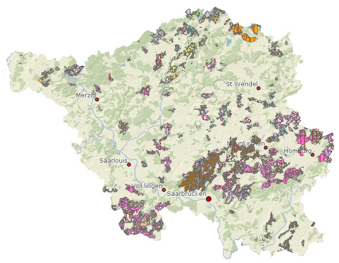
Standortskarte Wald Saarland
Standortskarte Wald Saarland Standortskatierung: LFNR: 1 usw. NUMMER: des Standorttyps Digitalisierung NAME: Kürzel des Standortstyps TYP: Langtext des Standorttyps,TROPHIE und FRISCHE (numerisch und als Text).
Simple
- Date (Creation)
- 2011-09-01
- Date (Revision)
- 2021-05-07
- Citation identifier
- https://registry.gdi-de.org/id/de.sl/cff02715-1d3b-4cda-94fc-b107b89e3c51
- Point of contact
-
Organisation name Individual name Electronic mail address Role Ministerium für Umwelt, Klima, Mobilität, Agrar und Verbraucherschutz
Referat D/6 Waldentwicklung, Waldökologie Forstplanung
poststelle@umwelt.saa poststelle@umwelt.saarland.de
Point of contact
- Resource format
-
Name Version filegdb-featureClass
10.0
-
GEMET - INSPIRE themes, version 1.0
-
-
Boden
-
-
GEMET - Concepts, version 2.4
-
-
Geowissenschaften
-
- Keywords
-
-
geoportal
-
inspireidentifiziert
-
Forst
-
- Place
-
-
Saarland
-
-
mapbender.2.inspireWholeArea
-
-
2500
-
-
mapbender.2.inspireActualCoverage
-
-
2500
-
-
Spatial scope
-
-
Regional
-
Resource constraints
Resource constraints
Resource constraints
Resource constraints
Resource constraints
Resource constraints
Resource constraints
Resource constraints
Resource constraints
Resource constraints
Resource constraints
Resource constraints
Resource constraints
Resource constraints
- Classification
- Unclassified
- Use limitation
-
Es gelten keine Bedingungen.
- Access constraints
- Other restrictions
- Other constraints
- Es gelten keine Zugriffsbeschränkungen
- Use constraints
- Other restrictions
- Other constraints
- Es gelten keine Bedingungen
- Other constraints
-
Die Daten unterliegen dem Urheberrecht. Jede Vervielfältigung bedarf einer Genehmigung. Die Nutzung für kommerzielle Zwecke ist nicht gestattet. Ein Quellenvermerk ist stets und bei jedweder Art der Nutzung erforderlich. Das LVGL übernimmt keine Haftung für die Vollständigkeit und die Fehlerfreiheit der Geofachdaten. Insbesondere übernimmt das LVGL keine Gewähr dafür, dass die Geofachdaten den Anforderungen und Zwecken des Nutzers genügen. Die Verantwortung für die richtige Auswahl und die Folgen der Benutzung der Geofachdaten sowie der damit beabsichtigten oder erzielten Ergebnisse trägt der Nutzer. Des Weiteren verweisen wir auf die geltenden Nutzungsbedingungen für Geofachdaten des Landesamtes für Vermessung, Geoinformation und Landentwicklung (LVGL). https://www.shop.lvgl.saarland.de/cloud/index.php/s/Nutzungsbedingungen_Geofachdaten#pdfviewer
- Spatial representation type
- Vector
- Denominator
- 1000
- Language
- Deutsch
- Character set
- UTF8
- Topic category
-
- Geoscientific information
))
- Geographic identifier
- Saarland
- Geographic identifier
- 100000000000
- Unique resource identifier
- EPSG:31466
- Distribution format
-
Name Version Esri Shape
1.0
- Distributor contact
-
Organisation name Individual name Electronic mail address Role Ministerium für Umwelt, Klima, Mobilität, Agrar und Verbraucherschutz
Referat D/6 Waldentwicklung, Waldökologie Forstplanung
poststelle@umwelt.saa poststelle@umwelt.saarland.de
Distributor
- Distributor contact
-
Organisation name Individual name Electronic mail address Role Ministerium für Umwelt, Klima, Mobilität, Agrar und Verbraucherschutz
Referat E/6 Geodatenzentrum
Geodatenzentrum@umwelt.saa Geodatenzentrum@umwelt.saarland.de
Distributor
- OnLine resource
-
Protocol Linkage Name https://geoportal.saarland.de/layer/view/36800
- OnLine resource
-
Protocol Linkage Name https://geoportal.saarland.de/arcgis/services/Internet/Forstwirtschaft/MapServer/WFSServer?VERSION=1.1.0&REQUEST=GetCapabilities&SERVICE=WFS
- Hierarchy level
- Dataset
Conformance result
- Date (Publication)
- 2010-12-08
- Explanation
-
Die Daten wurden mit dem EU-Validator überprüft.
- Pass
- No
- Statement
-
SaarForst Landesbetrieb Forstplanung, Geodatenzentrum
Metadata
- File identifier
- cff02715-1d3b-4cda-94fc-b107b89e3c51 XML
- Metadata language
- Deutsch
- Character set
- UTF8
- Hierarchy level
- Dataset
- Date stamp
- 2023-06-13
- Metadata standard name
-
ISO19115
- Metadata standard version
-
2003/Cor.1:2006
- Metadata author
-
Organisation name Individual name Electronic mail address Role Ministerium für Umwelt, Klima, Mobilität, Agrar und Verbraucherschutz
Referat E/6 Geodatenzentrum
Geodatenzentrum@umwelt.saa Geodatenzentrum@umwelt.saarland.de
Point of contact
- Dataset URI
-
M:\suis\GDZ_GDB.gdb ?ResourceName=Standortskarte_Wald
Overviews
Spatial extent
Provided by
