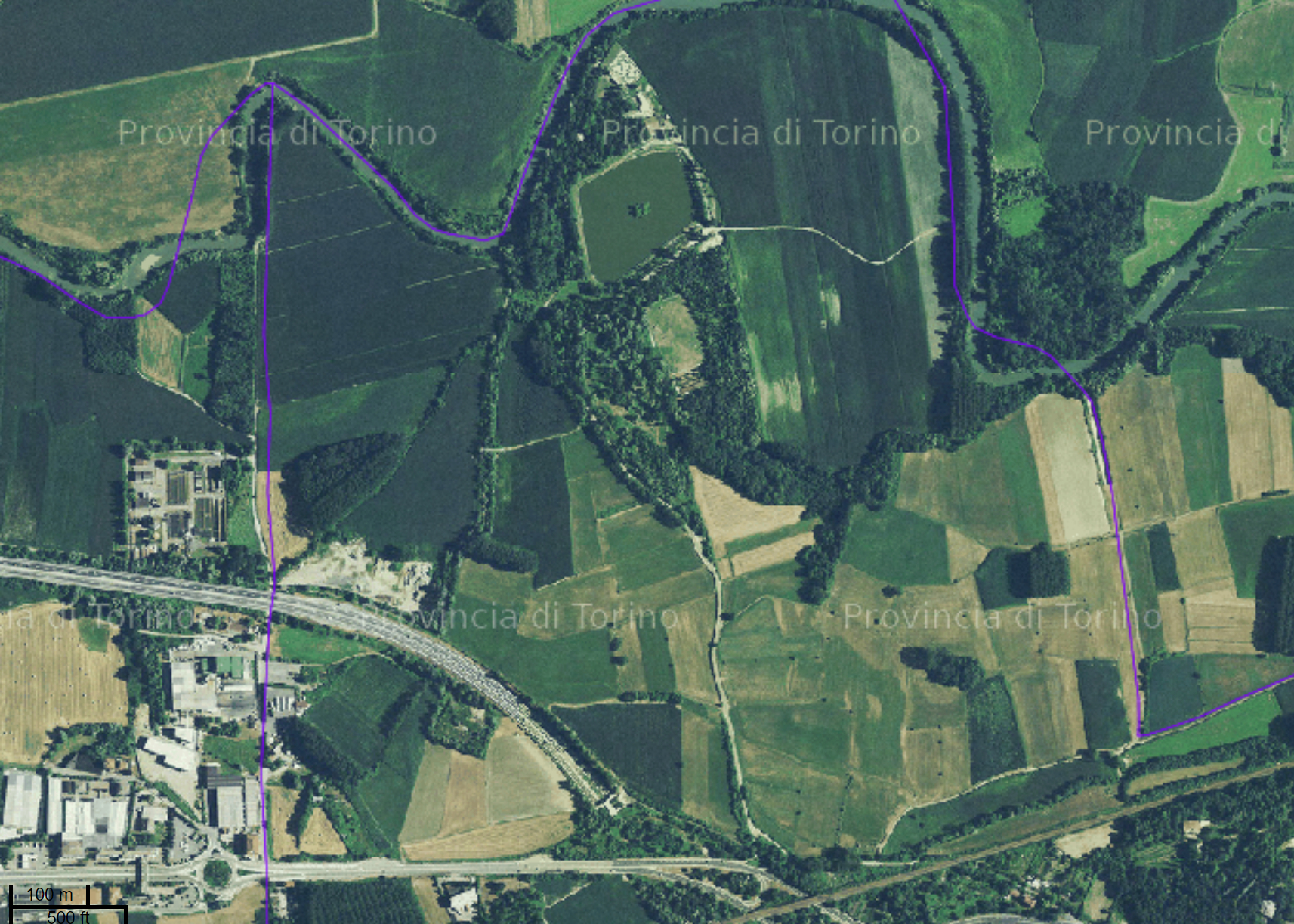
Ortofoto CGR/BLOM 2010 (GEOSERVIZIO WMS)
Geoservizio WMS di esposizione deil'ortofoto digitale sul territorio della Città metropolitana di Torino già Provincia di Torino, limitatamente alla zona di pianura, (volo 2010 - Compagnia Generale Ripreseaeree).
Simple
Identification info
- Date (Creation)
- 2011-06-06
- Date (Publication)
- 2011-06-27
- Citation identifier
- cmto:a81251b5-51fb-4b3e-9cab-824f393a54a9
- Cited responsible party
-
Organisation name Individual name Electronic mail address Role Città metropolitana di Torino
protocollo@cert.cit protocollo@cert.cittametropolitana.torino.it
Owner
- Point of contact
-
Organisation name Individual name Electronic mail address Role Città metropolitana di Torino
territorio@cittametropolitana.tor territorio@cittametropolitana.torino.it
Point of contact
- Keywords
-
-
RNDT
-
- Keywords
-
-
EU
-
- Keywords
-
-
opendata
-
- Keywords
-
-
ortofoto, digitale, aerea
-
-
ISO - 19119 geographic services taxonomy
- Access constraints
- Other restrictions
- Other constraints
- no limitations to public access
- Use constraints
- Other restrictions
- Other constraints
- Service Type
- view
))
- Begin date
- 2010-06-30
- End date
- 2010-06-30
- Coupling Type
- Loose
- Contains Operations
-
Operation Name Distributed Computing Platforms Connect Point GetMap
Web services https://www.geoportale.cittametropolitana.torino.it/geonetwork/cmto/ita/catalog.search#/home
- Distribution format
-
Name Version OGC:WMS
-
- OnLine resource
-
Protocol Linkage Name Web Map Service (WMS) https://www.cittametropolitana.torino.it/cartoview/
- Hierarchy level
- Service
- Other
-
Servizio
Conformance result
- Date (Publication)
- 2010-12-08
- Explanation
-
Fare riferimento alle specifiche indicate
Metadata
- File identifier
- cmto:a81251b5-51fb-4b3e-9cab-824f393a54a9 XML
- Metadata language
- Italiano
- Character set
- UTF8
- Hierarchy level
- Service
- Hierarchy level name
-
servizio
- Date stamp
- 2023-12-07
- Metadata standard name
-
Linee Guida RNDT
- Metadata standard version
-
2.0
- Metadata author
-
Organisation name Individual name Electronic mail address Role Città metropolitana di Torino
territorio@cittametropolitana.tor territorio@cittametropolitana.torino.it
Point of contact
Overviews

Spatial extent
))
Provided by

 INSPIRE Geoportal