INSPIRE Geoportal
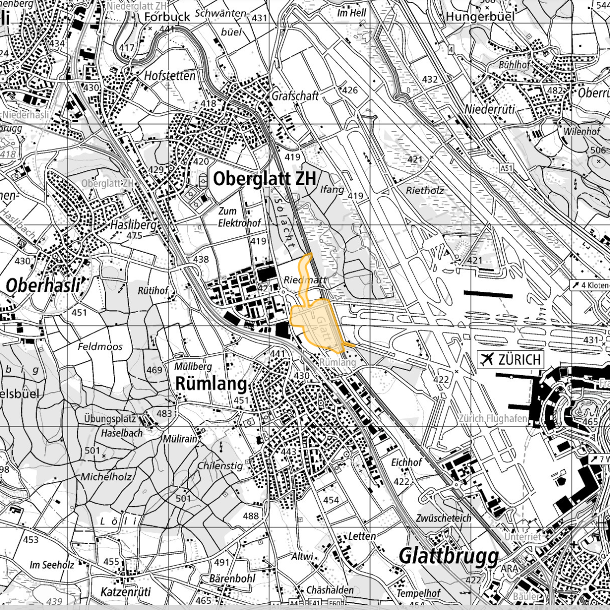
Projektierungszonen Flughafenanlagen
Zones réservées des installations aéroportuaires
Zone di progettazione per gli impianti aeroportuali
Reserved zones for airport installations
Zonas da projectaziun per implants d'eroports
Genau bezeichnetes Gebiet, in dem die Grundstücke für künftige Flughafenanlagen freizuhalten sind. Parzellenscharfe Darstellung mit einer Linie auf einem grossmassstäblichen Plan. Bauliche Veränderungen, die diesem Zweck widersprechen sind nicht gestattet. Befristete Wirkung von maximal 5 Jahren, mögliche Verlängerung um höchstens 3 Jahre. Rechtsgrundlage (LFG Art. 37n Abs. 1): «Das Bundesamt kann von Amtes wegen oder auf Antrag des Flugplatzhalters, des Kantons oder der Gemeinde für genau bezeichnete Gebiete Projektierungszonen festlegen, um Grundstücke für künftige Flughafenanlagen freizuhalten. …»
Zone clairement délimitée dont les terrains sont réservés en vue de futures installations aéroportuaires. Représentation des parcelles sur un plan à grande échelle. Les modifications de construction contraires à cette affectation ne sont pas admises. Durée limitée à une période de cinq ans prorogeable de trois ans au plus. Base légale (LA, art. 37n, al. 1): «En vue d’assurer la libre disposition des terrains nécessaires à des installations d’aéroport, l’Office fédéral peut, d’office ou sur requête de l’exploitant de l’aérodrome, du canton ou de la commune déterminer des zones réservées dont le périmètre est bien délimité. …»
Zona riservata determinata per impianti aeroportuali futuri. Rappresentazione che mette in evidenza le parcelle mediante linee su una carta a grande scala. Nelle zone riservate non possono essere eseguite trasformazioni edilizie contrarie al loro scopo. Durata: massimo cinque anni con possibile proroga di tre anni al massimo.Base giuridica (legge federale sulla navigazione aerea, LNA, art. 37n, cpv. 1): «L’UFAC può, d’ufficio o su proposta dell’esercente dell’aerodromo, del Cantone o del Comune, determinare zone riservate in regioni esattamente delimitate, per riservare i fondi necessari a costruzioni e impianti aeroportuali futuri. …»
Designated area in which the land must be kept free for future airport installations. Plot-specific representation with a line on a large-scale plan. Constructional changes that contradict this purpose are not permitted. Limited effect of five years maximum, with a potential extension of up to three years. Legal basis (CAA Art. 37n Para. 1): “By virtue of its office or at the request of the airport owner, the canton or the local authority, the Federal Office can specify project planning zones for designated areas in order to keep land free for future airport installations ...”
Territori cleramain determinà, nua ch'i ston vegnir tegnids libers ils bains immobigliars per implants d'eroports futurs. Preschentaziun da las parcellas cun ina lingia sin in plan cun ina scala engrondida. Midadas architectonicas che cuntrafan a quest intent n'èn betg permessas. Effect d'ina durada limitada da maximalmain 5 onns, che po vegnir prolungada per maximalmain 3 onns. Basa giuridica (art. 37n al. 1 da la Lescha d'aviatica): "D'uffizi u sin dumonda dal possessur da la plazza aviatica, dal chantun u da la vischnanca po l'uffizi federal fixar zonas da projectaziun per territoris cleramain determinads, cun l'intent da tegnair liber bains immobigliars per implants d'eroports futurs. ..."
Simple
-
AlternativtitelAutres appellations ou acronymesTitolo alternativoAlternate titleAlternate title
-
Projektierungszonen Flughäfen
Zones réservées aéroports
Zone riservate aeroporti
Reserved zones airports
Zonas projectaziun eroports
-
Date (Révision)Data (Revisione)Date (Revision)Date (Revision)Datumsangaben (Überarbeitung)
- 2020-10-16
-
Date (Création)Data (Creazione)Date (Creation)Date (Creation)Datumsangaben (Erstellung)
- 2007-01-01T00:00:00
-
IdentificateurIdentificatoreCitation identifierCitation identifierIdentifikator
- ch.bazl.projektierungszonen-flughafenanlagen
Identificateur
Identificatore
Citation identifier
Citation identifier
Identifikator
-
Gemeinsamer TitelTitre collectifTitolo collettivo
-
Projektierungszonen Flughafenanlagen
Zones réservées des installations aéroportuaires
Zone di progettazione per gli impianti aeroportuali
-
ZweckButFinalità
-
Geobasisdaten des Bundesrechts
Géodonnées de base relevant du droit fédéral
Geodati di base del diritto federale
-
EtatStatusStatusStatusBearbeitungsstatus
-
Mise à jour continueIn corsoOn goingOn goingKontinuierliche Aktualisierung
- Point of contact
-
Organisation name Individual name Electronic mail address Role Bundesamt für Zivilluftfahrt
Office fédéral de aviation civile
Ufficio federale dell'aviazione civile
Federal Office of Civil Aviation
Bundesamt für Zivilluftfahrt
info@bazl.adm info@bazl.admin.ch
PropriétaireProprietarioOwnerOwnerEigentümer / Datenherr
-
Fréquence de mise à jourFrequenza di aggiornamentoMaintenance and update frequencyMaintenance and update frequencyÜberarbeitungsintervall
-
Lorsque nécessaireSecondo necessitàAs neededAs neededBei Bedarf
- Metadata author
-
Organisation name Individual name Electronic mail address Role Bundesamt für Zivilluftfahrt
Office fédéral de aviation civile
Ufficio federale dell’aviazione civile
Federal Office of Civil Aviation
Bundesamt für Zivilluftfahrt
adrian.nuetzi@bazl.adm adrian.nuetzi@bazl.admin.ch
Point de contactPunto di contattoPoint of contactPoint of contactAnsprechpartner
-
geocat.ch
-
-
Aufbewahrungs- und Archivierungsplanung AAP - Bund
Planification de la conservation et de l'archivage AAP - Conféderation
Pianificazione della conservazione e dell’archiviazione AAP - Confederazione
Conservation and archiving planning AAP - Confederation
-
opendata.swiss
opendata.swiss
opendata.swiss
opendata.swiss
opendata.swiss
-
Geobasisdaten
géodonnées de base
geodati di base
official geodata
-
Zonenplan
plan de zones
piano delle zone
zoning plan
-
Luftfahrt
navigation aérienne
navigazione aerea
air navigation
-
-
GEMET
-
-
Flughafen
aéroport
aeroporto
airport
-
Zoneneinteilung
zonage
zonizzazione
zoning
-
-
GEMET - INSPIRE themes, version 1.0
-
-
Bewirtschaftungsgebiete/Schutzgebiete/geregelte Gebiete und Berichterstattungseinheiten
Zones de gestion, de restriction ou de réglementation et unités de déclaration
Zone sottoposte a gestione/limitazioni/regolamentazione e unità con obbligo di comunicare dati
Area management/restriction/regulation zones and reporting units
-
Verkehrsnetze
Réseaux de transport
Reti di trasporto
Transport networks
-
-
geocat.ch
-
-
BGDI Bundesgeodaten-Infrastruktur
IFDG l’Infrastructure Fédérale de données géographiques
IFDG Infrastruttura federale dei dati geografici
FSDI Federal Spatial Data Infrastructure
-
-
Contraintes d'utilisationVincoli di fruibilitàUse constraintsUse constraintsNutzungseinschränkungen
-
Autres restrictionsAltri vincoliOther restrictionsOther restrictionsBenutzerdefinierte Einschränkungen
-
Andere EinschränkungenAutres contraintesAltri vincoliOther constraints
-
Opendata BY: Freie Nutzung. Quellenangabe ist Pflicht.Opendata BY: Utilisation libre. Obligation d’indiquer la source.Opendata BY: Libero utilizzo. Indicazione della fonte obbligatoria.Opendata BY: Open use. Must provide the source.
-
Andere EinschränkungenAutres contraintesAltri vincoliOther constraintsOther constraints
-
Type de représentation spatialeTipo di rappresentazione spazialeSpatial representation typeSpatial representation typeRäumliche Darstellungsart
-
VecteurDati vettorialiVectorVectorVektor
-
Dénominateur de l'échelleDenominatoreDenominatorDenominatorMassstabszahl
- 1000
-
Dénominateur de l'échelleDenominatoreDenominatorDenominatorMassstabszahl
- 100000
-
Langue de la ressourceLingua dei datiLanguageLanguageSprache
- Deutsch
-
Langue de la ressourceLingua dei datiLanguageLanguageSprache
- Français
-
Langue de la ressourceLingua dei datiLanguageLanguageSprache
- Italiano
-
Encodage des caractèresSet dei caratteri dei datiCharacter setCharacter setZeichensatz
-
Utf8UTF8UTF8UTF8Utf8
-
Catégorie ISOTemaTopic categoryTopic categoryThematik
-
-
Cadastre, aménagementPianificazione del territorio e catastoPlanning cadastrePlanning cadastrePlanungsunterlagen, Kataster
-
Étendue
Estensione
Extent
Extent
Ausdehnung
-
BeschreibungDescriptionDescrizioneDescriptionDescription
-
Schweiz
Suisse
Svizzera
Switzerland
Svizra
))

-
Nom du système de référenceIdentificatore del sistema di riferimentoReference system identifierReference system identifierIdentifikator des Referenzsystems
-
EPSG:2056EPSG:2056EPSG:2056EPSG:2056EPSG:2056
-
Type de géométries des objetsOggetto di tipo geometricoGeometric object typeGeometric object typeGeometrietyp
-
PolygoneSuperficieSurfaceSurfaceFläche
- Distribution format
-
Name Version INTERLIS
2
andere Formate auf Anfrage
-
Geopackage (ogc)
-
- OnLine resource
-
Protocol Linkage Name MAP:Preview
https://map.geo.admin.ch/?layers=ch.bazl.projektierungszonen-flughafenanlagen Vorschau map.geo.admin.ch
Aperçu map.geo.admin.ch
Previsione map.geo.admin.ch
Preview map.geo.admin.ch
- OnLine resource
-
Protocol Linkage Name WWW:LINK
https://www.bazl.admin.ch/bazl/de/home/themen/geoinformation_statistik/geoinformation/geobasisdaten/projektierungszonen-flughafenanlagen--geoiv-id-103-.html
- OnLine resource
-
Protocol Linkage Name WWW:DOWNLOAD-URL
https://data.geo.admin.ch/browser/index.html#/collections/ch.bazl.projektierungszonen-flughafenanlagen/items/projektierungszonen-flughafenanlagen CHTOPO:specialised-geoportal
https://map.geo.admin.ch/?topic=ech&lang=de&bgLayer=ch.swisstopo.pixelkarte-grau&layers=ch.bazl.projektierungszonen-flughafenanlagen&layers_opacity=0.75&X=257115.00&Y=683735.00&zoom=7 OGC:WMS
https://wms.geo.admin.ch/?SERVICE=WMS&VERSION=1.3.0&REQUEST=GetCapabilities&lang=de ch.bazl.projektierungszonen-flughafenanlagen
ch.bazl.projektierungszonen-flughafenanlagen
ch.bazl.projektierungszonen-flughafenanlagen
ch.bazl.projektierungszonen-flughafenanlagen
ch.bazl.projektierungszonen-flughafenanlagen
- OnLine resource
-
Protocol Linkage Name ESRI:REST
https://api3.geo.admin.ch/rest/services/api/MapServer/ch.bazl.projektierungszonen-flughafenanlagen RESTful API von geo.admin.ch
RESTful API de geo.admin.ch
RESTful API da geo.admin.ch
RESTful API from geo.admin.ch
RESTful API dad geo.admin.ch
OPENDATA:SWISS
https://opendata.swiss/de/perma/d76d6e8d-c6ac-40f3-92c0-2a953cb99d9f@bundesamt-fur-zivilluftfahrt-bazl Permalink opendata.swiss
Permalink opendata.swiss
Permalink opendata.swiss
Permalink opendata.swiss
WWW:DOWNLOAD:INTERLIS
https://data.geo.admin.ch/ch.bazl.projektierungszonen-flughafenanlagen/projektierungszonen-flughafenanlagen/projektierungszonen-flughafenanlagen_2056.xtf.zip WWW:DOWNLOAD:Geopackage (ogc)
https://data.geo.admin.ch/ch.bazl.projektierungszonen-flughafenanlagen/projektierungszonen-flughafenanlagen/projektierungszonen-flughafenanlagen_2056.gpkg
Metadata
-
Identifiant de la ficheIdentificatore del file di metadatiFile identifierFile identifierMetadatensatzidentifikator
- d76d6e8d-c6ac-40f3-92c0-2a953cb99d9f XML
-
LangueLingua dei metadatiMetadata languageMetadata languageSprache
- Deutsch
-
Jeu de caractèresSet dei caratteri dei metadatiCharacter setCharacter setZeichensatz
-
Utf8UTF8UTF8UTF8Utf8
-
Type de ressourceLivello gerarchicoHierarchy levelHierarchy levelHierarchieebene
-
Jeu de donnéesDatasetDatasetDatasetDatenbestand
-
Date des métadonnéesData dei metadatiDate stampDate stampDatum
- 2023-10-26T09:31:49.16Z
- Metadata standard name
-
GM03 2+
- Metadata author
-
Organisation name Individual name Electronic mail address Role Bundesamt für Zivilluftfahrt
Office fédéral de aviation civile
Ufficio federale dell'aviazione civile
Federal Office of Civil Aviation
Bundesamt für Zivilluftfahrt
gis@bazl.adm gis@bazl.admin.ch
Point de contactPunto di contattoPoint of contactPoint of contactAnsprechpartner
- Other language
-
Language Character encoding FrançaisFranceseFrenchFrenchFranzösischUtf8UTF8UTF8UTF8Utf8ItalienItalianoItalianItalianItalienischUtf8UTF8UTF8UTF8Utf8AnglaisIngleseEnglishEnglishEnglischUtf8UTF8UTF8UTF8Utf8RomancheRomancioRomanshRomanshRätoromanischUtf8UTF8UTF8UTF8Utf8AllemandTedescoGermanGermanDeutschUtf8UTF8UTF8UTF8Utf8