 INSPIRE Geoportal
Offshore Tectonic Faults in Portugal
Most important faults identified in the portuguese offshore, occurring between the Middle Atlantic Rift zone (Azores archipelago) and the Continental margin.
Simple
- Date (Creation)
- 2011-01-06
- Citation identifier
- ipma / 72a03add-5f19-475d-a641-81f97e70d990
- Citation identifier
- http://id.igeo.pt/cdg/eadc0cf5-a3a2-4acd-ad22-6cdf2d09064c
- Credit
-
LNEG - Laboratório Nacional de Energia e Geologia
- Point of contact
-
Organisation name Individual name Electronic mail address Role Instituto Português do Mar e da Atmosfera, I.P. (IPMA, I.P.)
Divisão de Geologia Marinha e Georecursos Marinhos
Point of contact
- Maintenance and update frequency
- As needed
- Keywords
-
-
IPMA, I.P.
-
INSPIRECORE
-
infoMapAccessService
-
Batimetria e Geomorfologia Marinha
-
Falha tectónica
-
Geologia Marinha e Costeira
-
-
Spatial scope
-
-
Nacional
-
- Access constraints
- Other restrictions
- Use constraints
- Other restrictions
- Other constraints
-
Serviço de visualização sem restrições. Descarregamento sujeito a licenciamento e a pedido formal através de comercial@ipma.pt, poderá implicar cobrança de taxas. comercial@ipma.pt Serviço de visualização sem restrições. Descarregamento sujeito a licenciamento e a pedido formal através de comercial@ipma.pt, poderá implicar cobrança de taxas.
- Spatial representation type
- Vector
- Denominator
- 0
- Language
- Portuguese
- Character set
- UTF8
- Topic category
-
- Geoscientific information
))
- Extent type code
- Yes
- Geographic identifier
- PT
- Reference system identifier
- EPSG / 4326
- Unique resource identifier
- EPSG:4258
- Distribution format
-
Name Version SHP
não se aplica
- OnLine resource
-
Protocol Linkage Name http://mapservices.ipma.pt/observations/geology/wms?service=WMS&REQUEST=GetCapabilities
- Hierarchy level
- Dataset
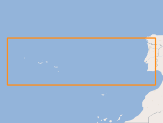
Extent
- Dataset
-
72a03add-5f19-475d-a641-81f97e70d990
Conformance result
- Date (Publication)
- 2010-12-08
- Explanation
-
Ver a especificação citada.
- Pass
- No
-
Statement
-
Tectonic faults identified by analysis and interpretation of seismic profiles and multibeam bathimetry from various oceanographic campaigns. The faults representation is done directly from the profiles interpretation and migration to a GIS software.
- Description
-
Carta Geológica de Portugal à escala 1:1 000 000, Edição 2010, LNEG-LGM, Lisboa. ISBN: 978-989-675-005-3
- Description
-
Nuno Lourenço (2007)- Tectono-Magmatic Processes At The Azores Triple Junction. PhD Thesis on Marine Geology. Algarve University, Faculty of Sciences of the Sea and Environment.
- Description
-
Hayward, N. et al.,(1999)-A seismic reflection and GLORIA study of compressional deformation in the Gorringe Bank region, eastern North Atlantic. Geophys. J. Int. (1999) 138, 831-850
Metadata
- File identifier
- eadc0cf5-a3a2-4acd-ad22-6cdf2d09064c XML
- Metadata language
- Portuguese
- Character set
- UTF8
- Hierarchy level
- Dataset
- Hierarchy level name
-
Conjunto de dados geográficos
- Date stamp
- 2020-12-04
- Metadata standard name
-
ISO 19115 Sistema de Metadados dos Açores
- Metadata author
-
Organisation name Individual name Electronic mail address Role Instituto Português do Mar e da Atmosfera, I.P. (IPMA, I.P.)
Grupo de Desenvolvimento da DivSI (Divisão de Sistemas de Informação, Comunicações e Desenvolvimento Tecnológico)
Point of contact
Overviews
Spatial extent
Provided by
