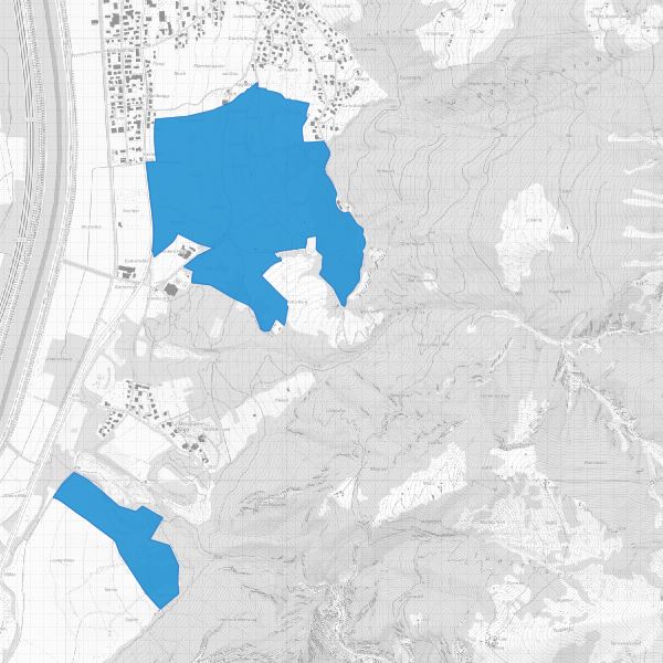
Protected landscape areas
Landscape protection areas in accordance with the Law on the Protection of Nature and Landscape LGBl. 1996 No. 117, Article 18). The landscape protection areas are protected by ordinance.
Simple
- Date (Publication)
- 2013-09-20
- Citation identifier
- https://metadata.geo.llv.li/f1830fc4-1606-4354-a025-83c189aeb534
- Cited responsible party
-
Organisation name Individual name Electronic mail address Role Civil Engineering and Geoinformation Office
Publisher
- Purpose
-
Protected areas, documentation Protected areas
- Status
- On going
- Point of contact
-
Organisation name Individual name Electronic mail address Role Civil Engineering and Geoinformation Office
Publisher Office for the Environment
Owner
- Maintenance and update frequency
- As needed
-
GEMET
-
-
vector
-
protected area
-
-
GEMET - INSPIRE themes, version 1.0
-
-
Protected sites
-
-
geocat.ch
-
-
OeREB
-
nature
-
INSPIRE
-
OpenData
-
-
Spatial scope
-
-
National
-
-
GEMET
-
-
landscape
-
Resource constraints
- Classification
- Unclassified
- Use limitation
-
keine
- Access constraints
- Other restrictions
- Use constraints
- Other restrictions
- Other constraints
- No limitations to public access
- Access constraints
- Other restrictions
- Use constraints
- Other restrictions
- Other constraints
- No conditions to access and use
- Other constraints
- Opendata BY: Open use. Must provide the source.
- Spatial representation type
- Vector
- Denominator
- 10000
- Language
- Deutsch
- Character set
- UTF8
- Topic category
-
- Environment
Extent
- Description
-
Liechtenstein
))

- Reference system identifier
- http://www.opengis.net/def/crs/EPSG/0/2056
- Reference system identifier
- http://www.opengis.net/def/crs/EPSG/0/4936
- Topology level
- Full planar graph
- Geometric object type
- Surface
- Geometric object count
- 2
- Distribution format
-
Name Version INTERLIS 1 (ITF)
ESRI Shapefile (SHP)
AutoCAD DXF (DXF)
- Distributor contact
-
Organisation name Individual name Electronic mail address Role Surveying and Geoinformation Division
Point of contact
- OnLine resource
-
Protocol Linkage Name CHTOPO:specialised-geoportal
https://geodaten.llv.li Geodata Portal of the National Administration
OGC:WMS
https://service.geo.llv.li/wmsli/service?service=WMS&language=ger&request=GetCapabilities li.au.nl_landschaftschutz
WWW:DOWNLOAD-URL
https://service.geo.llv.li/download/getfileByUUID.php?id=f1830fc4-1606-4354-a025-83c189aeb534 Zip download via the geodata portal
- Hierarchy level
- Dataset
Conformance result
- Title
-
VERORDNUNG (EG) Nr. 1089/2010 DER KOMMISSION vom 23. November 2010 zur Durchführung der Richtlinie 2007/2/EG des Europäischen Parlaments und des Rates hinsichtlich der Interoperabilität von Geodatensätzen und -diensten
- Date (Publication)
- 2010-12-08
- Explanation
-
nicht konform
- Pass
- No
- Statement
-
Konstruktion auf der Grundlage der AV und der Landeskarten
Metadata
- File identifier
- f1830fc4-1606-4354-a025-83c189aeb534 XML
- Metadata language
- Deutsch
- Character set
- UTF8
- Hierarchy level
- Dataset
- Date stamp
- 2024-12-10T12:35:41.396Z
- Metadata standard name
-
GM03 2+
- Metadata author
-
Organisation name Individual name Electronic mail address Role Amt für Umwelt
Point of contact
- Other language
-
Language Character encoding French UTF8 Italian UTF8 English UTF8 German UTF8
 INSPIRE Geoportal


