INSPIRE Geoportal
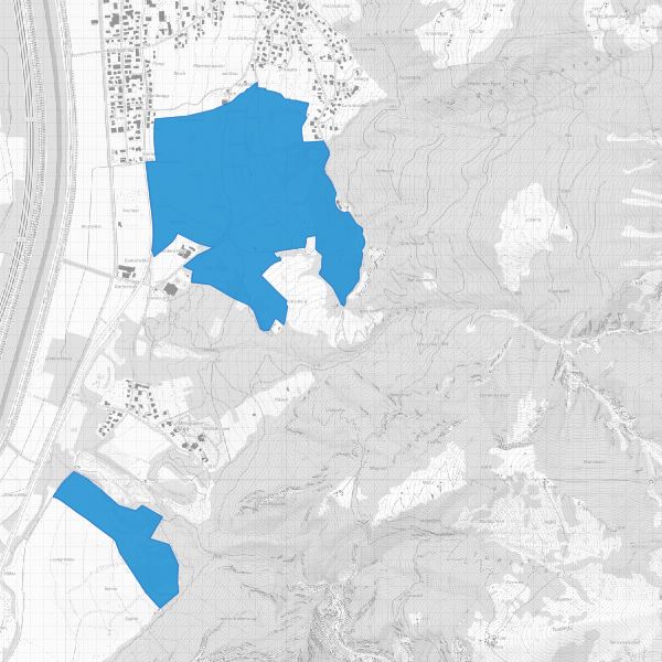
Landschaftsschutzgebiete
Protected landscape areas
Landschaftsschutzgebiete gemäss gemäss Gesetz zum Schutz von Natur und Landschaft LGBl. 1996 Nr. 117, Artikel 18). Die Landschaftsschutzgebiete sind mit Verordnung geschützt.
Landscape protection areas in accordance with the Law on the Protection of Nature and Landscape LGBl. 1996 No. 117, Article 18). The landscape protection areas are protected by ordinance.
Simple
-
Date (Publication)Data (Pubblicazione)Date (Publication)Datumsangaben (Publikation)
- 2013-09-20
-
IdentificateurIdentificatoreCitation identifierIdentifikator
- https://metadata.geo.llv.li/f1830fc4-1606-4354-a025-83c189aeb534
- Cited responsible party
-
Organisation name Individual name Electronic mail address Role Amt für Tiefbau und Geoinformation
Amt für Tiefbau und Geoinformation
Amt für Tiefbau und Geoinformation
Civil Engineering and Geoinformation Office
Editeur (publication)EditorePublisherHerausgeber
-
ZweckPurpose
-
Schutzgebiete, Dokumentation Schutzgebiete
Protected areas, documentation Protected areas
-
EtatStatusStatusBearbeitungsstatus
-
Mise à jour continueIn corsoOn goingKontinuierliche Aktualisierung
- Point of contact
-
Organisation name Individual name Electronic mail address Role Amt für Tiefbau und Geoinformation
Amt für Tiefbau und Geoinformation
Amt für Tiefbau und Geoinformation
Civil Engineering and Geoinformation Office
Editeur (publication)EditorePublisherHerausgeberAmt für Umwelt
Office pour l'environnement
Ufficio per l'ambiente
Office for the Environment
PropriétaireProprietarioOwnerEigentümer / Datenherr
-
Fréquence de mise à jourFrequenza di aggiornamentoMaintenance and update frequencyÜberarbeitungsintervall
-
Lorsque nécessaireSecondo necessitàAs neededBei Bedarf
-
GEMET
-
-
Vektor
vecteur
vettore
vector
-
Schutzgebiet
espace protégé
area protetta
protected area
-
-
GEMET - INSPIRE themes, version 1.0
-
-
Schutzgebiete
Sites protégés
Siti protetti
Protected sites
-
-
geocat.ch
-
-
ÖREB
RDPPF
RDPP
OeREB
-
Natur
nature
natura
nature
-
INSPIRE
INSPIRE
INSPIRE
INSPIRE
-
OpenData
OpenData
OpenData
OpenData
-
-
Spatial scope
-
-
National
Nationales
Nazionali
National
-
-
GEMET
-
-
Landschaft
paysage
paesaggio
landscape
-
Contraintes sur la ressource
Vincoli sulla risorsa
Resource constraints
Ressourceneinschränkungen
-
Restrictions de manipulationClassificazioneClassificationSicherheitseinstufung
-
Non classifiéNon riservatoUnclassifiedUnbeschränkt
-
Anwendungseinschränkungen
-
keine
-
Contraintes d'accèsVincoli di accessoAccess constraintsZugriffseinschränkungen
-
Autres restrictionsAltri vincoliOther restrictionsBenutzerdefinierte Einschränkungen
-
Contraintes d'utilisationVincoli di fruibilitàUse constraintsNutzungseinschränkungen
-
Autres restrictionsAltri vincoliOther restrictionsBenutzerdefinierte Einschränkungen
-
Andere EinschränkungenAutres contraintesAltri vincoliOther constraints
-
No limitations to public accessNo limitations to public accessNo limitations to public accessNo limitations to public access
-
Contraintes d'accèsVincoli di accessoAccess constraintsZugriffseinschränkungen
-
Autres restrictionsAltri vincoliOther restrictionsBenutzerdefinierte Einschränkungen
-
Contraintes d'utilisationVincoli di fruibilitàUse constraintsNutzungseinschränkungen
-
Autres restrictionsAltri vincoliOther restrictionsBenutzerdefinierte Einschränkungen
-
Andere EinschränkungenAutres contraintesAltri vincoliOther constraints
-
No conditions to access and useNo conditions to access and useNo conditions to access and useNo conditions to access and use
-
Andere EinschränkungenAutres contraintesAltri vincoliOther constraints
-
Opendata BY: Freie Nutzung. Quellenangabe ist Pflicht.Opendata BY: Utilisation libre. Obligation d’indiquer la source.Opendata BY: Libero utilizzo. Indicazione della fonte obbligatoria.Opendata BY: Open use. Must provide the source.
-
Type de représentation spatialeTipo di rappresentazione spazialeSpatial representation typeRäumliche Darstellungsart
-
VecteurDati vettorialiVectorVektor
-
Dénominateur de l'échelleDenominatoreDenominatorMaßstabszahl
- 10000
-
Langue de la ressourceLingua dei datiLanguageSprache
- Deutsch
-
Encodage des caractèresSet dei caratteri dei datiCharacter setZeichensatz
-
Utf8UTF8UTF8Utf8
-
Catégorie ISOTemaTopic categoryISO-Thematik
-
-
EnvironnementAmbienteEnvironmentUmwelt
-
Étendue
Estensione
Extent
Ausdehnung
-
BeschreibungDescriptionDescrizioneDescription
-
Liechtenstein
Liechtenstein
Liechtenstein
Liechtenstein
))

-
Nom du système de référenceIdentificatore del sistema di riferimentoReference system identifierIdentifikator des Referenzsystems
-
http://www.opengis.net/def/crs/EPSG/0/2056
-
Nom du système de référenceIdentificatore del sistema di riferimentoReference system identifierIdentifikator des Referenzsystems
-
http://www.opengis.net/def/crs/EPSG/0/4936
-
Niveau topologieLivello di topologiaTopology levelTopologielevel
-
Topologie de réseau complèteGrafo planare completoFull planar graphFlächen
-
Type de géométries des objetsOggetto di tipo geometricoGeometric object typeGeometrietyp
-
PolygoneSuperficieSurfaceFläche
-
Nombre d'objets géométriquesConteggio oggetto geometricoGeometric object countAnzahl
- 2
- Distribution format
-
Name Version INTERLIS 1 (ITF)
ESRI Shapefile (SHP)
AutoCAD DXF (DXF)
- Distributor contact
-
Organisation name Individual name Electronic mail address Role Abt. Vermessung und Geoinformation (ATG)
Abt. Vermessung und Geoinformation (ATG)
Abt. Vermessung und Geoinformation (ATG)
Surveying and Geoinformation Division
Point de contactPunto di contattoPoint of contactAnsprechpartner
- OnLine resource
-
Protocol Linkage Name CHTOPO:specialised-geoportal
https://geodaten.llv.li Geodatenportal der Liechtensteinischen Landesverwaltung
Geodata Portal of the National Administration
OGC:WMS
https://service.geo.llv.li/wmsli/service?service=WMS&language=ger&request=GetCapabilities li.au.nl_landschaftschutz
WWW:DOWNLOAD-URL
https://service.geo.llv.li/download/getfileByUUID.php?id=f1830fc4-1606-4354-a025-83c189aeb534 Zip Download über das Geodatenportal
Zip download via the geodata portal
-
NiveauLivelloHierarchy levelBezugsebene
-
Jeu de donnéesDatasetDatasetDatenbestand
Résultat de conformité
Conformità
Conformance result
Konformitätsergebnis
-
Titel
-
VERORDNUNG (EG) Nr. 1089/2010 DER KOMMISSION vom 23. November 2010 zur Durchführung der Richtlinie 2007/2/EG des Europäischen Parlaments und des Rates hinsichtlich der Interoperabilität von Geodatensätzen und -diensten
-
Date (Publication)Data (Pubblicazione)Date (Publication)Datumsangaben (Publikation)
- 2010-12-08
- Explanation
-
nicht konform
-
Degré de conformitéPassPassBestanden
- No
-
Erläuterung
-
Konstruktion auf der Grundlage der AV und der Landeskarten
Metadata
-
Identifiant de la ficheIdentificatore del file di metadatiFile identifierMetadatensatzidentifikator
- f1830fc4-1606-4354-a025-83c189aeb534 XML
-
LangueLingua dei metadatiMetadata languageSprache
- Deutsch
-
Jeu de caractèresSet dei caratteri dei metadatiCharacter setZeichensatz
-
Utf8UTF8UTF8Utf8
-
Type de ressourceLivello gerarchicoHierarchy levelHierarchieebene
-
Jeu de donnéesDatasetDatasetDatenbestand
-
Date des métadonnéesData dei metadatiDate stampDatum
- 2024-12-10T12:35:41.396Z
- Metadata standard name
-
GM03 2+
- Metadata author
-
Organisation name Individual name Electronic mail address Role Amt für Umwelt (LI)
Office de l'environnement
Amt für Umwelt
Amt für Umwelt
Point de contactPunto di contattoPoint of contactAnsprechpartner
- Other language
-
Language Character encoding FrançaisFranceseFrenchFranzösischUtf8UTF8UTF8Utf8ItalienItalianoItalianItalienischUtf8UTF8UTF8Utf8AnglaisIngleseEnglishEnglischUtf8UTF8UTF8Utf8AllemandTedescoGermanDeutschUtf8UTF8UTF8Utf8