INSPIRE Geoportal
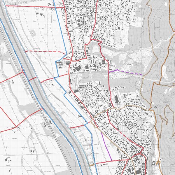
Radwege
Im Amt für Tiefbau und Geoinformation ist die Abteilung Infrastruktur Bau / Verkehrstechnik / Infrastruktur Bau zuständig für die Planung, den Bau, den Unterhalt und zur Kennzeichnung des Radwegnetzes. Dargestellt sind Radverbindungen, die von anderen Velofahrern für tägliche Arbeitswege empfohlen werden d.h. Radrouten in Liechtenstein und im Werdenberg. Offizielle Rad- und Mountainbikerouten aus Schweiz Mobil plus zusätzliche regionale Routen Liechtenstein/Werdenberg.
Simple
-
Alternativtitel
-
Radwegnetz
-
Date (Creation)Data (Creazione)Date (Création)Datumsangaben (Erstellung)
- 2011-12-21
-
Citation identifierIdentificatoreIdentificateurIdentifikator
- https://metadata.geo.llv.li/f86d9bab-60ab-45e0-ae37-0b5f35c009d1
-
Zweck
-
Erfassung und Pflege der Radwege und Information für Radfahrer.
-
StatusStatusEtatBearbeitungsstatus
-
On goingIn corsoMise à jour continueKontinuierliche Aktualisierung
- Point of contact
-
Organisation name Individual name Electronic mail address Role Amt für Tiefbau und Geoinformation
Civil Engineering and Geoinformation Office
Amt für Tiefbau und Geoinformation
Amt für Tiefbau und Geoinformation
Point of contactPunto di contattoPoint de contactAnsprechpartner
-
geocat.ch
-
-
INSPIRE
INSPIRE
INSPIRE
INSPIRE
-
Geodaten
geodata
geodati
géodonnées
-
Langsamverkehr
human-powered mobility
traffico lento
trafic non motorisé
-
Fahrrad
bike
bicicletta
vélo
-
-
GEMET
-
-
Freizeitnutzung
use of leisure time
uso del tempo libero
utilisation du temps libre
-
Radweg
cycle path
pista ciclabile
piste cyclable
-
-
GEMET - INSPIRE themes, version 1.0
-
-
Verkehrsnetze
Transport networks
Reti di trasporto
Réseaux de transport
-
-
Spatial scope
-
-
National
National
Nazionali
Nationales
-
-
Anwendungseinschränkungen
-
gebührenpflichtig
-
Access constraintsVincoli di accessoContraintes d'accèsZugriffseinschränkungen
-
LicenseLicenzaLicenceLizenz
-
Use constraintsVincoli di fruibilitàContraintes d'utilisationNutzungseinschränkungen
-
LicenseLicenzaLicenceLizenz
-
Spatial representation typeTipo di rappresentazione spazialeType de représentation spatialeRäumliche Darstellungsart
-
VectorDati vettorialiVecteurVektor
-
DenominatorDenominatoreDénominateur de l'échelleMassstabszahl
- 10000
-
LanguageLingua dei datiLangue de la ressourceSprache
- Deutsch
-
Character setSet dei caratteri dei datiEncodage des caractèresZeichensatz
-
UTF8UTF8Utf8Utf8
-
Topic categoryTemaCatégorie ISOThematik
-
-
TransportationTrasportoInfrastructures de transportVerkehrswesen
-
Extent
Estensione
Étendue
Ausdehnung
-
BeschreibungDescriptionDescrizioneDescription
-
Liechtenstein
Liechtenstein
Liechtenstein
Liechtenstein
))

-
Reference system identifierIdentificatore del sistema di riferimentoNom du système de référenceIdentifikator des Referenzsystems
-
http://www.opengis.net/def/crs/EPSG/0/2056
-
Reference system identifierIdentificatore del sistema di riferimentoNom du système de référenceIdentifikator des Referenzsystems
-
http://www.opengis.net/def/crs/EPSG/0/4936
-
Topology levelLivello di topologiaNiveau topologieTopologielevel
-
Topology 1DTopologia 1DTopologie de réseauLinien
-
Geometric object typeOggetto di tipo geometricoType de géométries des objetsGeometrietyp
-
CurveCurvaLigneLinie
-
Geometric object countConteggio oggetto geometricoNombre d'objets géométriquesAnzahl
- 300
- Distribution format
-
Name Version ESRI Shapefile (SHP)
INTERLIS 1 (ITF)
AutoCAD DXF (DXF)
Distributor
Distributore
Distributeur
Vertriebsstelle
- Distributor contact
-
Organisation name Individual name Electronic mail address Role Abt. Vermessung und Geoinformation (ATG)
Abt. Vermessung und Geoinformation (ATG)
Abt. Vermessung und Geoinformation (ATG)
Abt. Vermessung und Geoinformation (ATG)
Point of contactPunto di contattoPoint de contactAnsprechpartner
- Fees
-
Bereitstellungsgebühr CHF 60.50 pro 30 Min. sowie Nutzungsgebühr CHF 5.- pro Ebene u. angef. km2
- OnLine resource
-
Protocol Linkage Name https://geodaten.llv.li/ Geodatenportal
WWW:LINK-1.0-http--link
https://service.geo.llv.li/wmsli/service?service=WMS&language=ger&request=GetCapabilities OGC WMS Service der Liechtensteinen Landesverwaltung
-
Hierarchy levelLivelloNiveauBezugsebene
-
DatasetDatasetJeu de donnéesDatenbestand
Conformance result
Conformità
Résultat de conformité
Konformitätsergebnis
-
Date (Publication)Data (Pubblicazione)Date (Publication)Datumsangaben (Publikation)
- 2010-12-08
- Explanation
-
Gemäss INSPIRE Bestandteil des Themas Verkehrsnetze. Bisher keine Durchführungsrichtlinien vorhanden.
-
PassPassDegré de conformitéBestanden
- No
-
Erläuterung
-
Konstruktiv auf Grundlage der Amtlichen Vermessung
-
LanguageLinguaLangueSprache
- Deutsch
-
Included with datasetIncluded with datasetInclus dans le jeu de donnéesIm Datenbestand enthalten
-
Date (Creation)Data (Creazione)Date (Création)Datumsangaben (Erstellung)
- 2012-01-12
Metadata
-
File identifierIdentificatore del file di metadatiIdentifiant de la ficheMetadatensatzidentifikator
- f86d9bab-60ab-45e0-ae37-0b5f35c009d1 XML
-
Metadata languageLingua dei metadatiLangueSprache
- Deutsch
-
Character setSet dei caratteri dei metadatiJeu de caractèresZeichensatz
-
UTF8UTF8Utf8Utf8
-
Hierarchy levelLivello gerarchicoType de ressourceHierarchieebene
-
DatasetDatasetJeu de donnéesDatenbestand
-
Date stampData dei metadatiDate des métadonnéesDatum
- 2023-04-17T14:58:34.09Z
- Metadata standard name
-
GM03 2+
- Metadata author
-
Organisation name Individual name Electronic mail address Role Abt. Vermessung und Geoinformation (ATG)
Abt. Vermessung und Geoinformation (ATG)
Abt. Vermessung und Geoinformation (ATG)
Abt. Vermessung und Geoinformation (ATG)
Point of contactPunto di contattoPoint de contactAnsprechpartner
- Other language
-
Language Character encoding EnglishIngleseAnglaisEnglischUTF8UTF8Utf8Utf8ItalianItalianoItalienItalienischUTF8UTF8Utf8Utf8FrenchFranceseFrançaisFranzösischUTF8UTF8Utf8Utf8GermanTedescoAllemandDeutschUTF8UTF8Utf8Utf8