 INSPIRE Geoportal
GEORISK - Punktobjekte
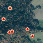
Zu diesen Punkten liegen Informationen zu Hang- bzw. Massenbewegungen vor. Es kann sich um aktive, um potentielle oder aber auch um schon lange abgeschlossene Vorgänge handeln.
Simple
- Date (Publication)
- 2004-10-11
- Citation identifier
- https://registry.gdi-de.org/id/de.by/DEBY_fc4809dd-1aa3-4d66-a52a-0fc3c61cb8f9
- Status
- On going
- Point of contact
-
Organisation name Individual name Electronic mail address Role Bayerisches Landesamt für Umwelt
Datenstelle
datenstelle@lfu.bay datenstelle@lfu.bayern.de
Point of contact
- Maintenance and update frequency
- Monthly
- Theme
-
-
Hangbewegungen
-
Georisiken
-
Rutschung
-
Hangrutschung
-
Steinschlag
-
Blockschlag
-
Felssturz
-
Bergsturz
-
Erdfall
-
Doline
-
-
Spatial scope
-
-
Regional
-
-
GEMET - INSPIRE themes, version 1.0
-
-
Gebiete mit naturbedingten Risiken
-
- Keywords
-
-
opendata
-
gdiby
-
inspireidentifiziert
-
- Use limitation
-
keine Einschränkungen
- Use constraints
- Other restrictions
- Other constraints
-
Der Datensatz/Dienst steht unter der Lizenz: Creative Commons Namensnennung 4.0 International (CC BY 4.0). Die Namensnennung des Bayerischen Landesamtes für Umwelt als Rechteinhaber hat in folgender Weise zu erfolgen: "Datenquelle: Bayerisches Landesamt für Umwelt, www.lfu.bayern.de". Die Nutzung von Daten über Dienste ist geldleistungsfrei. Bei Bezug von Daten über die Datenstelle des LfU (nur Daten, die nicht über Dienste verfügbar sind) wird eine Bereitstellungsgebühr erhoben, die sich an der Umweltgebührenordnung orientiert.
- Other constraints
-
{ "id": "cc-by", "name": "Creative Commons Namensnennung (CC BY)", "quelle": "Datenquelle: Bayerisches Landesamt für Umwelt, www.lfu.bayern.de", "url": " http://creativecommons.org/licenses/by/3.0/deed.de" }
- Access constraints
- Other restrictions
- Other constraints
- Es gelten keine Zugriffsbeschränkungen
- Classification
- Unclassified
- Spatial representation type
- Vector
- Denominator
- 10000
- Language
- Deutsch
- Topic category
-
- Geoscientific information
- Environment
- Description
-
Daten aus ganz Bayern
))
- Unique resource identifier
- EPSG:25832
- Version
-
7.9
- Topology level
- Geometry only
- Geometric object type
- Point
- Geometric object count
- 2185
- Distribution format
-
Name Version Shapefile (*.shp)
keine Angabe
Oracle Spatial Tabelle
11.x
Distributor
- Distributor contact
-
Organisation name Individual name Electronic mail address Role Bayerisches Landesamt für Umwelt
Datenstelle
datenstelle@lfu.bay datenstelle@lfu.bayern.de
Point of contact
- Fees
-
geldleistungsfrei
- OnLine resource
-
Protocol Linkage Name https://www.lfu.bayern.de/geologie/massenbewegungen/georisk/index.htm Informationsseite
https://www.lfu.bayern.de/umweltdaten/geodatendienste/index.htm Daten in Darstellungs- und Downloaddiensten
https://www.umweltatlas.bayern.de Daten im UmweltAtlas Bayern
- Hierarchy level
- Dataset
Conformance result
- Date (Publication)
- 2013-12-10
- Explanation
-
Es besteht keine Konformität zur Datenspezifikation.
- Pass
- No
Conformance result
- Date (Publication)
- 2010-12-08
- Explanation
-
Datenmodelltransformation noch nicht durchgeführt.
- Pass
- No
- Statement
-
Datenquelle: BAYERISCHES LANDESAMT FÜR UMWELT
Metadata
- File identifier
- fc4809dd-1aa3-4d66-a52a-0fc3c61cb8f9 XML
- Metadata language
- Deutsch
- Character set
- UTF8
- Hierarchy level
- Dataset
- Hierarchy level name
-
GEORISK-Objekte
- Date stamp
- 2022-10-26T06:58:56+01:00
- Metadata standard name
-
ISO 19115
- Metadata standard version
-
2003
- Metadata author
-
Organisation name Individual name Electronic mail address Role Bayerisches Landesamt für Umwelt
Datenstelle
datenstelle@lfu.bay datenstelle@lfu.bayern.de
Point of contact
Overviews
Spatial extent
Provided by
