 INSPIRE Geoportal
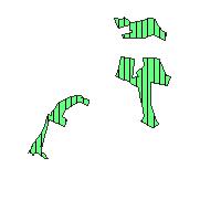
LAPRO2009_Wald_Landwirtschaft - LAPRO2009 - Pionierwald der Sukzession überlassen - großflächig
Der Kartendienst (WMS-Gruppe) stellt die Geodaten aus dem Landschaftsprogramm Saarland die Themenkarte Wald und Landwirtschaft dar.:Im Landschaftsprogramm Saarland werden Gehölzsukzessionen, die als Pionierwälder weiter der Sukzession überlassen bleiben sollen, dargestellt. Die Darstellung erfolgt in zwei Kategorien. Flächen unter 7,5ha Größe werden über eine Punktsignatur dargestellt und über 7,5 ha Größe als Fläche. Pionierwälder sind nicht im Waldlayer des Landschaftsprogramms enthalten.
Simple
Identification info
- Date (Revision)
- 2023-04-20
- Point of contact
-
Organisation name Individual name Electronic mail address Role Ministerium für Umwelt, Klima, Mobilität, Agrar und Verbraucherschutz
Geodatenzentrum@umwelt.saa Geodatenzentrum@umwelt.saarland.de
Publisher
- Keywords
-
-
Landschaftsprogramm 2009
-
infoMapAccessService
-
inspireidentifiziert
-
inspireidentifiziert
-
natur_landschaft
-
- Access constraints
- Other restrictions
- Other constraints
- INSPIRE: Keine Beschränkungen des öffentlichen Zugangs: Es existieren keine Beschränkungen des öffentlichen Zugangs zu Daten und Diensten
- Use constraints
- Other restrictions
- Other constraints
- Es gelten keine Bedingungen
- Service Type
- view
- Service Version
-
OGC:WMS 1.1.1
))
- Coupling Type
- Tight
- Contains Operations
-
Operation Name Distributed Computing Platforms Connect Point GetCapabilities
Web services https://geoportal.saarland.de/mapbender/php/wms.php?inspire=1&layer_id=37481&withChilds=1&REQUEST=GetCapabilities&SERVICE=WMS
- Distribution format
-
Name Version
- OnLine resource
-
Protocol Linkage Name OGC:WMS-1.1.1-http-get-map
https://geoportal.saarland.de/mapbender/php/wms.php?inspire=1&layer_id=37481&withChilds=1&REQUEST=GetCapabilities&SERVICE=WMS Pionierwald_Sukzession_ueberlassen_grfl
- Hierarchy level
- Service
- Other
-
Dienst
Conformance result
- Date (Publication)
- 2010-12-08
- Explanation
-
No explanation available
- Pass
- Yes
Conformance result
- Date (Publication)
- 2009-10-20
- Explanation
-
No explanation available
- Pass
- Yes
Conformance result
- Date (Publication)
- 2014-12-11
- Explanation
-
No explanation available
- Pass
- Yes
Conformance result
- Date (Publication)
- 2008-12-04
- Explanation
-
No explanation available
- Pass
- Yes
Conformance result
- Date (Publication)
- 2014-12-11
- Explanation
-
No explanation available
- Pass
- Yes
Conformance result
- Date (Publication)
- 2013-12-10
- Explanation
-
No explanation available
- Pass
- Yes
Conformance result
- Date (Publication)
- 2011-02-05
- Explanation
-
No explanation available
- Pass
- Yes
Conformance result
- Date (Publication)
- 2010-12-08
- Explanation
-
No explanation available
- Pass
- Yes
Metadata
- File identifier
- ff78e488-3c14-3539-63b9-0aceba5ca827 XML
- Metadata language
- Deutsch
- Character set
- UTF8
- Hierarchy level
- Service
- Hierarchy level name
-
Darstellungsdienst
- Date stamp
- 2023-04-20
- Metadata standard name
-
ISO19119
- Metadata standard version
-
2005/PDAM 1
- Metadata author
-
Organisation name Individual name Electronic mail address Role GDI-Saarland
gdi-sl@lvgl.saarland.de sl@lvgl.saa gdi-sl@lvgl.saarland.de
Point of contact
Overviews
Spatial extent
Provided by
