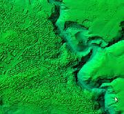
Modello Digitale della Superficie (DSM) risoluzione 5m
Modello Digitale della Superficie (DSM) risoluzione 5m
Simple
- Date (Publication)
- 2016-06-22
- Citation identifier
- https://geodati.gov.it/resource/id/r_basili:28FFB196-1EAA-49B4-769D-78C030B75042
- Cited responsible party
-
Organisation name Individual name Electronic mail address Role Regione Basilicata
vincenzo.loisi@regione.bas vincenzo.loisi@regione.basilicata.it
Owner
- Presentation form
- Digital map
- Issue identification
-
r_basili:28FFB196-1EAA-49B4-769D-78C030B75042
- Other citation details
-
Anno di rilievo: 2013
- Point of contact
-
Organisation name Individual name Electronic mail address Role Regione Basilicata - Centro cartografico dipartimentale della Direzione Generale del Dipartimento Ambiente e Territorio. - via V. Verrastro 5, POTENZA (PZ) 85100
vincenzo.loisi@regione.bas vincenzo.loisi@regione.basilicata.it
Point of contact
- Maintenance and update frequency
- Not planned
- Keywords
-
-
DSM
-
Modello Digitale della Superficie
-
Quota
-
Orografia
-
opendata
-
EU
-
-
Spatial scope
-
GEMET - INSPIRE themes, version 1.0
- Use limitation
-
Nessuna Limitazione
- Access constraints
- Other restrictions
- Other constraints
- noLimitations
- Access constraints
- Other restrictions
- Other constraints
-
Licenza IODL 2.0 - link: https://www.dati.gov.it/content/italian-open-data-license-v20
- Classification
- Unclassified
- Spatial representation type
- Grid
- Distance
- 5 http://standards.iso.org/ittf/PubliclyAvailableStandards/ISO_19139_Schemas/resources/uom/gmxUom.xml#m
- Language
- Italiano
- Character set
- UTF8
- Topic category
-
- Elevation
- Imagery base maps earth cover
))
Vertical extent
- Minimum value
- 0.0
- Maximum value
- 2267.0
- Supplemental Information
-
Link Applicazione per visualizzazione e download:
http://rsdi.regione.basilicata.it/viewGis/?project=CCBB2CC7-4D39-B4B4-3A07-72E3DE7F0443
- Unique resource identifier
- ETRS89/UTM-zone33N
- Number of dimensions
- 3
- Dimension name
- Column
- Dimension size
- 26810
- Resolution
- 5 http://standards.iso.org/ittf/PubliclyAvailableStandards/ISO_19139_Schemas/resources/uom/gmxUom.xml#m
- Dimension name
- Row
- Dimension size
- 28820
- Resolution
- 5 http://standards.iso.org/ittf/PubliclyAvailableStandards/ISO_19139_Schemas/resources/uom/gmxUom.xml#m
- Dimension name
- Vertical
- Dimension size
- 2267
- Resolution
- 1 http://standards.iso.org/ittf/PubliclyAvailableStandards/ISO_19139_Schemas/resources/uom/gmxUom.xml#m
- Cell geometry
- Area
- Transformation parameter availability
- No
- Checkpoint Availability
- No
- Point in Pixel
-
- Center
- Distribution format
-
Name Version x-ascii-grid N.D.
- Distributor contact
-
Organisation name Individual name Electronic mail address Role Regione Basilicata - Centro cartografico dipartimentale della Direzione Generale del Dipartimento Ambiente e Territorio. - via V. Verrastro 5, POTENZA (PZ) 85100
vincenzo.loisi@regione.bas vincenzo.loisi@regione.basilicata.it
Distributor
- OnLine resource
-
Protocol Linkage Name Web Map Service http://rsdi.regione.basilicata.it/rbgeoserver2016/maps_dsm/EL.ElevationGridCoverage/wms?service=wms&version=1.3.0&request=GetCapabilities Servizio WMS (GetCapabilities)
- Hierarchy level
- Dataset
Quantitative result
- Value
- 5.0
Conformance result
- Date (Publication)
- 2010-12-08
- Explanation
-
Fare riferimento alle specifiche indicate
- Statement
-
Il DSM è stato elaborato considerando i punti Ground, Low Vegetation, Medium Vegetation, High Vegetation, Building e Model Keypoint dai quali è stato creato un lattice model al passo definito in capitolato (5m).
- Attribute description
- Quota s.l.m. in metri della superficie.
- Content type
- Physical measurement
- Triangulation indicator
- No
Metadata
- File identifier
- r_basili:28FFB196-1EAA-49B4-769D-78C030B75042 XML
- Metadata language
- Italiano
- Character set
- UTF8
- Parent identifier
-
Modello Digitale della Superficie (DSM) risoluzione 5m
r_basili:28FFB196-1EAA-49B4-769D-78C030B75042
- Hierarchy level
- Dataset
- Date stamp
- 2016-06-22
- Metadata standard name
- Linee Guida RNDT
- Metadata standard version
-
2.0
- Metadata author
-
Organisation name Individual name Electronic mail address Role Regione Basilicata - Centro cartografico dipartimentale della Direzione Generale del Dipartimento Ambiente e Territorio. - Via V. Verrastro 5, POTENZA (PZ) 85100, POTENZA (PZ) 85100
vincenzo.loisi@regione.bas vincenzo.loisi@regione.basilicata.it
Point of contact
Overviews

Spatial extent
))
Provided by

 INSPIRE Geoportal