 INSPIRE Geoportal
Rete geodetica di Raffittimento - RER GPS7 ETRF00
Strato vettoriale costituito dalla realizzazione ETRF2000 (2008) del Sistema di riferimento geodetico europeo ETRS89, ottenuta dall'IGM nel Marzo 2012 con ricalcolo della rete GPS7 ETRF89 rilevata con metodo GPS secondo relativo capitolato.
Simple
- Date (Publication)
- 2010-01-01
- Citation identifier
- r_emiro:2013-05-06T160659
- Cited responsible party
-
Organisation name Individual name Electronic mail address Role Regione Emilia-Romagna
Regione Emilia-Romagna
n.d.
Owner Regione Emilia-Romagna
Regione Emilia-Romagna
n.d.
Publisher Regione Emilia-Romagna
Servizio Statistica e Sistemi informativi geografici
Serviziostatistica@regione.emi Serviziostatistica@regione.emilia-romagna.it
Author
- Presentation form
- Digital map
- Issue identification
-
r_emiro:2013-05-06T160659
- Purpose
-
Rete di raffittimento primario dei vertici d'inquadramento, che potrà consentire di determinare successivamente tutti i punti di raffittimento d'interesse tecnico e catastale.
- Point of contact
-
Organisation name Individual name Electronic mail address Role Regione Emilia-Romagna
Servizio Statistica e Sistemi informativi geografici
Serviziostatistica@regione.emi Serviziostatistica@regione.emilia-romagna.it
Point of contact
-
GEMET - Concepts, version 3.1
-
-
sistema informativo geografico
-
cartografia
-
-
Regione
-
-
open data
-
EU
-
Regionale
-
reti geodetiche
-
topografia
-
vertice di raffittimento
-
-
GEMET - INSPIRE themes, version 1.0
-
-
Sistemi di griglie geografiche
-
- Use limitation
-
CC BY 3.0 (Creative Commons - Attribuzione) https://creativecommons.org/licenses/by/3.0/legalcode.it
- Use limitation
-
Dato pubblico (cfr. art. 1 Codice Amministrazione Digitale)
- Access constraints
- Other restrictions
- Other constraints
- Accesso pubblico limitato in accordo all Articolo 13(1)(e) della Direttiva INSPIRE
- Use constraints
- Other restrictions
- Other constraints
- CC BY 3.0 (Creative Commons - Attribuzione)
- Classification
- Unclassified
- Spatial representation type
- Vector
- Distance
- 4 cm
- Language
- Italiano
- Character set
- UTF8
- Topic category
-
- Imagery base maps earth cover
- Description
-
Intero territorio della Regione Emilia-Romagna
))
- Geographic identifier
- X3001
- Begin date
- 2003-01-01
- End date
- 2012-12-31
- Reference system identifier
- http://www.epsg-registry.org/export.htm?gml=urn:ogc:def:crs:EPSG::4326 / WGS84
- Reference system identifier
- http://www.epsg-registry.org/export.htm?gml=urn:ogc:def:crs:EPSG::4258 / ETRS89
- Reference system identifier
- http://www.epsg-registry.org/export.htm?gml=urn:ogc:def:crs:EPSG::3004 / ROMA40/EST
- Reference system identifier
- http://www.epsg-registry.org/export.htm?gml=urn:ogc:def:crs:EPSG::3003 / ROMA40/OVEST
- Reference system identifier
- http://www.epsg-registry.org/export.htm?gml=urn:ogc:def:crs:EPSG::32632 / WGS84/UTM 32N
- Reference system identifier
- http://www.epsg-registry.org/export.htm?gml=urn:ogc:def:crs:EPSG::32633 / WGS84/UTM 33N
- Reference system identifier
- http://www.epsg-registry.org/export.htm?gml=urn:ogc:def:crs:EPSG::4265 / ROMA40
- Reference system identifier
- ETRF00
- Reference system identifier
- http://www.epsg-registry.org/export.htm?gml=urn:ogc:def:crs:EPSG::25832 / ETRS89/UTM-ZONE32N
- Reference system identifier
- http://www.epsg-registry.org/export.htm?gml=urn:ogc:def:crs:EPSG::25833 / ETRS89/UTM-ZONE33N
- Distribution format
-
Name Version SHP
Ver1000
Vettoriale
Ver1000
WMS
1.3.0
Distributor
- Distributor contact
-
Organisation name Individual name Electronic mail address Role Regione Emilia-Romagna
Servizio Statistica e Sistemi informativi geografici
Serviziostatistica@regione.emi Serviziostatistica@regione.emilia-romagna.it
Distributor
- Fees
-
Non in vendita
- OnLine resource
- Hierarchy level
- Dataset
Quantitative result
- Value
- 0.04
Domain consistency
Conformance result
- Date (Publication)
- 2010-12-08
- Explanation
-
REGOLAMENTO (UE) N. 1089/2010 DELLA COMMISSIONE del 23 novembre 2010 recante attuazione della direttiva 2007/2/CE del Parlamento europeo e del Consiglio per quanto riguarda l'interoperabilità dei set di dati territoriali e dei servizi di dati territoriali
- Pass
- No
Conformance result
- Date (Publication)
- 2001-01-01
- Explanation
-
Le specifiche tecniche prendono in considerazione sia le istanze dei vari settori della P.A. sia le evoluzioni tecnologiche in atto. Il raffittimento della rete fondamentrale IGM95 prevede l'inserimento anche dei punti di nuova istituzione omogeneamente distribuiti sul territorio. La rete di raffittimento costituisce una struttura autonoma.
- Pass
- Yes
- Statement
-
Lo strato puntuale è ricavato a partire dalle coordinate ETRS89 dei vertici della rete, che sono stati rilevati calcolati e collaudati secondo le modalità previste dai capitolati. Lo strato è poi convertito in altri sistemi di riferimento tramite grigliati verto IGM.
Metadata
- File identifier
- r_emiro:2013-05-06T160659 XML
- Metadata language
- Italiano
- Character set
- UTF8
- Hierarchy level
- Dataset
- Date stamp
- 2020-02-06
- Metadata standard name
-
Linee Guida RNDT
- Metadata standard version
-
2.0
- Metadata author
-
Organisation name Individual name Electronic mail address Role Servizio Statistica e Sistemi informativi geografici - Regione Emilia-Romagna
Stefano Olivucci
solivucci@regione.emi solivucci@regione.emilia-romagna.it
Point of contact
Overviews
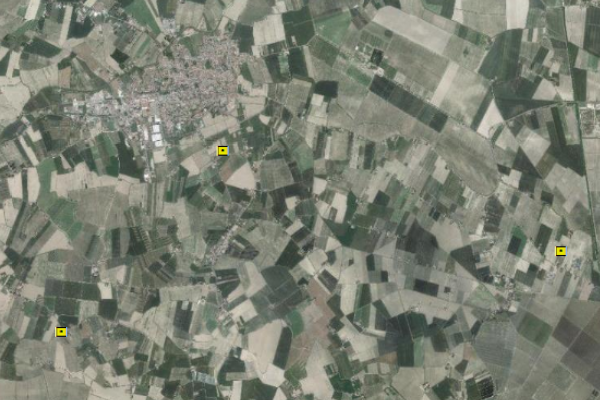
Spatial extent
Provided by
