 INSPIRE Geoportal
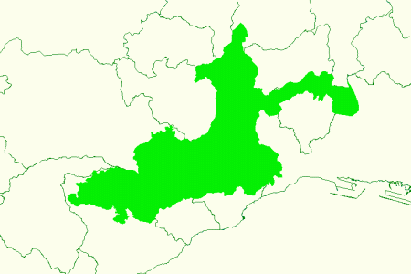
Zone a Protezione Speciale (ZPS) - DGR n.650/2012
LE ZONE A PROTEZIONE SPECIALE ZPS SONO STATE REALIZZATE AI SENSI DELLA DIRETTIVA N. 79/409/CEE 'UCCELLI'. LA BASE DATI È CONFORME ALLE SPECIFICHE DELLA DIRETTIVA INSPIRE 2007/2/CE DEL 14/03/2007.
Simple
- Date (Revision)
- 2012-01-01
- Citation identifier
- https://geoportal.regione.liguria.it / r_liguri:D.1572
- Cited responsible party
-
Organisation name Individual name Electronic mail address Role Regione Liguria
Federico.Marenco@regione.lig Federico.Marenco@regione.liguria.it
Owner Regione Liguria - Politiche della natura e delle aree interne, protette e marine, parchi e biodiversità - Vice direzione generale agricoltura, risorse naturali, aree protette e interne
Federico.Marenco@regione.lig Federico.Marenco@regione.liguria.it
Author
- Presentation form
- Digital map
- Issue identification
-
r_liguri:D.1572
- Point of contact
-
Organisation name Individual name Electronic mail address Role Regione Liguria - Sportello cartografico
infoter@regione.lig infoter@regione.liguria.it
Point of contact
-
GEMET - INSPIRE themes, version 1.0
- Keywords
-
-
CARTE TEMATICHE
-
AMBIENTE
-
open data
-
EU
-
- Access constraints
- Other restrictions
- Other constraints
- Nessuna limitazione al pubblico accesso
- Use constraints
- Other restrictions
- Other constraints
- Creative Commons Attribuzione 4.0 Internazionale (CC BY 4.0)
- Classification
- Unclassified
- Spatial representation type
- Vector
- Denominator
- 10000
- Language
- Italiano
- Character set
- UTF8
- Topic category
-
- Environment
))
- Unique resource identifier
- Monte-Mario-Italy1
- Distribution format
-
Name Version KML
n.d.
Mapinfo
n.d.
GeoPackage
n.d.
GML versione 2
n.d.
Shapefile
n.d.
GML versione 3
n.d.
- Distributor contact
-
Organisation name Individual name Electronic mail address Role Regione Liguria - Sportello cartografico
infoter@regione.lig infoter@regione.liguria.it
Distributor
- OnLine resource
-
Protocol Linkage Name Web Map Service (WMS) https://geoservizi.regione.liguria.it/geoserver/M1572/wms?version=1.3.0&request=getcapabilities
- OnLine resource
-
Protocol Linkage Name WWW:DOWNLOAD-1.0-http--download https://srvcarto.regione.liguria.it/geoservices/apps/viewer/pages/apps/download/index.html?id=1572
- OnLine resource
-
Protocol Linkage Name Web Feature Service (WFS) https://geoservizi.regione.liguria.it/geoserver/M1572/wfs?version=2.0.0&request=getcapabilities
- Hierarchy level
- Dataset
Quantitative result
- Value
- 2
Conformance result
- Date (Publication)
- 2010-12-08
- Explanation
-
Fare riferimento alle specifiche indicate
- Pass
- No
- Statement
-
Digitalizzazione da fotografie aeree, carte tematiche preesistenti e bibliografia scientifica.
Metadata
- File identifier
- r_liguri:D.1572 XML
- Metadata language
- Italiano
- Character set
- UTF8
- Hierarchy level
- Dataset
- Date stamp
- 2022-05-19
- Metadata standard name
-
Linee guida RNDT
- Metadata standard version
-
2.0
- Metadata author
-
Organisation name Individual name Electronic mail address Role Regione Liguria - Sportello Cartografico
infoter@regione.lig infoter@regione.liguria.it
Point of contact
Overviews
Spatial extent
Provided by
