 INSPIRE Geoportal
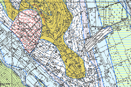
Carta Geologica Regionale (CGR) sc. 1:10000 riferita al Foglio 212 Spigno Monferrato - sc. 1:50000
Le Carte Geologiche Regionali rappresentano le caratteristiche delle formazioni geologiche e l'evoluzione geomorfologica del territorio. I fogli pubblicati sono: 212040 Lago di Ortiglieto, 212050 Case Cornareto, 212060 Monte Acuto, 212070 Pian Castagna, 212080 Tiglieto, 212090 Mioglia, 212100 Sassello, 212110 Palo, 212120 Urbe, 212130 Giusvalla, 212140 Pontinvrea, 212150 Monte Beigua e 212160 Lerca.
Simple
- Date (Revision)
- 2012-01-01
- Citation identifier
- https://geoportal.regione.liguria.it / r_liguri:D.1575
- Cited responsible party
-
Organisation name Individual name Electronic mail address Role Regione Liguria
assetto.territorio@regione.lig assetto.territorio@regione.liguria.it
Owner Regione Liguria - SETTORE ASSETTO DEL TERRITORIO - Dipartimento Ambiente e Protezione civile
assetto.territorio@regione.lig assetto.territorio@regione.liguria.it
Author
- Presentation form
- Digital map
- Issue identification
-
r_liguri:D.1575
- Point of contact
-
Organisation name Individual name Electronic mail address Role Regione Liguria - Sportello cartografico
infoter@regione.lig infoter@regione.liguria.it
Point of contact
-
GEMET - INSPIRE themes, version 1.0
- Keywords
-
-
CARTE TEMATICHE
-
INFORMAZIONI GEOSCIENTIFICHE
-
open data
-
EU
-
- Access constraints
- Other restrictions
- Other constraints
- Nessuna limitazione al pubblico accesso
- Use constraints
- Other restrictions
- Other constraints
- Creative Commons Attribuzione 4.0 Internazionale (CC BY 4.0)
- Classification
- Unclassified
- Spatial representation type
- Grid
- Denominator
- 10000
- Language
- Italiano
- Character set
- UTF8
- Topic category
-
- Geoscientific information
))
- Supplemental Information
-
Vedi documentazione all'indirizzo: https://srvcarto.regione.liguria.it/repertoriocartografico/documentazione/DOC_CGR10_212.pdf
- Unique resource identifier
- Monte-Mario-Italy1
- Number of dimensions
- 2
- Dimension name
- Row
- Dimension size
- 9879
- Dimension name
- Column
- Dimension size
- 7850
- Cell geometry
- Area
- Transformation parameter availability
- No
- Checkpoint Availability
- No
- Point in Pixel
-
- Upper left
- Distribution format
-
Name Version GeoTIFF
n.d.
- Distributor contact
-
Organisation name Individual name Electronic mail address Role Regione Liguria - Sportello cartografico
infoter@regione.lig infoter@regione.liguria.it
Distributor
- OnLine resource
-
Protocol Linkage Name Web Map Service (WMS) https://geoservizi.regione.liguria.it/geoserver/M1575/wms?version=1.3.0&request=getcapabilities
- OnLine resource
-
Protocol Linkage Name WWW:DOWNLOAD-1.0-http--download https://srvcarto.regione.liguria.it/geoservices/apps/viewer/pages/apps/download/index.html?id=1575
- OnLine resource
-
Protocol Linkage Name Web Coverage Service (WCS) https://geoservizi.regione.liguria.it/geoserver/M1575/wcs?version=1.1.1&request=getcapabilities
- Hierarchy level
- Dataset
Quantitative result
- Value
- 2
Conformance result
- Date (Publication)
- 2010-12-08
- Explanation
-
Fare riferimento alle specifiche indicate
- Pass
- No
- Statement
-
Rilevamento geologico scala 1:10000
- Attribute description
- valore di RGB della mappa tematica
- Content type
- Thematic classification
Metadata
- File identifier
- r_liguri:D.1575 XML
- Metadata language
- Italiano
- Character set
- UTF8
- Hierarchy level
- Dataset
- Date stamp
- 2022-05-19
- Metadata standard name
-
Linee guida RNDT
- Metadata standard version
-
2.0
- Metadata author
-
Organisation name Individual name Electronic mail address Role Regione Liguria - Sportello Cartografico
infoter@regione.lig infoter@regione.liguria.it
Point of contact
Overviews
Spatial extent
Provided by
