 INSPIRE Geoportal
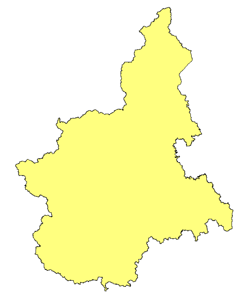
Ambiti amministrativi - Area regionale
Perimetrazione dell'area regionale, ottenuta per accorpamento delle aree comunali di fonte ISTAT 2011, alla scala 1:10.000.
Simple
- Date (Creation)
- 2012-01-01
- Citation identifier
- r_piemon:0c65110b-a9bb-4572-a14f-dbdca1d2becd
- Cited responsible party
-
Organisation name Individual name Electronic mail address Role Regione Piemonte - A1613B - Sistema informativo territoriale e ambientale
cartografico@regione.pie cartografico@regione.piemonte.it
Custodian Regione Piemonte
info-geoportale@regione.piemonte.it geoportale@regione.pie info-geoportale@regione.piemonte.it
Owner
- Presentation form
- Digital map
- Issue identification
-
r_piemon:0c65110b-a9bb-4572-a14f-dbdca1d2becd
- Point of contact
-
Organisation name Individual name Electronic mail address Role Regione Piemonte - A1613B - Sistema informativo territoriale e ambientale
cartografico@regione.pie cartografico@regione.piemonte.it
Point of contact
- Maintenance and update frequency
- As needed
- Keywords
-
-
limiti
-
-
GEMET- Concepts version 2.4
-
-
regione
-
- Keywords
-
-
RNDT
-
- Keywords
-
-
EU
-
- Keywords
-
-
opendata
-
-
Spatial scope
-
-
Regionale
-
- Access constraints
- Other restrictions
- Other constraints
- no limitations to public access
- Use constraints
- Other restrictions
- Other constraints
- Spatial representation type
- Vector
- Denominator
- 10000
- Language
- Italiano
- Character set
- UTF8
- Topic category
-
- Boundaries
))
- Unique resource identifier
- WGS84/UTM 32N
- Distribution format
-
Name Version ESRI Shape
N.A.
- Distributor contact
-
Organisation name Individual name Electronic mail address Role Regione Piemonte - A1613B - Sistema informativo territoriale e ambientale
cartografico@regione.pie cartografico@regione.piemonte.it
Distributor
- OnLine resource
- Hierarchy level
- Dataset
Conformance result
- Date (Publication)
- 2010-12-08
- Explanation
-
Fare riferimento alle specifiche indicate
Quantitative result
- Value
- 4
- Statement
-
- scarico del dato ISTAT "Confini amministrativi dei Comuni al 1° gennaio 2011", non generalizzato, nel sistema di riferimento ED50UTM 32N- conversione nel sistema di riferimento WGS84UTM 32N mediante grigliati IGM- fusione dei poligoni comunali a formare l'area regionale
Metadata
- File identifier
- r_piemon:0c65110b-a9bb-4572-a14f-dbdca1d2becd XML
- Metadata language
- Italiano
- Character set
- UTF8
- Hierarchy level
- Dataset
- Date stamp
- 2022-05-19
- Metadata standard name
-
Linee Guida RNDT
- Metadata standard version
-
2.0
- Metadata author
-
Organisation name Individual name Electronic mail address Role CSI Piemonte
info-geoportale@regione.piemonte.it geoportale@regione.pie info-geoportale@regione.piemonte.it
Point of contact
Overviews

Spatial extent
Provided by
