 INSPIRE Geoportal
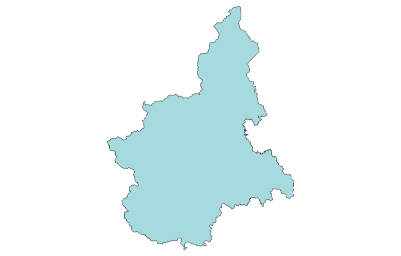
Limiti amministrativi 1:100.000 - Area regionale - Storico
Perimetrazione dell'area regionale, ottenuta per accorpamento delle aree provinciali e comprensiva di due isole appartenenti alla Lombardia (in Provincia di Alessandria), sulla base della Carta topografica di Italia I.G.M.I serie 100/L con successivi aggiornamenti secondo le disposizioni amministrative vigenti.
Simple
- Date (Revision)
- 2004-07-28
- Date (Creation)
- 1960-01-01
- Citation identifier
- r_piemon:0d6fcd00-e6fe-44db-bd5d-1185e7f2ee57
- Cited responsible party
-
Organisation name Individual name Electronic mail address Role Regione Piemonte - A1613B - Sistema informativo territoriale e ambientale
cartografico@regione.pie cartografico@regione.piemonte.it
Custodian Regione Piemonte
info-geoportale@regione.piemonte.it geoportale@regione.pie info-geoportale@regione.piemonte.it
Owner
- Presentation form
- Digital map
- Issue identification
-
r_piemon:0d6fcd00-e6fe-44db-bd5d-1185e7f2ee57
- Point of contact
-
Organisation name Individual name Electronic mail address Role Regione Piemonte - A1613B - Sistema informativo territoriale e ambientale
cartografico@regione.pie cartografico@regione.piemonte.it
Point of contact
- Maintenance and update frequency
- As needed
- Keywords
-
-
RNDT
-
- Keywords
-
-
EU
-
- Keywords
-
-
storico
-
opendata
-
limiti
-
-
Spatial scope
-
-
Regionale
-
- Access constraints
- Other restrictions
- Other constraints
- no limitations to public access
- Use constraints
- Other restrictions
- Other constraints
- Spatial representation type
- Vector
- Denominator
- 100000
- Language
- Italiano
- Character set
- UTF8
- Topic category
-
- Boundaries
))
- Unique resource identifier
- WGS84/UTM 32N
- Distribution format
-
Name Version ESRI Shape
N.A.
- Distributor contact
-
Organisation name Individual name Electronic mail address Role Regione Piemonte - A1613B - Sistema informativo territoriale e ambientale
cartografico@regione.pie cartografico@regione.piemonte.it
Distributor
- OnLine resource
-
Protocol Linkage Name WWW:DOWNLOAD-1.0-http--download https://www.datigeo-piem-download.it/direct/Geoportale/RegionePiemonte/Limiti_amministrativi/Regione100_STORICO.zip
- Hierarchy level
- Dataset
Conformance result
- Date (Publication)
- 2010-12-08
- Explanation
-
Fare riferimento alle specifiche indicate
Quantitative result
- Value
- 40
- Statement
-
- Acquisizione da cartografia IGM e compensazione tra fogli (Regione Piemonte) 1981 - 1982 - Aggregazioni a livello superiore (Regione, Province, Asl, Comunita' montane) - CSI Piemonte
Metadata
- File identifier
- r_piemon:0d6fcd00-e6fe-44db-bd5d-1185e7f2ee57 XML
- Metadata language
- Italiano
- Character set
- UTF8
- Hierarchy level
- Dataset
- Date stamp
- 2022-05-19
- Metadata standard name
-
Linee Guida RNDT
- Metadata standard version
-
2.0
- Metadata author
-
Organisation name Individual name Electronic mail address Role CSI Piemonte
info-geoportale@regione.piemonte.it geoportale@regione.pie info-geoportale@regione.piemonte.it
Point of contact
Overviews

Spatial extent
Provided by
