 INSPIRE Geoportal
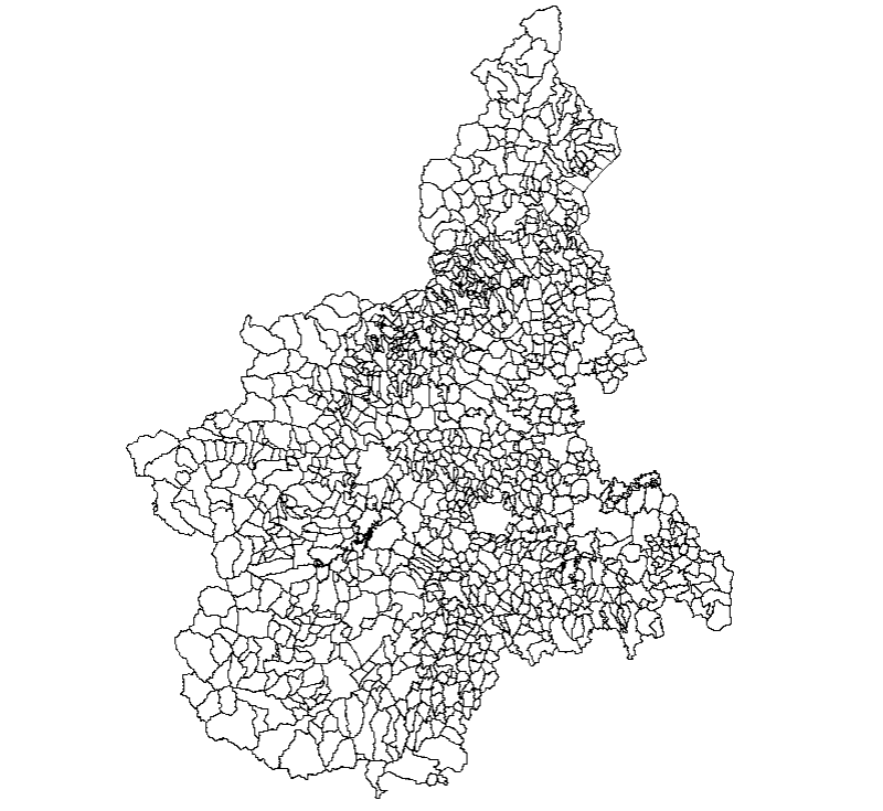
Ambiti amministrativi - Comuni Census 2000 (STORICO)
Aggregazioni delle sezioni di censimento appartenenti ad uno stesso comune secondo le ridefinizioni di Census 2000 in occasione del Censimento generale 2000-2001.
Simple
- Date (Revision)
- 2001-01-01
- Date (Creation)
- 1991-01-01
- Citation identifier
- r_piemon:19e1642f-a4ca-4231-8193-f1a777d6ede0
- Cited responsible party
-
Organisation name Individual name Electronic mail address Role Regione Piemonte - A1613B - Sistema informativo territoriale e ambientale
cartografico@regione.pie cartografico@regione.piemonte.it
Custodian Regione Piemonte
info-geoportale@regione.piemonte.it geoportale@regione.pie info-geoportale@regione.piemonte.it
Owner
- Presentation form
- Digital map
- Issue identification
-
r_piemon:19e1642f-a4ca-4231-8193-f1a777d6ede0
- Point of contact
-
Organisation name Individual name Electronic mail address Role Regione Piemonte - A1613B - Sistema informativo territoriale e ambientale
cartografico@regione.pie cartografico@regione.piemonte.it
Point of contact
- Maintenance and update frequency
- Not planned
- Keywords
-
-
RNDT
-
- Keywords
-
-
EU
-
- Keywords
-
-
limiti
-
comuni
-
- GEMET - Concepts, version 2.4
-
-
census
-
censimento
-
- Keywords
-
-
opendata
-
- Keywords
-
-
storico
-
- Keywords
-
-
regione
-
- Keywords
-
-
provincia
-
- Keywords
-
-
sezione
-
-
Spatial scope
-
-
Regionale
-
- Access constraints
- Other restrictions
- Other constraints
- no limitations to public access
- Use constraints
- Other restrictions
- Other constraints
- Spatial representation type
- Vector
- Denominator
- 10000
- Language
- Italiano
- Character set
- UTF8
- Topic category
-
- Boundaries
- Begin date
- 1991-01-01
- End date
- 2001-01-01
))
- Supplemental Information
-
"Census 2000" è il progetto ISTAT relativo al Censimento generale dell’agricoltura, dell’industria e della popolazione per gli anni 2000-2001.In quell'occasione sono stati adottati nuovi criteri per il disegno delle sezioni di censimento, che hanno portato:- miglioramento della cartografica di riferimento (dalla scala 1:25000 alla Carta Tecnica Regionale 1:10000);- congruenza con i fogli di mappa catastale nel territorio extraurbano.Rielaborazione da dati ISTAT.
- Unique resource identifier
- WGS84/UTM 32N
- Distribution format
-
Name Version ESRI Shape
N.A.
- Distributor contact
-
Organisation name Individual name Electronic mail address Role Regione Piemonte - A1613B - Sistema informativo territoriale e ambientale
cartografico@regione.pie cartografico@regione.piemonte.it
Distributor
- OnLine resource
-
Protocol Linkage Name WWW:DOWNLOAD-1.0-http--download https://www.datigeo-piem-download.it/direct/Geoportale/RegionePiemonte/Limiti_amministrativi/COMUNI_CENSUS.zip
- Hierarchy level
- Dataset
Conformance result
- Date (Publication)
- 2010-12-08
- Explanation
-
Fare riferimento alle specifiche indicate
Quantitative result
- Value
- 4
- Statement
-
Revisione delle sezioni di censimento Istat 1991, ridisegnate su base topografica CTR 1:10000 e dati da satellite, sulla base di accordi intercomunali
Metadata
- File identifier
- r_piemon:19e1642f-a4ca-4231-8193-f1a777d6ede0 XML
- Metadata language
- Italiano
- Character set
- UTF8
- Hierarchy level
- Dataset
- Date stamp
- 2022-05-19
- Metadata standard name
-
Linee Guida RNDT
- Metadata standard version
-
2.0
- Metadata author
-
Organisation name Individual name Electronic mail address Role CSI Piemonte
info-geoportale@regione.piemonte.it geoportale@regione.pie info-geoportale@regione.piemonte.it
Point of contact
Overviews

Spatial extent
Provided by
