 INSPIRE Geoportal
Ortofoto 1980-1990 Regione Piemonte geoservizio WMS - WMTS
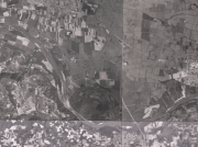
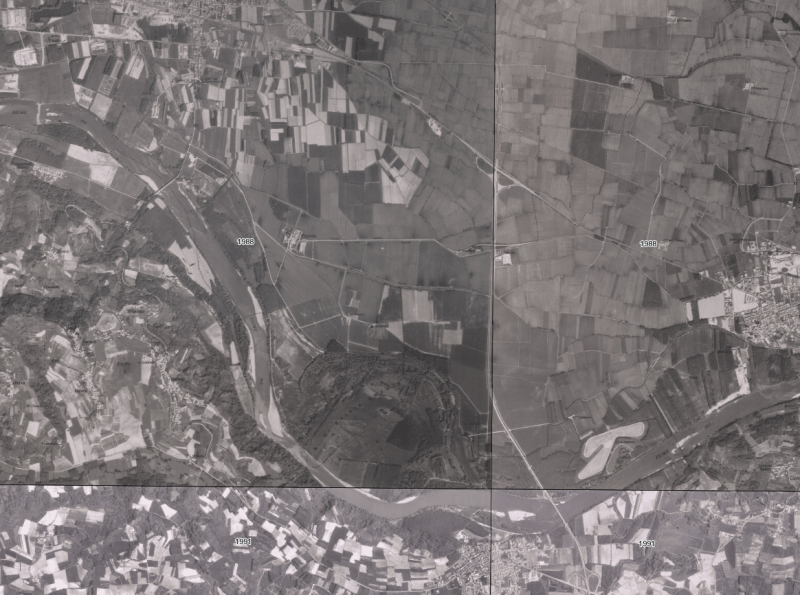
I geoservizi WMS e WMTS Ortofoto 1980-1990 permettono la visualizzazione delle ortofoto in bianco e nero prodotte contestualmente al primo impianto della Carta Tecnica Regionale 1:10'000.Il periodo di acquisizione varia dal 1985 al 1992.Il servizio WMS contiene, oltre al livello dell'immagine dell'ortofoto (regp_ortofoto_1980_90), anche un livello relativo alla data di ripresa di ciascuna ortofoto (regp_qu_CTR).Il servizio WMTS contiene invece solo le mattonelle delle immagini senza la data di ripresa.Genealogia del dato.- Scansione degli originali ortofotopiani cartacei, in formato TIFF con compressione LZW;- Georeferenziazione, mosaicatura e ritaglio sul bordo delle sezioni CTR corrispondenti;- Generazione catalogo;- Produzione dei servizi WMS e WMTS.
Simple
Identification info
- Date (Creation)
- 2017-11-22
- Citation identifier
- r_piemon:1aeb597a-b663-4146-a049-2d0c896508fd
- Cited responsible party
-
Organisation name Individual name Electronic mail address Role Regione Piemonte - A1613B - Sistema informativo territoriale e ambientale
cartografico@regione.pie cartografico@regione.piemonte.it
Custodian Regione Piemonte
info-geoportale@regione.piemonte.it geoportale@regione.pie info-geoportale@regione.piemonte.it
Owner
- Point of contact
-
Organisation name Individual name Electronic mail address Role Regione Piemonte - A1613B - Sistema informativo territoriale e ambientale
cartografico@regione.pie cartografico@regione.piemonte.it
Point of contact
-
ISO - 19119 geographic services taxonomy
- Keywords
-
-
RNDT
-
- Keywords
-
-
EU
-
- Access constraints
- Other restrictions
- Other constraints
- no limitations to public access
- Use constraints
- Other restrictions
- Other constraints
- Service Type
- view
))
- Coupling Type
- Loose
- Contains Operations
-
Operation Name Distributed Computing Platforms Connect Point GetMap
Web services http://geomap.reteunitaria.piemonte.it/WEBCAT/CAPABILITIES/wms_regp_ortofoto_1980_90.xml
- Distribution format
-
Name Version OGC:WMS
1.3.0
OGC:WMTS
1.0
- OnLine resource
-
Protocol Linkage Name WWW:LINK-1.0-http--link https://geomap.reteunitaria.piemonte.it/WEBCAT/CAPABILITIES/wms_regp_ortofoto_1980_90.xml URL per il caricamento diretto del livello da client
- OnLine resource
-
Protocol Linkage Name Web Map Tile Service (WMTS) https://geomap.reteunitaria.piemonte.it/WEBCAT/CAPABILITIES/wmts_regp_ortofoto_1980_90.xml
- OnLine resource
-
Protocol Linkage Name Web Map Service (WMS) https://geomap.reteunitaria.piemonte.it/mapproxy/service?service=WMS&version=1.3.0&request=getCapabilities regp_ortofoto_1980_90
- OnLine resource
-
Protocol Linkage Name Web Map Service (WMS) https://geomap.reteunitaria.piemonte.it/mapproxy/service?service=WMS&version=1.3.0&request=getCapabilities regp_qu_CTR
- Hierarchy level
- Service
- Other
-
servizio
Conformance result
- Date (Publication)
- 2009-10-19
- Explanation
-
non conforme
- Pass
- No
Metadata
- File identifier
- r_piemon:1aeb597a-b663-4146-a049-2d0c896508fd XML
- Metadata language
- Italiano
- Character set
- UTF8
- Hierarchy level
- Service
- Hierarchy level name
-
servizio
- Date stamp
- 2023-04-05
- Metadata standard name
-
Linee Guida RNDT
- Metadata standard version
-
2.0
- Metadata author
-
Organisation name Individual name Electronic mail address Role Regione Piemonte - A1613B - Sistema informativo territoriale e ambientale
cartografico@regione.pie cartografico@regione.piemonte.it
Point of contact
Overviews
Spatial extent
Provided by
