 INSPIRE Geoportal
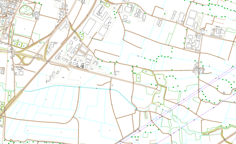
CTRN vettoriale 1:10.000 (1991-2005) - Singole sezioni - STORICO
Il dataset contiene i dati vettoriali della Carta Tecnica Regionale Numerica (CTRN) alla scala 1:10.000 acquisita dal Servizio Cartografico della Regione Piemonte negli anni 1991-2005. I dati sono sono georiferiti nel sistema di riferimento WGS84 UTM 32 Nord, e suddivisi per sezione CTR.
Simple
- Date (Revision)
- 2005-12-31
- Date (Creation)
- 1991-01-01
- Citation identifier
- r_piemon:2e02fda6-24ee-45bb-a36e-a2fab030b9e1
- Cited responsible party
-
Organisation name Individual name Electronic mail address Role Regione Piemonte - A1613B - Sistema informativo territoriale e ambientale
cartografico@regione.pie cartografico@regione.piemonte.it
Custodian Regione Piemonte
info-geoportale@regione.piemonte.it geoportale@regione.pie info-geoportale@regione.piemonte.it
Owner
- Presentation form
- Digital map
- Issue identification
-
r_piemon:2e02fda6-24ee-45bb-a36e-a2fab030b9e1
- Point of contact
-
Organisation name Individual name Electronic mail address Role Regione Piemonte - A1613B - Sistema informativo territoriale e ambientale
cartografico@regione.pie cartografico@regione.piemonte.it
Author Regione Piemonte - A1613B - Sistema informativo territoriale e ambientale
cartografico@regione.pie cartografico@regione.piemonte.it
Point of contact
- Maintenance and update frequency
- As needed
- Keywords
-
-
RNDT
-
- Keywords
-
-
EU
-
- Keywords
-
-
opendata
-
cartografiadibase
-
carta tecnica
-
CTRN
-
-
Spatial scope
-
-
Regionale
-
- Access constraints
- Other restrictions
- Other constraints
- no limitations to public access
- Use constraints
- Other restrictions
- Other constraints
- Spatial representation type
- Vector
- Denominator
- 10000
- Language
- Italiano
- Character set
- UTF8
- Topic category
-
- Imagery base maps earth cover
))
- Supplemental Information
-
Accuratezza tematica: Ad eccezione della trasformazione nel formato shape, i dati non sono stati modificati nel contenuto, per cui la qualita' e' quella dei dati originali. Completezza: Non sono state fatte integrazioni rispetto ai dati originali. In certi livelli si riscontrano alcune incompletezze (ad. es in 4 sezioni mancano i limiti amministrativi, in altre le curve di livello). Accuratezza temporale: i dati fanno riferimento alla situazione registrata dai voli aerei effettuati nel 1991, ad eccezione delle sezioni della Valle di Susa, aggiornate al 1995, alla Provincia di Asti, aggiornata al 2004, e al Comune di Torino, aggiornato al 2005.
- Unique resource identifier
- WGS84/UTM 32N
- Distribution format
-
Name Version ESRI Shape
ESRI Shapefile
- Distributor contact
-
Organisation name Individual name Electronic mail address Role Regione Piemonte - A1613B - Sistema informativo territoriale e ambientale
cartografico@regione.pie cartografico@regione.piemonte.it
Distributor
- OnLine resource
- Hierarchy level
- Dataset
Conformance result
- Date (Publication)
- 2010-12-08
- Explanation
-
Fare riferimento alle specifiche indicate
Quantitative result
- Value
- 4
- Statement
-
-rilievo aerofotogrammetrico e produzione raster-Digitalizzazione della cartografia raster-produzione di files vettoriali in formato dxf ed E00- conversione del sistema di coordinate da GaussBoaga a UTM-Trasformazione dei file E00 e DXF in formato shapefile
Metadata
- File identifier
- r_piemon:2e02fda6-24ee-45bb-a36e-a2fab030b9e1 XML
- Metadata language
- Italiano
- Character set
- UTF8
- Hierarchy level
- Dataset
- Date stamp
- 2022-11-24
- Metadata standard name
-
Linee Guida RNDT
- Metadata standard version
-
2.0
- Metadata author
-
Organisation name Individual name Electronic mail address Role Regione Piemonte - A1613B - Sistema informativo territoriale e ambientale
cartografico@regione.pie cartografico@regione.piemonte.it
Point of contact
Overviews

Spatial extent
Provided by
