 INSPIRE Geoportal
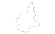
Ppr - Laghi (tav. P2)
Il dato, areale, rappresenta i corpi idrici a carattere permanente, rappresentati e riconoscibili tramite un toponimo nella cartografia ufficiale regionale, con perimetro superiore a 500 metri, naturali, lentici, superficiali, interni, fermi, di acqua dolce, nonché gli invasi e sbarramenti artificiali anch'essi a carattere permanente e con medesimo perimetro. I territori contermini a tali corpi idrici sono tutelati ai sensi dell'art. 142, comma 1, lettera b) del D.lgs. 42/2004
Simple
- Date (Publication)
- 2017-10-20
- Citation identifier
- r_piemon:4fb63c5b-813b-4c6d-9fed-6ce92df6ca64
- Cited responsible party
-
Organisation name Individual name Electronic mail address Role Regione Piemonte - A1610C - Pianificazione Regionale per il Governo del Territorio
piano.paesaggistico@regione.pie piano.paesaggistico@regione.piemonte.it
Custodian Regione Piemonte
info-geoportale@regione.piemonte.it geoportale@regione.pie info-geoportale@regione.piemonte.it
Owner
- Presentation form
- Digital map
- Issue identification
-
r_piemon:b65fc959-dfa5-4edd-991d-b6b9f638ab5b
- Point of contact
-
Organisation name Individual name Electronic mail address Role Regione Piemonte - A1610C - Pianificazione Regionale per il Governo del Territorio
piano.paesaggistico@regione.pie piano.paesaggistico@regione.piemonte.it
Author Regione Piemonte - A1610C - Pianificazione Regionale per il Governo del Territorio
piano.paesaggistico@regione.pie piano.paesaggistico@regione.piemonte.it
Author
- Maintenance and update frequency
- As needed
- Keywords
-
-
RNDT
-
- Keywords
-
-
EU
-
- Keywords
-
-
laghi
-
lacuali
-
galasso
-
ppr
-
opendata
-
- GEMET - Concepts, version 2.4
-
-
rete idrografica
-
-
Spatial scope
-
-
Regionale
-
- Access constraints
- Other restrictions
- Other constraints
- no limitations to public access
- Use constraints
- Other restrictions
- Other constraints
- Spatial representation type
- Vector
- Denominator
- 10000
- Language
- Italiano
- Character set
- UTF8
- Topic category
-
- Planning cadastre
- Inland waters
))
- Unique resource identifier
- WGS84/UTM 32N
- Distribution format
-
Name Version ESRI Shape
ESRI Shapefile
- Distributor contact
-
Organisation name Individual name Electronic mail address Role Regione Piemonte - A1610C - Pianificazione Regionale per il Governo del Territorio
piano.paesaggistico@regione.pie piano.paesaggistico@regione.piemonte.it
Distributor
- OnLine resource
-
Protocol Linkage Name WWW:DOWNLOAD-1.0-http--download https://www.datigeo-piem-download.it/direct/Geoportale/RegionePiemonte/PPR/laghiP2.zip
- Hierarchy level
- Dataset
Conformance result
- Date (Publication)
- 2010-12-08
- Explanation
-
Fare riferimento alle specifiche indicate
Quantitative result
- Value
- 6
- Statement
-
Il dato è stato creato ex novo dalla Regione Piemonte in condivisione col MiBACT
Metadata
- File identifier
- r_piemon:4fb63c5b-813b-4c6d-9fed-6ce92df6ca64 XML
- Metadata language
- Italiano
- Character set
- UTF8
- Hierarchy level
- Dataset
- Date stamp
- 2020-12-04
- Metadata standard name
-
Linee Guida RNDT
- Metadata standard version
-
2.0
- Metadata author
-
Organisation name Individual name Electronic mail address Role Regione Piemonte - A1610C - Pianificazione Regionale per il Governo del Territorio
piano.paesaggistico@regione.pie piano.paesaggistico@regione.piemonte.it
Point of contact
Overviews
Spatial extent
Provided by
