 INSPIRE Geoportal
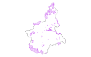
Ppr - ZPS (tav. P5)
Il dato, areale, delimita le zone di protezione speciale secondo la Direttiva Uccelli 2009/147/CE (ex 79/409/CEE) concernente la conservazione di tutte le specie di uccelli viventi naturalmente allo stato selvatico nel territorio europeo. L'obiettivo di tutela di questi siti è la conservazione della natura. I siti sono designati secondo la normativa della Rete Natura 2000. Il dato deriva dallo shape file presente sulla pagina web del Settore Regionale Biodiversità e Aree Naturali, ma è stato modificato dal Settore Territorio e Paesaggio escludendo le aree che oltrepassano i confini regionali
Simple
- Date (Publication)
- 2017-10-20
- Citation identifier
- r_piemon:817ceda9-717b-4d89-b1af-bd50a5434faa
- Cited responsible party
-
Organisation name Individual name Electronic mail address Role Regione Piemonte - A1610C - Pianificazione Regionale per il Governo del Territorio
piano.paesaggistico@regione.pie piano.paesaggistico@regione.piemonte.it
Custodian Regione Piemonte
info-geoportale@regione.piemonte.it geoportale@regione.pie info-geoportale@regione.piemonte.it
Owner
- Presentation form
- Digital map
- Issue identification
-
r_piemon:0e2a5aec-d108-4c0d-86f3-30129b6fd4d0
- Point of contact
-
Organisation name Individual name Electronic mail address Role Regione Piemonte - A1610C - Pianificazione Regionale per il Governo del Territorio
piano.paesaggistico@regione.pie piano.paesaggistico@regione.piemonte.it
Author Regione Piemonte - A1610C - Pianificazione Regionale per il Governo del Territorio
piano.paesaggistico@regione.pie piano.paesaggistico@regione.piemonte.it
Author
- Maintenance and update frequency
- As needed
- Keywords
-
-
zps
-
zone
-
protezione
-
speciale
-
ppr
-
opendata
-
- GEMET - Concepts, version 2.4
-
-
habitat
-
- Keywords
-
-
RNDT
-
- Keywords
-
-
EU
-
-
Spatial scope
-
-
Regionale
-
- Access constraints
- Other restrictions
- Other constraints
- no limitations to public access
- Use constraints
- Other restrictions
- Other constraints
- Spatial representation type
- Vector
- Denominator
- 25000
- Language
- Italiano
- Character set
- UTF8
- Topic category
-
- Planning cadastre
- Environment
))
- Unique resource identifier
- WGS84/UTM 32N
- Distribution format
-
Name Version ESRI Shape
ESRI Shapefile
- Distributor contact
-
Organisation name Individual name Electronic mail address Role Regione Piemonte - A1610C - Pianificazione Regionale per il Governo del Territorio
piano.paesaggistico@regione.pie piano.paesaggistico@regione.piemonte.it
Distributor
- OnLine resource
-
Protocol Linkage Name WWW:DOWNLOAD-1.0-http--download https://www.datigeo-piem-download.it/direct/Geoportale/RegionePiemonte/PPR/zps_wgs84.zip
- Hierarchy level
- Dataset
Conformance result
- Date (Publication)
- 2010-12-08
- Explanation
-
Fare riferimento alle specifiche indicate
Quantitative result
- Value
- 12.5
- Statement
-
Il dato deriva dallo shape file presente sulla pagina web del Settore Regionale Biodiversità e Aree Naturali, ma è stato modificato dal Settore Territorio e Paesaggio escludendo le aree che oltrepassano i confini regionali
Metadata
- File identifier
- r_piemon:817ceda9-717b-4d89-b1af-bd50a5434faa XML
- Metadata language
- Italiano
- Character set
- UTF8
- Hierarchy level
- Dataset
- Date stamp
- 2021-12-09
- Metadata standard name
-
Linee Guida RNDT
- Metadata standard version
-
2.0
- Metadata author
-
Organisation name Individual name Electronic mail address Role Regione Piemonte - A1610C - Pianificazione Regionale per il Governo del Territorio
piano.paesaggistico@regione.pie piano.paesaggistico@regione.piemonte.it
Point of contact
Overviews
Spatial extent
Provided by
