 INSPIRE Geoportal
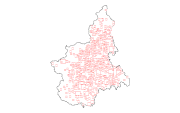
Ppr - Torino e centri di I-II-III rango (tav. P4)
Il dato, puntuale, classifica i centri piemontesi in 4 ranghi di tipo storico, distinguendo: Torino, centri di I rango (città capitali e dominanti, sedi diocesane, centri amministrativi), centri di II rango (centri amministrativi e di mercato di rilievo subregionale, centri riconosciuti quali "città" in antico regime e sino al postunitario, centri a specializzazione funzionale di rilevanza regionale), centri di III rango (centri con forte identità morfologica, centri di riconoscibile complessità funzionale, centri specializzati di rilevanza subregionale, insediamenti abbandonati noti attraverso indagini archeologiche)
Simple
- Date (Publication)
- 2017-10-20
- Citation identifier
- r_piemon:fb63b80d-d938-4b86-b803-4efd8d69ea92
- Cited responsible party
-
Organisation name Individual name Electronic mail address Role Regione Piemonte - A1610C - Pianificazione Regionale per il Governo del Territorio
piano.paesaggistico@regione.pie piano.paesaggistico@regione.piemonte.it
Custodian Regione Piemonte
info-geoportale@regione.piemonte.it geoportale@regione.pie info-geoportale@regione.piemonte.it
Owner
- Presentation form
- Digital map
- Issue identification
-
r_piemon:fb63b80d-d938-4b86-b803-4efd8d69ea92
- Point of contact
-
Organisation name Individual name Electronic mail address Role Regione Piemonte - A1610C - Pianificazione Regionale per il Governo del Territorio
piano.paesaggistico@regione.pie piano.paesaggistico@regione.piemonte.it
Author Regione Piemonte - A1610C - Pianificazione Regionale per il Governo del Territorio
piano.paesaggistico@regione.pie piano.paesaggistico@regione.piemonte.it
Author
- Maintenance and update frequency
- As needed
- Keywords
-
-
RNDT
-
- Keywords
-
-
EU
-
- Keywords
-
-
torino
-
storico
-
rango
-
ppr
-
centri
-
città
-
- Keywords
-
-
opendata
-
-
Spatial scope
-
-
Regionale
-
- Access constraints
- Other restrictions
- Other constraints
- no limitations to public access
- Use constraints
- Other restrictions
- Other constraints
- Spatial representation type
- Vector
- Denominator
- 25000
- Language
- Italiano
- Character set
- UTF8
- Topic category
-
- Planning cadastre
))
- Unique resource identifier
- WGS84/UTM 32N
- Distribution format
-
Name Version ESRI Shape
ESRI Shapefile
- Distributor contact
-
Organisation name Individual name Electronic mail address Role Regione Piemonte - A1610C - Pianificazione Regionale per il Governo del Territorio
piano.paesaggistico@regione.pie piano.paesaggistico@regione.piemonte.it
Distributor
- OnLine resource
-
Protocol Linkage Name WWW:DOWNLOAD-1.0-http--download https://www.datigeo-piem-download.it/direct/Geoportale/RegionePiemonte/PPR/torino_e_centri_i_ii_iii_rango_upp.zip
- Hierarchy level
- Dataset
Conformance result
- Date (Publication)
- 2010-12-08
- Explanation
-
Fare riferimento alle specifiche indicate
Quantitative result
- Value
- 12.5
- Statement
-
Il dato è stato creato ex novo dalla Regione Piemonte in collaborazione con il Politecnico di Torino
Metadata
- File identifier
- r_piemon:fb63b80d-d938-4b86-b803-4efd8d69ea92 XML
- Metadata language
- Italiano
- Character set
- UTF8
- Hierarchy level
- Dataset
- Date stamp
- 2020-12-04
- Metadata standard name
-
Linee Guida RNDT
- Metadata standard version
-
2.0
- Metadata author
-
Organisation name Individual name Electronic mail address Role Regione Piemonte - A1610C - Pianificazione Regionale per il Governo del Territorio
piano.paesaggistico@regione.pie piano.paesaggistico@regione.piemonte.it
Point of contact
Overviews
Spatial extent
Provided by
