 INSPIRE Geoportal
Regione Toscana - WMS Castore
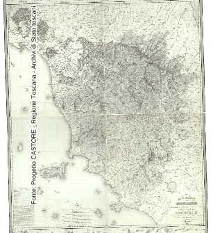
Si tratta di un servizio WMS OGC di Regione Toscana dedicato specificamente alla pubblicazione delle mappe del Progetto CASTORE (Catasti Storici Regionali). il progetto CASTORE e' stato realizzato, in collaborazione con Archivi di Stato toscani, sulla base di un Accordo sottoscritto con il Ministero per i Beni e le Attivita' Culturali. Il progetto ha riguardato la riproduzione digitale ad alta risoluzione di oltre 12000 mappe catastali ottocentesche, la loro schedatura e la loro georeferenziazione.
Simple
Identification info
- Date (Creation)
- 2011-12-31
- Citation identifier
- r_toscan:1c69c93d-339f-423f-bedd-300d2dd6c824
- Cited responsible party
-
Organisation name Individual name Electronic mail address Role Regione Toscana
urp@regione.tos urp@regione.toscana.it
Owner
- Issue identification
-
r_toscan:1c69c93d-339f-423f-bedd-300d2dd6c824
- Point of contact
-
Organisation name Individual name Electronic mail address Role Regione Toscana - Settore Sistema Informativo e Pianificazione del Territorio
contatto.cartografia@regione.tos contatto.cartografia@regione.toscana.it
Point of contact
-
REGOLAMENTO (CE) N. 1205/2008 DELLA COMMISSIONE del 3 dicembre 2008 recante attuazione della direttiva 2007/2/CE del Parlamento europeo e del Consiglio per quanto riguarda i metadati, Parte D 4, Classificazione dei servizi di dati territoriali
-
GEMET
-
-
ricerca storica
-
- Keywords
-
-
EU
-
- Use limitation
-
Nessuna condizione applicabile
- Access constraints
- Other restrictions
- Other constraints
- no limitations to public access
- Use constraints
- Other restrictions
- Other constraints
-
Nessun Vincolo
- Service Type
- view
))
- Coupling Type
- Loose
- Contains Operations
-
Operation Name Distributed Computing Platforms Connect Point GetCapabilities
Web services https://www502.regione.toscana.it/wmsraster/com.rt.wms.RTmap/wms?map=wmscastore&SERVICE=WMS&VERSION=1.3.0&REQUEST=GetCapabilities
- Unique resource identifier
- RDN2008-TM32EN
- Distribution format
-
Name Version PNG
1.0
- OnLine resource
-
Protocol Linkage Name OGC:WMS
https://www502.regione.toscana.it/wmsraster/com.rt.wms.RTmap/wms?map=wmscastore&SERVICE=WMS&VERSION=1.3.0&REQUEST=GetCapabilities&map_resolution=91
- Hierarchy level
- Service
- Other
-
Service
Conformance result
- Date (Publication)
- 2010-12-08
- Explanation
-
Fare riferimento alle specifiche indicate
Metadata
- File identifier
- r_toscan:1c69c93d-339f-423f-bedd-300d2dd6c824 XML
- Metadata language
- Italiano
- Character set
- UTF8
- Hierarchy level
- Service
- Hierarchy level name
-
servizio
- Date stamp
- 2022-03-21
- Metadata standard name
-
Linee Guida RNDT
- Metadata standard version
-
2.0
- Metadata author
-
Organisation name Individual name Electronic mail address Role Regione Toscana - Settore Sistema Informativo e Pianificazione del Territorio
contatto.cartografia@regione.tos contatto.cartografia@regione.toscana.it
Point of contact
Overviews
Spatial extent
Provided by
